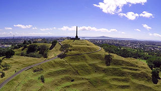
Maungakiekie / One Tree Hill is a 182-metre (597 ft) volcanic peak and Tūpuna Maunga in Auckland, New Zealand. It is an important place culturally and archeologically for both Māori and Pākehā. The suburb around the base of the hill is also called One Tree Hill. It is surrounded by the suburbs of Royal Oak to the west, and clockwise, Epsom, Greenlane, Oranga, and Onehunga. The summit provides views across the Auckland area, and allows visitors to see both of Auckland's harbours.

South Auckland is one of the major geographical regions of Auckland, the largest city in New Zealand. The area is south of the Auckland isthmus, and on the eastern shores of the Manukau Harbour. The area has been populated by Tāmaki Māori since at least the 14th Century, and has important archaeological sites, such as the Ōtuataua stonefield gardens at Ihumātao, and Māngere Mountain, a former pā site important to Waiohua tribes.

Māngere is a major suburb in South Auckland, New Zealand, located on mainly flat land on the northeastern shore of the Manukau Harbour, to the northwest of Manukau City Centre and 15 kilometres south of the Auckland city centre. It is the location of Auckland Airport, which lies close to the harbour's edge to the south of the suburb.

Clevedon, previously known as Wairoa South, is a rural town to the south-east of Auckland, New Zealand, located in Franklin. The area is a part of the rohe of Ngāi Tai ki Tāmaki, who settled around the Wairoa River. The township was founded in the 1850s, and was named Clevedon in 1866. Over time, Clevedon developed into a centre for the dairy industry in south-eastern Auckland.

Manurewa is a major suburb in South Auckland, New Zealand, located 6 km (3.7 mi) south of Manukau Central, and 26 km (16 mi) southeast of the Auckland City Centre. It is home to the Auckland Botanic Gardens, which receives over a million visitors a year. Manurewa has a high proportion of non-European ethnicities, making it one of the most multi-cultural suburbs in New Zealand. Employment for many is at the many companies of nearby Wiri, Papakura, and at the steel mill at Glenbrook.

Pakuranga is an eastern suburb of Auckland, in northern New Zealand. Pakuranga covers a series of low ridges and previously swampy flats, now drained, that lie between the Pakuranga Creek and Tamaki River, two estuarial arms of the Hauraki Gulf. It is located to the north of Manukau and 15 kilometres southeast of the Auckland CBD.
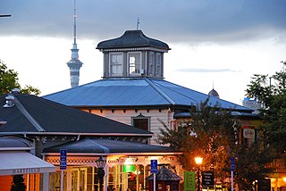
Parnell is a suburb of Auckland, New Zealand. It is one of New Zealand's most affluent suburbs, consistently ranked within the top three wealthiest, and is often billed as Auckland's "oldest suburb" since it dates from the earliest days of the European settlement of Auckland in 1841. It is characterised by its mix of tree-lined streets with large estates; redeveloped industrial zones with Edwardian town houses and 1920s bay villas; and its hilly topography that allows for views of the port, the Waitematā Harbour, Rangitoto Island and the Auckland Domain. To its west lies the Auckland Domain, to the south Newmarket, and to the north the Ports of Auckland.
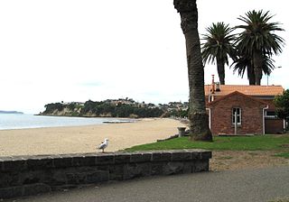
Saint Heliers is an affluent seaside suburb of Auckland with a population of 11,520 as of June 2022. This suburb is popular amongst visitors for the beaches, cafés, and views of Rangitoto Island, the distinctive volcanic island in the Hauraki Gulf.

Māngere Mountain, also known by the names Te Pane-o-Mataaho and Te Ara Pueru, is a volcanic cone in Māngere, Auckland. Located within Māngere Domain, it is one of the largest volcanic cones in the Auckland volcanic field, with a peak 106 metres (348 ft) above sea level. It was the site of a major pā and many of the pā's earthworks are still visible. It has extensive panoramic views of Auckland from its location in the southeastern portion of the city's urban area.

The Auckland isthmus, also known as the Tāmaki isthmus, is a narrow stretch of land on the North Island of New Zealand in the Auckland Region, and the location of the central suburbs of the city of Auckland, including the CBD. The isthmus is located between two rias : the Waitematā Harbour to the north, which opens to the Hauraki Gulf / Tīkapa Moana and Pacific Ocean, and the Manukau Harbour to the south, which opens to the Tasman Sea. The isthmus is the most southern section of the Northland Peninsula.
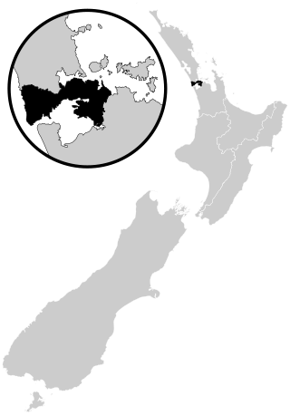
Tāmaki Makaurau is a New Zealand parliamentary Māori electorate returning one Member of Parliament to the New Zealand House of Representatives. It was first formed for the 2002 election. The electorate covers the Auckland area and was first held by Labour's John Tamihere before going to Dr Pita Sharples of the Māori Party for three terms from 2005 to 2014. After Sharples' retirement, the electorate was won by Peeni Henare of the Labour Party in the 2014 election.

Ōwairaka / Mount Albert, also known as Te Ahi-kā-a-Rakataura, is a volcanic peak and Tūpuna Maunga which dominates the landscape of the Owairaka and Mount Albert suburbs of Auckland.
The Pukekiwiriki, also known as Red Hill, is the northernmost volcano of the South Auckland volcanic field in New Zealand, located east of Papakura, which erupted an estimated one million years ago. The hill was the site of a major Tāmaki Māori pā, and the Te Ākitai Waiohua village Te Aparangi in the 19th century.

Te Ākitai Waiohua is a Māori iwi of the southern part of the Auckland Region of New Zealand.

Tāmaki Māori are Māori iwi and hapū who have a strong connection to Tāmaki Makaurau, and whose rohe was traditionally within the region. Among Ngā Mana Whenua o Tāmaki Makaurau, also known as the Tāmaki Collective, there are thirteen iwi and hapū, organised into three rōpū (collectives), however Tāmaki Māori can also refer to subtribes and historical iwi not included in this list.
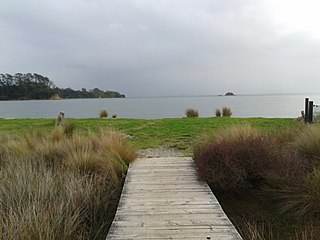
Whakanewha Regional Park is a regional park situated on Waiheke Island in New Zealand's Hauraki Gulf. It is owned and operated by Auckland Council.
Kiwi Tāmaki was a Māori warrior and paramount chief of the Waiohua confederation in Tāmaki Makaurau. The third generation paramount chief of Waiohua, Kiwi Tāmaki consolidated and extended Waiohua power over Tāmaki Makaurau, making it one of the most prosperous and populated areas of Aotearoa. Kiwi Tāmaki's seat of power was at Maungakiekie, which was the most elaborate pā complex in Aotearoa.
Ngā Oho, also known as Ngā Ohomatakamokamo-o-Ohomairangi, is the name of a historical iwi (tribe) of Māori who settled in the Auckland Region. In the 17th century, Ngā Oho and two other tribes of shared heritage, Ngā Riki and Ngā Iwi, formed the Waiohua confederation of tribes.

Pukekohe Hill is one of the most prominent volcanoes of the South Auckland volcanic field in New Zealand. The shield volcano erupted approximately 550,000 years ago, making it one of the youngest known volcanoes of the field.

The Puhinui Creek, also known as the Puhinui Stream or Te Puhinui, is a major stream in South Auckland, in the Auckland Region of New Zealand's North Island. It flows westwards from Totara Park through Manukau, then southwest at Wiri to the Manukau Harbour.


