The Khumbu Glacier is located in the Khumbu region of northeastern Nepal between Mount Everest and the Lhotse-Nuptse ridge. With elevations of 4,900 m (16,100 ft) at its terminus to 7,600 m (24,900 ft) at its source, it is the world's highest glacier. The Khumbu Glacier is followed for the final part of the trail to one of the Everest Base Camps. The start of the glacier is in the Western Cwm near Everest. The glacier has a large icefall, the Khumbu Icefall, at the west end of the lower Western Cwm. This icefall is the first major obstacle—and among the more dangerous—on the standard south col route to the Everest summit. It is also the largest glacier of Nepal.

Poddębice is a town in Poland, in Łódź Voivodeship, about 40 km northwest of Łódź. It is the capital of Poddębice County. Population is 7,630 (2016).
Novodruzhesk is a city in Lysychansk Municipality, Luhansk Oblast (region) of Ukraine. Population: 7,749 (2013 est.).

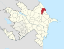
This is a list of the extreme points of Azerbaijan, the points that are farther north, south, east or west than any other location.

Drahňov is a village and municipality in Michalovce District in the Kosice Region of eastern Slovakia.

Karlová is a village and municipality in Martin District in the Žilina Region of northern Slovakia.

Badalgacchi is a Upazila of Naogaon District in Bangladesh. It consists of 36,614 households and has a total area of 213.98 square kilometres (82.62 sq mi).
San Vicente de Arévalo is a municipality located in the province of Ávila, Castile and León, Spain. According to the 2006 census (INE), the municipality has a population of 217 inhabitants.

Sadova is a commune in Dolj County, Romania. It is composed of two villages, Piscu Sadovei and Sadova.
Ohaba Lungă is a commune in Timiș County, Romania. It is composed of four villages: Dubești (Dobosd), Ierșnic (Jerce), Ohaba Lungă and Ohaba Română (Rácszabadi).

Zangi is a village in the Ismailli Rayon of Azerbaijan.
Duvaryan is a village in the Ismailli Rayon of Azerbaijan. The village forms part of the municipality of Əhən.

Duńkowice is a village in the administrative district of Gmina Radymno, within Jarosław County, Subcarpathian Voivodeship, in south-eastern Poland, close to the border with Ukraine. It lies approximately 7 kilometres (4 mi) east of Radymno, 17 km (11 mi) east of Jarosław, and 65 km (40 mi) east of the regional capital Rzeszów.

Bavoryně is a municipality and village in Beroun District in the Central Bohemian Region of the Czech Republic.
Hernádkak is a village in Borsod-Abaúj-Zemplén County in northeastern Hungary.
Semjén is a village in Borsod-Abaúj-Zemplén County in northeastern Hungary.
Kalmaküla is a village in Mustvee Parish, Jõgeva County in northeastern Estonia.
Merja is a village in Järva Parish, Järva County in northern-central Estonia.
Põrsaku is a village in Kehtna Parish, Rapla County in northern-central Estonia.

Famenin County is a county in Hamadan Province in Iran. The capital of the county is Famenin. At the 2006 census, its population was 40,541, in 9,928 families. The county is subdivided into two districts: the Central District and Pish Khowr District. The county has one city: Famenin.