This article needs additional citations for verification .(May 2018) (Learn how and when to remove this template message) |
| Napperby South Australia | |||||||||||||||
|---|---|---|---|---|---|---|---|---|---|---|---|---|---|---|---|
 Napperby | |||||||||||||||
| Coordinates | 33°09′20″S138°07′03″E / 33.155578°S 138.117496°E Coordinates: 33°09′20″S138°07′03″E / 33.155578°S 138.117496°E [1] | ||||||||||||||
| Population |
| ||||||||||||||
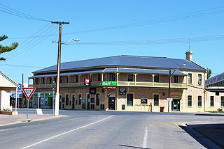
| Established | 29 March 1877 (town) 29 June 1995 (locality) [1] | ||||||||||||||
| Time zone | ACST (UTC+9:30) | ||||||||||||||
| • Summer (DST) | ACST (UTC+10:30) | ||||||||||||||
| LGA(s) | Port Pirie Regional Council [1] | ||||||||||||||
| Region | Yorke and Mid North [1] | ||||||||||||||
| County | Victoria [1] | ||||||||||||||
| State electorate(s) | Frome [4] | ||||||||||||||
| Federal Division(s) | Grey [5] | ||||||||||||||
| |||||||||||||||
| Footnotes | Adjoining localities [1] | ||||||||||||||
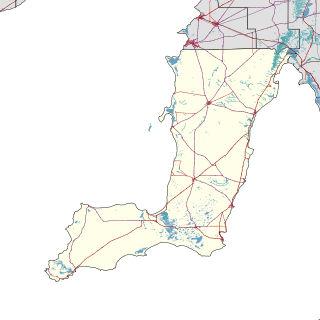
Napperby is a locality in the Mid North of South Australia in the approach to the lower Flinders Ranges and is near Mount Remarkable National Park and the town of Crystal Brook.

The Mid North is a region of South Australia, north of the Adelaide Plains, but not as far north as the Far North, or the outback. It is generally accepted to extend from Spencer Gulf east to the Barrier Highway, including the coastal plain, the southern part of the Flinders Ranges, and the northern part of the Mount Lofty Ranges. The area was settled as early as 1840 and provided early farming and mining outputs for the fledgling colony. Farming is still significant in the area, particularly wheat, sheep and grapevines. There are not currently any significant mining activities in the Mid North.

South Australia is a state in the southern central part of Australia. It covers some of the most arid parts of the country. With a total land area of 983,482 square kilometres (379,725 sq mi), it is the fourth-largest of Australia's states and territories by area, and fifth largest by population. It has a total of 1.7 million people, and its population is the second most highly centralised in Australia, after Western Australia, with more than 77 percent of South Australians living in the capital, Adelaide, or its environs. Other population centres in the state are relatively small; Mount Gambier, the second largest centre, has a population of 28,684.

The Flinders Ranges are the largest mountain range in South Australia, which starts about 200 km (125 mi) north of Adelaide. The discontinuous ranges stretch for over 430 km (265 mi) from Port Pirie to Lake Callabonna.
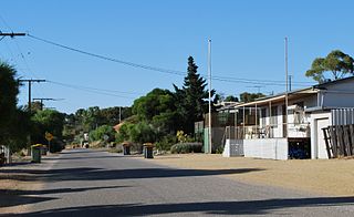
The 2016 Australian census which was conducted in August 2016 reports that Napperby had a population of 665 of which 284 lived in its town centre. [3] [2]
The 2016 Australian census was the seventeenth national population census held in Australia. The census was officially conducted with effect on Tuesday, 9 August 2016. The total population of the Commonwealth of Australia was counted as 23,401,892 – an increase of 8.8 per cent or 1,894,175 people since the 2011 census. Norfolk Island joined the census for the first time in 2016, adding 1,748 to the population.
Napperby is located within the federal division of Grey, the state electoral district of Frome and the local government area of the Port Pirie Regional Council. [5] [4] [1]

The Division of Grey is an Australian electoral division in South Australia. The division was one of the seven established when the former Division of South Australia was redistributed on 2 October 1903 and is named for Sir George Grey, who was Governor of South Australia from 1841 to 1845.

Frome is a single-member electoral district for the South Australian House of Assembly. It is named after Edward Charles Frome, the third surveyor-general of South Australia. The electorate is based on the industrial city of Port Pirie, and also includes many of the agricultural areas of the Clare and Gilbert Valleys. It covers a total of 6,435 km2 (2,485 sq mi) and takes in the towns of Auburn, Clare, Crystal Brook, Mintaro, Port Broughton, Saddleworth, Snowtown and Riverton in addition to Port Pirie.

The Port Pirie Regional Council (PPRC) is a local government area in South Australia, focused on the city of Port Pirie. It has a population of about 18,000 people. The council's main administrative facilities and works depot can be found in Port Pirie; it also have a rural office in Crystal Brook. In addition to Port Pirie, the municipality also includes the surrounding towns and localities of Bungama, Collinsfield, Coonamia, Crystal Brook, Koolunga, Lower Broughton, Merriton, Napperby, Nelshaby, Pirie East, Port Davis, Port Pirie South, Port Pirie West, Redhill, Risdon Park, Risdon Park South, Solomontown, Wandearah East, Wandearah West and Warnertown, and part of Clements Gap, and Mundoora.