Germein Bay, South Australia

Last updated

Germein Bay
South Australia
Australia South Australia location map.svg
Red pog.svg
Germein Bay
Coordinates 33°05′33″S137°58′39″E / 33.09238819°S 137.97745293°E / -33.09238819; 137.97745293 Coordinates: 33°05′33″S137°58′39″E / 33.09238819°S 137.97745293°E / -33.09238819; 137.97745293
Population 0 (2011 census) [1]
Established 1997 [2]
Postcode(s) none allocated [2]
Time zone ACST (UTC+9:30)
 • Summer (DST) ACST (UTC+10:30)
Location
LGA(s) Port Pirie Regional Council
District Council of Mount Remarkable [2]
State electorate(s) Frome [3]
Stuart [4]
Federal Division(s) Grey [5]
Mean max tempMean min tempAnnual rainfall
22.7 °C
73 °F
9.3 °C
49 °F
473.3 mm
18.6 in
Suburbs around Germein Bay:
Germein Bay (body of water) Port Germein Port Germein
Weeroona Island
Germein Bay (body of water)
Germein Bay Telowie
Nelshaby
Napperby
Germein Bay (body of water) Solomontown
Bungama
Napperby
Footnotes Coordinates [2]
Locations [2]
Climate [6]
Adjoining localities [2]

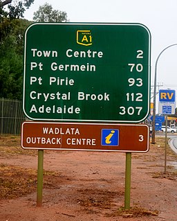
Germein Bay is a locality in the Australian state of South Australia about 205 kilometres (127 miles) north of the state capital of Adelaide and about 6 kilometres (3.7 mi) northeast of the city of Port Pirie. [2]

South Australia State of Australia

South Australia is a state in the southern central part of Australia. It covers some of the most arid parts of the country. With a total land area of 983,482 square kilometres (379,725 sq mi), it is the fourth-largest of Australia's states and territories by area, and fifth largest by population. It has a total of 1.7 million people, and its population is the second most highly centralised in Australia, after Western Australia, with more than 77 percent of South Australians living in the capital, Adelaide, or its environs. Other population centres in the state are relatively small; Mount Gambier, the second largest centre, has a population of 28,684.

Adelaide city centre Suburb of Adelaide, South Australia

Adelaide city centre is the innermost locality of Greater Adelaide, the capital city of South Australia. It is known by locals simply as "The City" or "Town" to distinguish it from Greater Adelaide and from the City of Adelaide. The locality is split into two key geographical distinctions: the city "square mile", bordered by North, East, South and West Terraces; and the section of the parklands south of the River Torrens which separates the built up part of the city from the surrounding suburbs and North Adelaide.

Its boundaries were created for the “long established name” for the portion within the Port Pirie Regional Council in March 1997 followed by the portion within the District Council of Mount Remarkable at a later time. Its name is derived from Germein Bay, the body of water to its immediate west. [2]

Port Pirie Regional Council Local government area in South Australia

The Port Pirie Regional Council (PPRC) is a local government area in South Australia, focused on the city of Port Pirie. It has a population of about 18,000 people. The council's main administrative facilities and works depot can be found in Port Pirie; it also have a rural office in Crystal Brook. In addition to Port Pirie, the municipality also includes the surrounding towns and localities of Bungama, Collinsfield, Coonamia, Crystal Brook, Koolunga, Lower Broughton, Merriton, Napperby, Nelshaby, Pirie East, Port Davis, Port Pirie South, Port Pirie West, Redhill, Risdon Park, Risdon Park South, Solomontown, Wandearah East, Wandearah West and Warnertown, and part of Clements Gap, and Mundoora.

District Council of Mount Remarkable Local government area in South Australia

The Mount Remarkable District Council is a local government area located between the top of the Spencer Gulf and the base of the Southern Flinders Ranges in South Australia. The district encompasses a wide variety of towns, including coastal ports and agricultural centres. The economy of the district council is largely based on agriculture.

The locality occupies land on the coastline in the south-eastern corner of Germein Bay. It is bounded to the east by the Augusta Highway and to the south in part by both the Port Pirie River and the Spencer Highway. It encloses the locality of Weeroona Island on all sides except for the west. The Adelaide-Port Augusta railway line passes through the locality on its east side. [2] [7]

Augusta Highway road in South Australia, Australia

The Augusta Highway is the part of Australia's ring route located in South Australia between Port Wakefield and Port Augusta. It was named Augusta Highway in 2011, and was formerly known simply as Highway One and also as the Princes Highway, despite not being continuous to the Princes Highway in the southeast of the state.

Spencer Highway road in South Australia, Australia

The Spencer Highway is a highway along the east coast of Spencer Gulf in South Australia. It starts at the Augusta Highway and runs south through Port Pirie to Minlaton. The highway is also designated as State route B89 except between Alford and Moonta. In this section, the Spencer Highway goes through the coastal town of Wallaroo, but route B89 goes through the regional business centre of Kadina.

In 1937, the South Australian Railways extended its broad gauge line north from Redhill to Port Pirie. In the same year, the Commonwealth Railways extended its standard gauge Trans-Australian Railway line from Port Augusta south to Port Pirie.

The principal land use within the locality is conservation where built development will be minimal and will be limited to “low-intensity recreational uses” and where provided, will complement the environment of the locality. [7] [8]

Conservation (ethic) ethic of resource use, allocation, and protection

Conservation is an ethic of resource use, allocation, and protection. Its primary focus is upon maintaining the health of the natural world, its fisheries, habitats, and biological diversity. Secondary focus is on material conservation, including non-renewable resources such as metals, minerals and fossil fuels, and energy conservation, which is important to protect the natural world. Those who follow the conservation ethic and, especially, those who advocate or work toward conservation goals are termed conservationists.

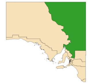
Germein Bay is located within the federal division of Grey, the state electoral districts of Frome and Stuart and the local government areas of the Port Pirie Regional Council and District Council of Mount Remarkable. [5] [3] [2] [4]

Division of Grey Australian federal electoral division

The Division of Grey is an Australian electoral division in South Australia. The division was one of the seven established when the former Division of South Australia was redistributed on 2 October 1903 and is named for Sir George Grey, who was Governor of South Australia from 1841 to 1845.

Electoral district of Frome state electoral district of South Australia

Frome is a single-member electoral district for the South Australian House of Assembly. It is named after Edward Charles Frome, the third surveyor-general of South Australia. The electorate is based on the industrial city of Port Pirie, and also includes many of the agricultural areas of the Clare and Gilbert Valleys. It covers a total of 6,435 km2 (2,485 sq mi) and takes in the towns of Auburn, Clare, Crystal Brook, Mintaro, Port Broughton, Saddleworth, Snowtown and Riverton in addition to Port Pirie.

Electoral district of Stuart state electoral district of South Australia

Stuart is a single-member electoral district for the South Australian House of Assembly. At 330,656 km², it covers the northeast part of the state extending from just north of the Barossa Valley all the way to the Northern Territory, Queensland and New South Wales borders. The seat's main population centre is Port Augusta, however the seat spans from Kapunda, 80 km north of Adelaide, up to the state borders, and includes the agricultural areas of Orroroo, Peterborough, Jamestown, Burra and Leigh Creek. Stuart is the second-largest electorate by area in South Australia.

Related Research Articles

Port Germein, South Australia Town in South Australia

Port Germein is a small sea-side town in the Australian state of South Australia located about 219 kilometres (136 mi) north of the state capital of Adelaide and about 19 kilometres (12 mi) north of the city of Port Pirie on the eastern side of South Australia's Spencer Gulf overlooking Germein Bay. Port Germein was named after Samuel Germein, who discovered it in 1840. though some credit his brother John with the discovery. The township was proclaimed in 1878. Port Germein's population in the 2006 census was 249.

Mambray Creek, South Australia Suburb of District Council of Mount Remarkable, South Australia

Mambray Creek is a locality in the Australian state of South Australia located on the east coast of Spencer Gulf about 240 kilometres (150 mi) north of the state capital of Adelaide and about 40 kilometres (25 mi) north of the city of Port Pirie.

District Council of Port Germein

The District Council of Port Germein was a local government area in South Australia, centred on the town of Port Germein. It was gazetted on 5 January 1888 under the provisions of the District Councils Act 1887 and encompassed the hundreds of Baroota, Wongyarra, Booleroo, Telowie, Darling and Appila. It replaced an abortive earlier municipality, the Corporate Town of Port Germein, which had been established on 15 September 1887 when residents, concerned about increased taxation and their interests being lost in a broader shire under the forthcoming reforms, decided to incorporate the town. The local residents reportedly regretted the decision, and when the Act passed late in the year creating the new District Council, state parliament agreed to amalgamate the Corporate Town into the new municipality.

Blanche Harbor, South Australia Suburb of City of Port Augusta, South Australia

Blanche Harbor is a locality in South Australia located on the east coast of the Eyre Peninsula overlooking Spencer Gulf about 260 kilometres north north-west of the Adelaide city centre and about 20 kilometres south of the centre of Port Augusta.

Commissariat Point, South Australia Suburb of City of Port Augusta, South Australia

Commissariat Point is a locality in the Australian state of South Australia located on the east coast of the Eyre Peninsula overlooking Spencer Gulf about 270 kilometres north north-west of the state capital of Adelaide and about 11 kilometres south of the municipal seat in Port Augusta.

Davenport, South Australia Suburb of Port Augusta, South Australia

Davenport is a suburb in the Australian state of South Australia located about 282 kilometres (175 mi) north of the state capital of Adelaide and about 4 kilometres (2.5 mi) north-east of the municipal seat in Port Augusta.

Wandearah West, South Australia Suburb of Port Pirie Regional Council , South Australia

Wandearah West is a locality in the Australian state of South Australia located on the east coast of Spencer Gulf about 179 kilometres north-west of the Adelaide city centre and about 22 kilometres south of Port Pirie.

Port Paterson, South Australia Suburb of Port Augusta, South Australia

Port Paterson is a locality in the Australian state of South Australia located on the east coast of Spencer Gulf at the gulf's northern end about 237.4 kilometres north of the state capital of Adelaide and about 9 kilometres south of the centre of Port Augusta.

Brownlow, South Australia Suburb of Regional Council of Goyder, Mid Murray Council, South Australia

Brownlow is a locality in the Australian state of South Australia about 98 kilometres north-east of the Adelaide city centre

Weeroona Island, South Australia Suburb of District Council of Mount Remarkable, South Australia

Weeroona Island is a locality in the Australian state of South Australia about 209 kilometres north of the state capital of Adelaide and about 9.5 kilometres (5.9 mi) northeast of the city of Port Pirie.

Port Davis, South Australia Suburb of Port Pirie Regional Council, South Australia

Port Davis is a locality in the Australian state of South Australia on the east coast of Spencer Gulf about 18 kilometres to the west of the city of Port Pirie and about 197 kilometres north of the state capital of Adelaide.

Lower Broughton, South Australia Suburb of Port Pirie Regional Council, South Australia

Lower Broughton is a locality in the Australian state of South Australia on the east coast of Spencer Gulf about 17 kilometres to the south of the city of Port Pirie and about 186 kilometres north of Adelaide city centre.

Baroota, South Australia Suburb of District Council of Mount Remarkable, South Australia

Baroota is a locality in the Australian state of South Australia located on the east coast of Spencer Gulf about 230 kilometres north of the state capital of Adelaide and about 29 kilometres (18 mi) north-east of the city of Port Pirie.

Racecourse Bay, South Australia Suburb of District Council of Grant, South Australia

Racecourse Bay is a locality in the Australian state of South Australia located on the state’s south-east coast overlooking the body of water known in Australia as the Southern Ocean and by international authorities as the Great Australian Bight. It is about 398 kilometres south-east of the state capital of Adelaide and 25 kilometres south of the municipal seat of Mount Gambier in the south-east of the state.

Napperby, South Australia Suburb of Port Pirie Regional Council, South Australia

Napperby is a locality in the Mid North of South Australia in the approach to the lower Flinders Ranges and is near Mount Remarkable National Park and the town of Crystal Brook.

Saltia, South Australia Town in South Australia

Saltia is a locality in the Australian state of South Australia located on the western side of the Flinders Ranges about 279 kilometres (173 mi) north of the state capital of Adelaide and about 19 kilometres (12 mi) east of the city of Port Augusta.

County of Frome Cadastral in South Australia

The County of Frome is one of the 49 cadastral counties of South Australia in straddling the Mid North and Flinders Ranges regions. It was proclaimed in 1851 by Governor Henry Young and was named for the former Surveyor-General of South Australia, Edward Charles Frome. The iconic Mount Remarkable in the Hundred of Gregory is at the centre of the county.

Woolundunga, South Australia Suburb of Port Augusta , South Australia

Woolundunga is a locality in the Australian state of South Australia located on the western side of the Flinders Ranges about 271 kilometres (168 mi) north of the state capital of Adelaide and about 21 kilometres (13 mi) south-east of the city of Port Augusta.

Amyton, South Australia Suburb of Mount Remarkable , South Australia

Amyton is a locality in the Australian state of South Australia located on the eastern side of the Flinders Ranges about 259 kilometres (161 mi) north of the state capital of Adelaide and about 28 kilometres (17 mi) north-east of the municipal seat of Melrose.

Moockra, South Australia Suburb of Flinders Ranges , South Australia

Moockra is a locality in the Australian state of South Australia located on the eastern side of the Flinders Ranges about 274 kilometres (170 mi) north of the state capital of Adelaide and about 47 kilometres (29 mi) north-east and 36 kilometres (22 mi) south-east respectively of the municipal seats of Melrose and Quorn.

References

  1. Australian Bureau of Statistics (31 October 2012). "Germein Bay". 2011 Census QuickStats. Retrieved 25 May 2016. Blue pencil.svg
  2. 1 2 3 4 5 6 7 8 9 10 "Search result for "Germein Bay (Locality Bounded)" (Record no SA0025872) with the following layers selected - "Suburbs and Localities", "Place names (gazetteer)" and "Road Labels"". Property Location Browser. Government of South Australia. Retrieved 25 May 2016.
  3. 1 2 "District of Frome Background Profile". Electoral Commission SA. 29 April 2014. Retrieved 6 May 2016.
  4. 1 2 "District of Stuart Background Profile". ELECTORAL COMMISSION SA. Retrieved 20 August 2015.
  5. 1 2 "Federal electoral division of Grey" (PDF). Australian Electoral Commission. Retrieved 24 July 2015.
  6. "Monthly climate statistics: Summary statistics Georgetown (nearest station)". Commonwealth of Australia , Bureau of Meteorology. Retrieved 25 May 2016.
  7. 1 2 "Development Plan, Port Pirie (RC), Consolidated – 10 January 2013" (PDF). Government of South Australia. pp. 141, 170 & 187. Retrieved 26 May 2016.
  8. "Development Plan, Mount Remarkable Council, Consolidated – 5 September 2013" (PDF). Government of South Australia. pp. 106 & 209–213. Retrieved 26 May 2016.