| Telowie South Australia | |||||||||||||||
|---|---|---|---|---|---|---|---|---|---|---|---|---|---|---|---|
 Telowie | |||||||||||||||
| Coordinates | 33°03′23″S138°04′01″E / 33.05639°S 138.067068°E Coordinates: 33°03′23″S138°04′01″E / 33.05639°S 138.067068°E [1] | ||||||||||||||
| Population | 95 (2016 census) [2] | ||||||||||||||
| Established | 13 March 1997 [3] | ||||||||||||||
| Postcode(s) | 5540 [4] | ||||||||||||||
| Time zone | ACST (UTC+9:30) | ||||||||||||||
| • Summer (DST) | ACST (UTC+10:30) | ||||||||||||||
| Location | |||||||||||||||
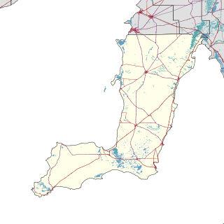
| LGA(s) | District Council of Mount Remarkable [1] | ||||||||||||||
| Region | Yorke and Mid North [1] | ||||||||||||||
| County | Frome [1] | ||||||||||||||
| State electorate(s) | Stuart [5] | ||||||||||||||
| Federal Division(s) | Grey [6] | ||||||||||||||
| |||||||||||||||
| |||||||||||||||
| Footnotes | Adjoining localities [1] | ||||||||||||||
Telowie is a locality in the Australian state of South Australia located about 213 kilometres (132 mi) north of the state capital of Adelaide and about 28 kilometres (17 mi) south-west of the municipal seat of Melrose. [1]

South Australia is a state in the southern central part of Australia. It covers some of the most arid parts of the country. With a total land area of 983,482 square kilometres (379,725 sq mi), it is the fourth-largest of Australia's states and territories by area, and fifth largest by population. It has a total of 1.7 million people, and its population is the second most highly centralised in Australia, after Western Australia, with more than 77 percent of South Australians living in the capital, Adelaide, or its environs. Other population centres in the state are relatively small; Mount Gambier, the second largest centre, has a population of less than 30,000.

Adelaide city centre is the innermost locality of Greater Adelaide, the capital city of South Australia. It is known by locals simply as "The City" or "Town" to distinguish it from Greater Adelaide and from the City of Adelaide. The locality is split into two key geographical distinctions: the city "square mile", bordered by North, East, South and West Terraces; and the section of the parklands south of the River Torrens which separates the built up part of the city from the surrounding suburbs and North Adelaide.

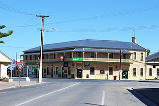
Melrose is the oldest town in the Flinders Ranges. It is in the shadow of Mount Remarkable, 265 km north of Adelaide, and the town was once named "Mount Remarkable". At the 2011 census, Melrose had a population of 406.
It spans Telowie Gorge and Telowie Gorge Conservation Park.[ citation needed ]

Telowie Gorge Conservation Park is a protected area located in the Australian state of South Australia about 7.5 kilometres east of the town of Port Germein in the gazetted locality of Telowie.
The 2016 Australian census which was conducted in August 2016 reports that Telowie had a population of 95 people. [2]
The 2016 Australian census was the seventeenth national population census held in Australia. The census was officially conducted with effect on Tuesday, 9 August 2016. The total population of the Commonwealth of Australia was counted as 23,401,892 – an increase of 8.8 per cent or 1,894,175 people since the 2011 census. Norfolk Island joined the census for the first time in 2016, adding 1,748 to the population.
Telowie is located within the federal division of Grey, the state electoral district of Stuart and the local government area of the District Council of Mount Remarkable. [6] [5] [1]

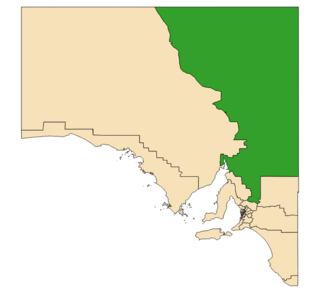
The Division of Grey is an Australian electoral division in South Australia. The division was one of the seven established when the former Division of South Australia was redistributed on 2 October 1903 and is named for Sir George Grey, who was Governor of South Australia from 1841 to 1845.
Stuart is a single-member electoral district for the South Australian House of Assembly. At 330,656 km², it covers the northeast part of the state extending from just north of the Barossa Valley all the way to the Northern Territory, Queensland and New South Wales borders. The seat's main population centre is Port Augusta, however the seat spans from Kapunda, 80 km north of Adelaide, up to the state borders, and includes the agricultural areas of Orroroo, Peterborough, Jamestown, Burra and Leigh Creek. Stuart is the second-largest electorate by area in South Australia.

The Mount Remarkable District Council is a local government area located between the top of the Spencer Gulf and the base of the Southern Flinders Ranges in South Australia. The district encompasses a wide variety of towns, including coastal ports and agricultural centres. The economy of the district council is largely based on agriculture.