Nashville, Wisconsin

Last updated

Nashville, Wisconsin
NashvilleWisconsinTownHall2009WIS55.jpg
Town hall
WIMap-doton-Nashville.png
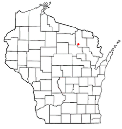
Location of Nashville, Wisconsin
Coordinates: 45°27′17″N88°54′38″W / 45.45472°N 88.91056°W / 45.45472; -88.91056
Country Flag of the United States.svg  United States
State Flag of Wisconsin.svg  Wisconsin
County Forest
Area
  Total72.3 sq mi (187.4 km2)
  Land67.2 sq mi (174.0 km2)
  Water5.2 sq mi (13.4 km2)
Elevation
[1]
1,594 ft (486 m)
Population
 (2010)
  Total1,064
  Density15/sq mi (5.7/km2)
Time zone UTC-6 (Central (CST))
  Summer (DST) UTC-5 (CDT)
Area code(s) 715 & 534
FIPS code 55-55575 [2]
GNIS feature ID1583780 [1]

Nashville is a town in Forest County, Wisconsin, United States. The population was 1,064 at the 2010 census. [3] The Mole Lake Indian Reservation is located within the town. The town is named after G.V. Nash of Forest City, Arkansas. [4]

Contents

History

A post office called Nashville was established in 1902, and remained in operation until it was discontinued in 1944. [5] The community was named for G. V. Nash. [6]

Geography

According to the United States Census Bureau, the town has a total area of 72.3 square miles (187 km2), of which 67.2 square miles (174 km2) is land and 5.2 square miles (13 km2), or 7.16%, is water.

Demographics

As of the census [2] of 2000, there were 1,157 people, 485 households, and 342 families residing in the town. The population density was 17.2 people per square mile (6.7/km2). There were 1,264 housing units at an average density of 18.8 per square mile (7.3/km2). The racial makeup of the town was 67.93% White, 31.29% Native American, 0.09% from other races, and 0.69% from two or more races. Hispanic or Latino of any race were 0.35% of the population.

There were 485 households, out of which 28.7% had children under the age of 18 living with them, 53.2% were married couples living together, 10.9% had a female householder with no husband present, and 29.3% were non-families. 25.4% of all households were made up of individuals, and 8.7% had someone living alone who was 65 years of age or older. The average household size was 2.39 and the average family size was 2.79.

In the town, the population was spread out, with 26.0% under the age of 18, 6.1% from 18 to 24, 24.5% from 25 to 44, 26.4% from 45 to 64, and 16.9% who were 65 years of age or older. The median age was 40 years. For every 100 females, there were 107.0 males. For every 100 females age 18 and over, there were 99.1 males.

The median income for a household in the town was $29,750, and the median income for a family was $31,680. Males had a median income of $25,909 versus $19,438 for females. The per capita income for the town was $16,013. About 11.7% of families and 16.8% of the population were below the poverty line, including 27.8% of those under age 18 and 7.0% of those age 65 or over.

Related Research Articles

<span class="mw-page-title-main">Luzerne, Iowa</span> City in Iowa, United States

Luzerne is a city in Benton County, Iowa, United States. The population was 112 at the time of the 2020 census. It is part of the Cedar Rapids Metropolitan Statistical Area.

<span class="mw-page-title-main">Courtland, Minnesota</span> City in Minnesota, United States

Courtland is a city in Nicollet County, Minnesota, United States. The population was 734 at the 2020 census. It is part of the Mankato-North Mankato Metropolitan Statistical Area.

<span class="mw-page-title-main">Redfield, South Dakota</span> City in South Dakota, United States

Redfield is a city in and the county seat of Spink County, South Dakota, United States. The population was 2,214 at the 2020 census. The city was named for J. B. Redfield, a railroad official.

<span class="mw-page-title-main">Eileen, Wisconsin</span> Town in Wisconsin, United States

Eileen is a town in Bayfield County, Wisconsin, United States. The population was 681 at the 2010 census. The unincorporated community of Ashland Junction is located in the town.

<span class="mw-page-title-main">Auburn, Chippewa County, Wisconsin</span> Town in Wisconsin, United States

Auburn is a town in Chippewa County in the U.S. state of Wisconsin. The population was 697 at the 2010 census, up from 580 at the 2000 census.

<span class="mw-page-title-main">Lakeside, Wisconsin</span> Town in Wisconsin, United States

Lakeside is a town in Douglas County, Wisconsin, United States. The population was 609 at the 2000 census. The town was named for its location at the shore of Lake Superior.

<span class="mw-page-title-main">Laona, Wisconsin</span> Town in Wisconsin, United States

Laona is a town in Forest County, Wisconsin, United States. The population was 1,212 at the 2010 census. The census-designated place of Laona is located in the town. The unincorporated community of Blackwell Junction is also located partially in the town.

<span class="mw-page-title-main">Liberty, Grant County, Wisconsin</span> Town in Wisconsin, United States

Liberty is a town in Grant County, Wisconsin, United States. The population was 552 at the 2000 census. The unincorporated community of Stitzer, Wisconsin is in the town. The town was named from the American ideal of liberty.

<span class="mw-page-title-main">Manitowoc Rapids, Wisconsin</span> Town in Wisconsin, United States

Manitowoc Rapids is a town in Manitowoc County, Wisconsin, United States. The population was 2,520 at the 2000 census.

<span class="mw-page-title-main">Wyeville, Wisconsin</span> Village in Wisconsin, United States

Wyeville is a village in Monroe County, Wisconsin, United States. It is located on Wisconsin Highway 21. The population was 147 at the 2010 census.

<span class="mw-page-title-main">Breed, Wisconsin</span> Town in Wisconsin, United States

Breed is a town in Oconto County, Wisconsin, United States. The population was 657 at the 2000 census.

<span class="mw-page-title-main">Stella, Wisconsin</span> Town in Wisconsin, United States

Stella is a town in Oneida County, Wisconsin, United States. The population was 633 at the 2000 census. The unincorporated community of Starks is located within the town.

<span class="mw-page-title-main">Belle Plaine, Wisconsin</span> Town in Wisconsin, United States

Belle Plaine is a town in Shawano County, Wisconsin, United States. The population was 1,867 at the 2000 census. The unincorporated communities of Adams Beach and Belle Plaine are located in the town. The former unincorporated community of Hunting was located partially in the town.

<span class="mw-page-title-main">Emerald, Wisconsin</span> Town in Wisconsin, United States

Emerald is a town in St. Croix County, Wisconsin, United States. The population was 691 at the 2000 census. The census-designated place of Emerald is located partially in the town.

<span class="mw-page-title-main">Deerfield (town), Dane County, Wisconsin</span> Town in Wisconsin, USA

Deerfield is a town in Dane County, Wisconsin, United States. The population was 1,470 at the 2000 census. The Village of Deerfield is located within the town. The unincorporated communities of London and Old Deerfield are located in the town.

Sullivan is a town in Jefferson County, Wisconsin, United States. The population was 2,208 at the 2010 census. The village of Sullivan, the census-designated place of Rome, and the unincorporated communities of Heath Mills, Oak Hill, and Slabtown are located in the town.

<span class="mw-page-title-main">Bangor, Wisconsin</span> Village in Wisconsin, United States

Bangor is a village in La Crosse County, Wisconsin, United States, along the La Crosse River. It is part of the La Crosse-Onalaska, WI-MN Metropolitan Statistical Area. The population was 1,437 as of the 2020 Census. The village is located partially within the Town of Bangor.

<span class="mw-page-title-main">Ellsworth, Wisconsin</span> Village in Wisconsin, United States

Ellsworth is a village in and the county seat of Pierce County, Wisconsin, United States. The population was 3,348 at the 2020 census. The village is adjacent to the Town of Ellsworth and now incorporates the formerly separate district known as East Ellsworth. The municipality of Ellsworth and its surroundings are slowly becoming incorporated into the Twin Cities Metro Area.

<span class="mw-page-title-main">Baldwin, Wisconsin</span> Village in Wisconsin, United States

Baldwin is a village in St. Croix County, Wisconsin, United States. The population was 3,957 at the 2010 census, a growth rate of 48% from 2000. The village is adjacent to the Town of Baldwin.

<span class="mw-page-title-main">Spooner, Wisconsin</span> City in Wisconsin, United States

Spooner is a city in Washburn County, Wisconsin, United States. The population was 2,573 at the 2020 census. The city is located mostly within the southwest corner of the Town of Spooner, with a small portion extending into the Town of Beaver Brook on the south, the Town of Bashaw on the southwest, and the Town of Evergreen on the west. The city's nickname, Crossroads of the North, is a reference to the city's location at the junction of two U.S. highways, 53 and 63, and State Highways 70 and 253.

References

  1. 1 2 "US Board on Geographic Names". United States Geological Survey. October 25, 2007. Retrieved January 31, 2008.
  2. 1 2 "U.S. Census website". United States Census Bureau . Retrieved January 31, 2008.
  3. "Race, Hispanic or Latino, Age, and Housing Occupancy: 2010 Census Redistricting Data (Public Law 94-171) Summary File (QT-PL), Nashville town, Wisconsin". United States Census Bureau . Retrieved August 12, 2011.
  4. Stennett, William H. (1908). A History of the Origin of the Place Names Connected with the Chicago & North Western and Chicago, St. Paul, Minneapolis & Omaha Railways. p.  106. Nashville, Forest County, State of Wisconsin Wiliam H. Stennett.
  5. "Forest County". Jim Forte Postal History. Retrieved March 23, 2015.
  6. Chicago and North Western Railway Company (1908). A History of the Origin of the Place Names Connected with the Chicago & North Western and Chicago, St. Paul, Minneapolis & Omaha Railways. p. 106.

45°31′22″N89°01′29″W / 45.52278°N 89.02472°W / 45.52278; -89.02472