Corfu is an island in the Ionian Sea, owned by Greece. The following is a synopsis of National Roads in Corfu.
Corfu is an island in the Ionian Sea, owned by Greece. The following is a synopsis of National Roads in Corfu.

National Road 23 (EO23) is a national road on the island of Corfu. It connects Corfu with Lefkimmi crossing the southern part of the island. It is 38 kilometers long. National Highway 23 is a single lane in each direction.
| OpenSteetMaps |
|---|
| National Road 23 |
Along the highway one can visit:
Finally, the national road connects the city of Corfu with the port of Lefkimmi.


National Road 24 (EO24) is a national road on the island of Corfu. It connects Corfu with Paleokastritsa crossing the northern part of the island. It is 22.7 kilometers long. National Highway 24 is a single lane in each direction except for the section "National Resistance Road - Dassia Crossing" where it has a double lane with a dividing island.
| OpenSteetMaps |
|---|
| National Road 24 |
Along the highway one can visit:


National Road 25 (EO25) is also a national road on the island of Corfu. This connects Corfu with Achillio, this time crossing the southern part of the island.
| OpenSteetMaps |
|---|
| National Road 25 |
Along the highway one can visit:
Finally, the national road connects the city of Corfu with the island's airport.


Interstate 95 (I-95) is the main north–south Interstate Highway on the East Coast of the United States, running from U.S. Route 1 (US 1) in Miami, Florida, north to the Houlton–Woodstock Border Crossing between Maine and the Canadian province of New Brunswick. The highway largely parallels the Atlantic coast and US 1, except for the portion between Savannah, Georgia, and Washington, D.C., and the portion between Portland and Houlton in Maine, both of which follow a more direct inland route.

Route 35 is a state highway in the U.S. state of New Jersey, primarily traveling through the easternmost parts of Middlesex, Monmouth, and Ocean counties. It runs 58.11 mi (93.52 km) from the entrance to Island Beach State Park in Berkeley Township, Ocean County to an intersection with Route 27 in Rahway, Union County. Between Seaside Park and Mantoloking, Route 35 follows the right-of-way of the former Pennsylvania Railroad along the Jersey Shore. The route heads through Point Pleasant Beach and crosses the Manasquan River on the Brielle Bridge, meeting Route 34 and Route 70 at the former Brielle Circle in Wall Township. From there, Route 35 heads north and intersects Route 138, an extension of Interstate 195, continuing north through Monmouth County before crossing the Victory Bridge over the Raritan River into Perth Amboy, where the route continues north to Rahway.

The National Roads and Motorways in Greece constitute the main road network of the country. These two types of roads are distinct in terms of their construction specifications. Their main difference is that motorways adhere to higher quality construction standards than National Roads.

The Belt Parkway is the name given to a series of controlled-access parkways that form a belt-like circle around the New York City boroughs of Brooklyn and Queens. The Belt Parkway comprises three of the four parkways in what is known as the Belt System: the Shore Parkway, the Southern Parkway, and the Laurelton Parkway. The three parkways in the Belt Parkway are a combined 25.29 miles (40.70 km) in length. The Cross Island Parkway makes up the fourth parkway in the system, but is signed separately.
The Hampton Roads Beltway is a loop of Interstate 64 and Interstate 664, which links the communities of the Virginia Peninsula and South Hampton Roads which surround the body of water known as Hampton Roads and comprise much of the region of the same name in the southeastern portion of Virginia in the United States. It crosses the harbor of Hampton Roads at two locations on large four-laned bridge-tunnel facilities: the eastern half carries Interstate 64 and uses the Hampton Roads Bridge-Tunnel and the western half carries Interstate 664 and uses the Monitor-Merrimac Memorial Bridge-Tunnel. The beltway has the clockwise direction signed as the Inner Loop, and the counter-clockwise direction signed as the Outer Loop. The entire beltway, including the bridge-tunnels, is owned and operated by the Virginia Department of Transportation.

A limited-access road, known by various terms worldwide, including limited-access highway, dual-carriageway, expressway, and partial controlled-access highway, is a highway or arterial road for high-speed traffic which has many or most characteristics of a controlled-access highway, including limited or no access to adjacent property, some degree of separation of opposing traffic flow, use of grade separated interchanges to some extent, prohibition of slow modes of transport, such as bicycles, horse-drawn vehicles or ridden horses, or self-propelled agricultural machines; and very few or no intersecting cross-streets or level crossings. The degree of isolation from local traffic allowed varies between countries and regions. The precise definition of these terms varies by jurisdiction.

Bundesautobahn 1 is an autobahn in Germany. It runs from Heiligenhafen in Schleswig-Holstein to Saarbrücken, a distance of 749 km (465 mi), but is incomplete between Cologne and Trier. B 207 continues north from Heiligenhafen to Puttgarden, at the end of the island of Fehmarn, with a ferry to Rødby, Denmark.

Bundesautobahn 7 is the longest German Autobahn and the longest national motorway in Europe at 963 km. It bisects the country almost evenly between east and west. In the north, it starts at the border with Denmark as an extension of the Danish part of E45. In the south, the autobahn ends at the Austrian border. This final gap was closed in September 2009.

Bundesautobahn 2 is an autobahn in Germany that connects the Ruhr area in the west to Berlin in the east. The A 2 starts at the junction with the A3 near the western city of Oberhausen, passes through the north of the Ruhr valley, through the Münsterland and into Ostwestfalen, crossing the former inner German border and continuing through the Magdeburger Börde to merge into the Berliner Ring shortly before reaching Berlin. Major cities such as Magdeburg, Braunschweig, Hannover and Dortmund are situated very close to the A 2. The A 2 is one of the most important autobahns, connecting several large industrial areas with each other.

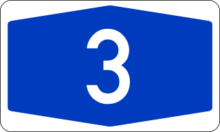
Bundesautobahn 3 is an autobahn in Germany running from the Germany-Netherlands border near Wesel in the northwest to the Germany-Austria border near Passau.

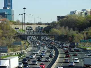
A controlled-access highway is a type of highway that has been designed for high-speed vehicular traffic, with all traffic flow—ingress and egress—regulated. Common English terms are freeway, motorway, and expressway. Other similar terms include throughway or thruway and parkway. Some of these may be limited-access highways, although this term can also refer to a class of highways with somewhat less isolation from other traffic.

Interstate 95 (I-95) is the main north–south Interstate Highway on the East Coast of the United States, running in a general east–west compass direction for 111.57 miles (179.55 km) in Connecticut, from the New York state line to the Rhode Island state line. I-95 from Greenwich to East Lyme is part of the Connecticut Turnpike, during which it passes through the major cities of Stamford, Bridgeport, and New Haven. After leaving the turnpike in East Lyme, I-95 is known as the Jewish War Veterans Memorial Highway and passes through New London, Groton, and Mystic, before exiting the state through North Stonington at the Rhode Island border.

U.S. Route 101 (US 101) is a major north–south United States Numbered Highway, stretching from Los Angeles, California, to Tumwater, Washington. The California portion of US 101 is one of the last remaining and longest U.S. Routes still active in the state, and the longest highway of any kind in California. US 101 was also one of the original national routes established in 1926. Significant portions of US 101 between the Los Angeles area and the San Francisco Bay Area follow El Camino Real, the commemorative route connecting the former Alta California's 21 missions.

U.S. Highway 1 (US 1) in Florida runs 545 miles (877 km) along the state's east coast from Key West to its crossing of the St. Marys River into Georgia north of Boulogne and south of Folkston. US 1 was designated through Florida when the U.S. Numbered Highway System was established in 1926. With the exception of Monroe County, the highway runs through the easternmost tier of counties in the state, connecting numerous towns and cities along its route, including nine county seats. The road is maintained by the Florida Department of Transportation (FDOT).
Perivoli is a village and a community in the southern part of the island of Corfu, Greece. It is part of the municipal unit of Korissia. The community includes the village Potamia. Perivoli is 1 km northwest of Vitalades, 4 km west of Lefkimmi, 4 km southeast of Argyrades and 24 km south of the city of Corfu. The Greek National Road 25 passes through the village. The small fishing port Kalyviotis is to the north, and the Agia Varvara beach is to the southwest.
This article describes the highway systems available in selected countries.

Terminology related to road transport—the transport of passengers or goods on paved routes between places—is diverse, with variation between dialects of English. There may also be regional differences within a single country, and some terms differ based on the side of the road traffic drives on. This glossary is an alphabetical listing of road transport terms.