Greek National Road 53 (abbr: EO53) [1] is a national highway of Greece. [2] It connects Alexandroupoli with Ormenio on the Bulgarian border, passing through Aisymi, Mikro Dereio, Metaxades and Kyprinos.
| Motorways |  |
|---|---|
| National Roads | 
|
Greek National Road 53 (abbr: EO53) [1] is a national highway of Greece. [2] It connects Alexandroupoli with Ormenio on the Bulgarian border, passing through Aisymi, Mikro Dereio, Metaxades and Kyprinos.
| Motorways | |
|---|---|
| National Roads |
|
Transport in Greece have undergone significant changes in the past two decades, vastly modernizing the country's infrastructure and transportation. Although ferry transport between islands remains the prominent method of transport between the nation's islands, improvements to the road infrastructure, rail, urban transport, and airports have all led to a vast improvement in transportation. These upgrades have played a key role in supporting Greece's economy, which in the past decade has come to rely heavily on the construction industry.

The National Roads and Motorways in Greece constitute the main road network of the country. These two types of roads are distinct in terms of their construction specifications. Their main difference is that motorways adhere to higher quality construction standards than National Roads.

Evros is one of the regional units of Greece. It is part of the region of East Macedonia and Thrace. Its name is derived from the river Evros, which appears to have been a Thracian hydronym. Evros is the northernmost regional unit. It borders Turkey to the east, across the river Evros, and it borders Bulgaria to the north and the northwest. Its capital is Alexandroupoli. Together with the regional units Rhodope and Xanthi, it forms the geographical region of Western Thrace. The population density was 34.77 per km2 (2011).

Thesprotia is one of the regional units of Greece. It is part of the Epirus region. Its capital and largest town is Igoumenitsa. Thesprotia is named after the Thesprotians, an ancient Greek tribe that inhabited the region in antiquity.
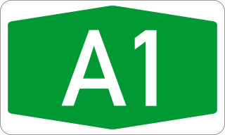
Motorway 1 the 2nd longest motorway in Greece with a length of 550 km. It is the principal north–south road connection in Greece, connecting the country's capital Athens with the regions of Thessaly and Macedonia, as well as the country's second largest city, Thessaloniki. It starts from Neo Faliro in Attica and continues north to reach the Evzonoi border station, on the Greek border with North Macedonia.

Kastanies is a town located in northern part of the regional unit of Evros, Greece, and is part of the municipal unit of Vyssa. It is situated at the border with Turkey.

Alexandroupoli or Alexandroupolis is a city in Greece and the capital of the Evros regional unit in East Macedonia and Thrace. It has 57,812 inhabitants and is the largest city in Thrace and the region of Eastern Macedonia and Thrace. It is an important port and commercial center of northeastern Greece.

Greek National Road 2 is a single carriageway with at-grade intersections, located in the regions of West Macedonia, Central Macedonia and East Macedonia and Thrace. It connects the Albanian border near Florina with the Turkish border near Alexandroupoli. Its section east of Thessaloniki has been replaced by the new A2 motorway. The section between the Albanian border and Thessaloniki is part of European route E86.
Peiraios Street is a main road in Athens, Greece linking the center of the city with the port of Piraeus. It is part of the system of national roads, as number 56. Its length spans 10 km. Major intersections and an interchange include Karaoli Dimitriou Street, Kifissou Avenue, the Konstantinopouleos Avenue junction, Apostolou Pavlou with Vasileiou tou Megalou, Ermou, Thermopylon, Sofokleous, Deligiorgi and Sokratous Street. The island areas of the road are aligned with trees, and historically the avenue runs over parts of the north wall and ancient road of Phaleron.

Egnatia Odos or Egnatia Motorway is the Greek part of European route . It is a motorway in Greece that extends from the western port of Igoumenitsa to the eastern Greek–Turkish border at Kipoi. It runs a total of 670 km (420 mi). The megaproject began in 1994 and was completed in 2009 at a cost of €5.93 billion ; it was managed by the company Egnatia Odos, S.A.

The Greek Motorway 5 is a motorway in Greece. The motorway, commonly referred to as Ionia Odos, starts at Ioannina and it follows the western coastline of mainland Greece down to the Gulf of Corinth. At Rio, it crosses the gulf via the Rio–Antirrio bridge and is connected with the A8 Motorway at an interchange near Patras. The future, currently under construction, Patras - Pyrgos motorway is typically part of the A5 Motorway.
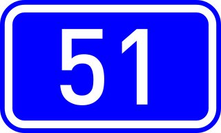
Greek National Road 51 is a single carriageway road in northeastern Greece. It connects the Greek National Road 2 near Feres with the Bulgarian border near Ormenio. The main towns on the GR-51 are Didymoteicho and Orestiada. The entire GR-51 is part of the European route E85. Its length is about 128 km. It runs from south to north, parallel to the river Evros.
Greek National Road 57 is a national highway of Greece. It connects Drama with the Bulgarian border near Exochi, via Prosotsani and Kato Nevrokopi. At the border it is connected with the Bulgarian national road 19 to Gotse Delchev.
Greek National Road 63 is a national highway in northern Greece. It connects Serres with Promachonas on the Bulgarian border, via Sidirokastro. It is part of the European route E79.

Greek National Road 65 is a national highway of Greece. It connects the Greek National Road 2 at Diavata, a northwestern suburb of Thessaloniki, with Kilkis. Most of the National-Road has been upgraded to a Motor-Road, connecting Thessaloniki via Kilkis with Doirani, the eastern border of Greece and North Macedonia.
Greek National Road 55 is a national highway of northern Greece. It connects Xanthi with the Bulgarian border via Echinos.
Greek National Road 59 is a national highway in northeastern Greece. It connects the Greek National Road 12 at Mesorrachi with the Greek National Road 2 near Amfipoli, via Draviskos.

European route E 94 is part of the International E-road network, which is a series of main roads in Europe.
Makaza, previously also known as Balkan Toresi, is a mountain pass in the Eastern Rhodope Mountains, connecting southernmost central Bulgaria with north-easternmost Greece and thus the regions of Northern and Western Thrace. The Makaza pass forms part of Pan-European Corridor IX, connecting Helsinki in Finland with the Greek port of Alexandroupolis on the Aegean Sea. The international border between Bulgaria and Greece lies at the highest point of the pass, at 682 metres (2,238 ft) above sea level.
| | This Greek road or road transport-related article is a stub. You can help Wikipedia by expanding it. |