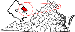
Nauck, Virginia

Last updated

Nauck is a neighborhood in the southern part of Arlington County, Virginia, known locally as Green Valley. It is bordered by Four Mile Run and Shirlington to the south, Douglas Park to the west, I-395 to the east, and Columbia Heights and the Army-Navy Country Club to the north. The southeastern corner of the neighborhood borders the City of Alexandria. [1]

Contents

The neighborhood acquired the name of "Nauck" when John D. Nauck, a former Confederate Army soldier who was serving the county as a Justice of the Peace and in other positions, purchased, subdivided and sold 46 acres of farmland from 1874 to 1900 in its area, thus laying the foundation for the neighborhood's development. [2] In 2019, the Nauck Civic Association voted to change its name to the "Green Valley Civic Association" to remove the name of a Confederate from that of an organization which by that time represented what had become a historically black neighborhood. The association next asked the Arlington County Civic Federation to approve its proposed name change, which the Federation did later that year. Although the County government will change its relevant databases and maps to reflect the association's new name, the County Board has not voted to alter the name of the neighborhood itself. [3] [4]

History

Portrait of John Parke Custis by Charles Willson Peale, ca. 1774 Portrait of John Parke Custis by Charles Willson Peale, ca. 1774.jpg

Portrait of John Parke Custis by Charles Willson Peale, ca. 1774

In 1719, John Todd and Evan Thomas received a land grant within the area that is now the Nauck neighborhood. Robert Alexander later acquired the land. In 1778, Alexander sold his property to John Parke Custis, whereupon the land became part of Custis' Abingdon estate. [5]

During the mid-1800s, Gustavus Brown Alexander owned much of the area that became Nauck, which at the time was called Green Valley African Americans began to purchase property and settle in the Nauck area during that period. Among the early African American property owners were Levi and Sarah Ann Jones. [6]

In 1859, the Alexandria, Loudoun and Hampshire Railroad began operating to Vienna from a terminal in old town Alexandria. [7] The rail line, which subsequently became branches of the Richmond and Danville Railroad, the Southern Railway, the Washington and Old Dominion Railway and the Washington and Old Dominion Railroad, eventually reached the town of Bluemont at the base of the Blue Ridge Mountains in 1900. [8] The line, which traveled through the valley of Four Mile Run, had stations named Nauck and (later) Cowdon where it crossed Shirlington Road. [8] [9] Although the line carried freight until it closed in 1968, passenger service through Nauck ended in 1932 during the Great Depression. [10]

1863 map of Union Army convalescent camp in the area of the future Nauck neighborhood. The camp was north of Four Mile Run, a swamp, and the Alexandria, Loudoun and Hampshire Railroad. Map of the new convalescent camp, Fairfax Co., Va. four miles S.W. from Washington, D.C. (5120542269).jpg
1863 map of Union Army convalescent camp in the area of the future Nauck neighborhood. The camp was north of Four Mile Run, a swamp, and the Alexandria, Loudoun and Hampshire Railroad.

During the American Civil War, the Union Army constructed Fort Barnard and other fortifications in the area. [11] The army also established there a number of encampments for its troops, as well as a large convalescent camp bordered by a swamp. After the war ended in 1865, Thornton and Selina Gray, an African American couple that had earlier been slaves at Arlington House, purchased a small piece of property in the area in 1867. [6]

During 1874–1875, John D. Nauck, a former Confederate Army soldier who had immigrated from Germany, purchased a 69 acres (28 ha) parcel of land in the area. [6] Nauck, who held at least one political office in the area, lived on his property and subdivided and sold the remainder. [6] [12]

During the post-war period, the area attracted several African American families residing in Freedman's Village and other locations. [5] In 1876, William Augustus Rowe, an African American who lived in Freedman's Village and was elected to a number of political positions, was among those who purchased property in the area during that period. [6] In 1885, a "Map of the Town of Nauck, Alexandria County, Virginia" that resulted from an earlier land survey was recorded. [6]

Nauck grew slowly during the late nineteenth century. [6] In 1874, a congregation initially organized in Freedman's Village purchased land in the area on which to relocate a building containing an African Methodist Episcopal Zion Church, the Little Zion Church. [5] [12] The church's building housed a public school that was later known as the Kemper School. In 1885, the Alexandria County school board built a one-room school nearby. The board constructed a new two-story brick school in 1893 at South Lincoln Street. The board later replaced that building with a larger facility that now contains the Drew Model Elementary School. [5]

In 1898, the Washington, Arlington & Falls Church Railway constructed a branch of its interurban electric trolley system that began in Rosslyn, connected with lines that traveled to downtown Washington, D.C. and other points, and terminated a short distance north of the Southern Railway's Nauck (Cowdon) station (see: Nauck line (Fort Myer line)). [5] [13] [14] The line paralleled the present South Kenmore Street and stimulated the neighborhood's development. [5] [13] The trolley line's Nauck station was located south of Steuben Street (now 19th Street South). [5] [13]

However, the 1902 Virginia Constitution, which established racial segregation throughout the state and restricted the rights of African Americans, stopped the neighborhood's expansion. Property owners continued to subdivide their lands to accommodate more people, but Nauck's boundaries largely remained unchanged. [5]

Lomax African Methodist Episcopal Zion Church (2012) Lomax-ame-church050.JPG
Lomax African Methodist Episcopal Zion Church (2012)

In 1922, the Lomax African Methodist Episcopal Zion Church was constructed on 24th Road South between South Glebe Road (Virginia State Route 120) to the east and Shirlington Road to the west. The church, which is a successor to the Little Zion Church, was added to the National Register of Historic Places in 2004. [12]

During World War II, the federal government constructed Paul Dunbar Homes, an 11 acres (4 ha) segregated barracks-style wartime emergency low-income housing community for African Americans. [15] The government built this affordable housing project on a parcel of land at Kemper Road and Shirlington Road that Levi Jones and his family had once owned. [5]

Meanwhile, construction of The Pentagon and its surrounding roads during the war destroyed several older African American communities. Some of those communities' displaced residents relocated to Nauck, thus stimulating the neighborhood's development and increasing its African American population. [5]

By 1952, few blocks in Nauck were still vacant. Others were built nearly to capacity. The neighborhood continued to develop during the remainder of the 20th century along the lines established many years earlier. [5]

Redevelopment

Gentrification is changing the character of the neighborhood. Developers have recently demolished many of Nauck's older houses and replaced them with larger homes because of increases in residential land values that the neighborhood experienced during the 2000s and 2010s. Recent residential redevelopment in the neighborhood has included the construction of the Townes of Shirlington, [16] Shirlington Crest, [17] and The Macedonian, an affordable housing project that tax exempt bonds from the Virginia Housing Development Authority and low-interest loans from the Arlington County government financed. [18]

The land along Shirlington Road has been the target of major redevelopment in recent years. In 2004, the Arlington County Board adopted the Nauck Village Center Action Plan. The Action Plan covers the commercial core of Nauck, which is bounded by Glebe Road to the north, the bend in Shirlington Road to the south, and approximately one block east and west of Shirlington Road. [19]

In 2011, Walmart expressed an interest in constructing a store near I-395 on Shirlington Road in Nauck. Walmart's plans fell through after the Arlington County Board amended the county's zoning ordinance to require County Board approval of such plans. [20]

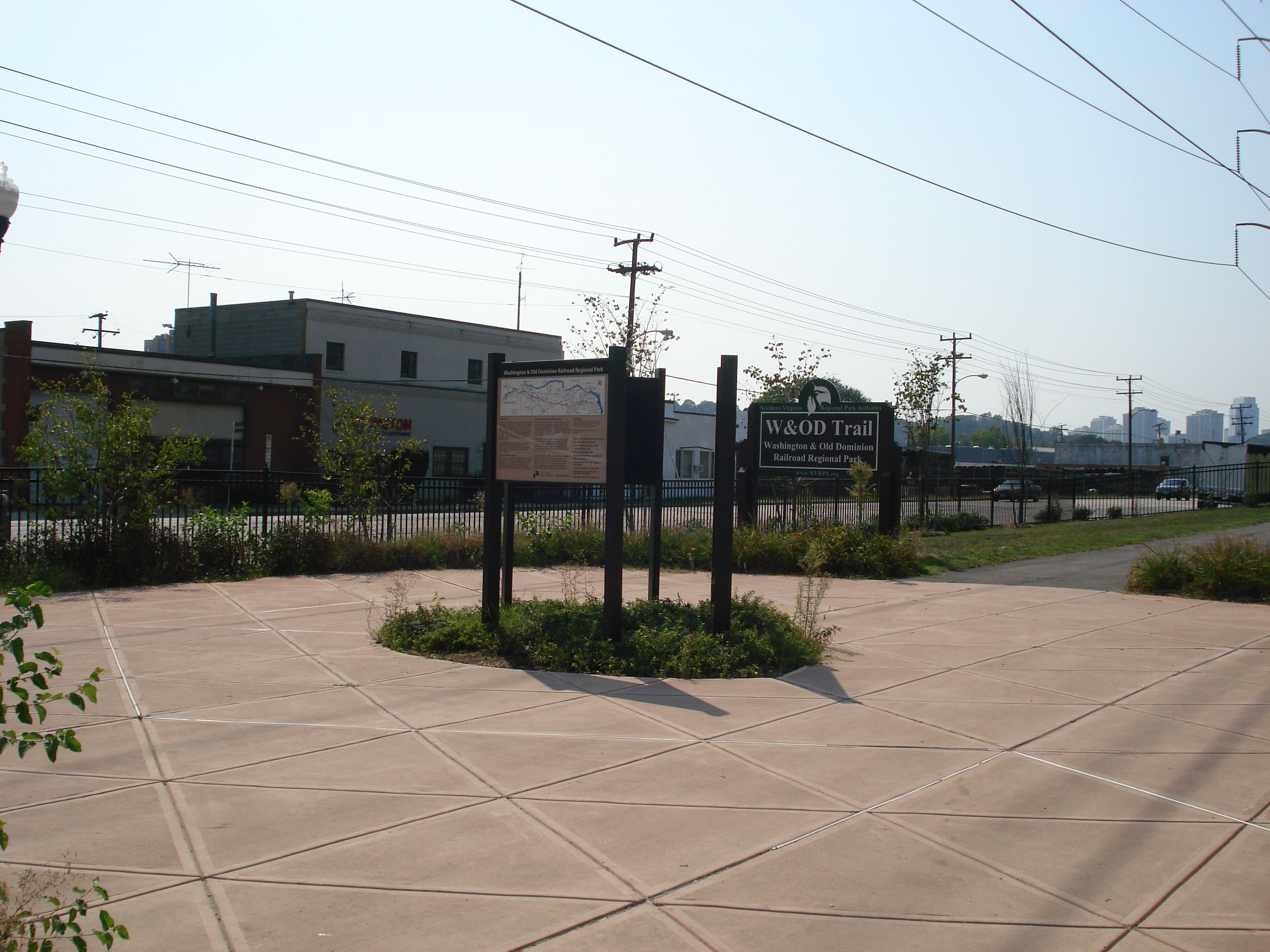
The Four Mile Run valley, within which the Washington and Old Dominion Railroad traveled through Nauck until 1968, is the last large area in Arlington County that still contains a concentration of properties zoned for industrial uses. In November 2018, the Arlington County Board adopted the Four Mile Run Valley Area Plan. The document addresses a number of planning issues that are intended to guide the future development of the area, including environmental sustainability, open space planning, building height, land use mix, urban design and transportation systems. [21]

Landmarks

In 2013, the Arlington County Board designated the Green Valley Pharmacy in Nauck as a local historic district. [22] In 2014, the county's government held an unveiling ceremony for a historical marker that it had recently erected at the Pharmacy's site. [23]

Parks

Nauck Park, located at 2551 19th Street South, offers the neighborhood 0.32 acres (0.1 ha) of recreational space. The park contains restrooms, picnic tables and a school-age playground. [24]

Drew Park is located at 2310 South Kenmore Street, adjacent to the Charles Drew Community Center. The park contains a playground, a basketball court, a baseball diamond and a sprayground. [25]

Fort Barnard Park, located at 2101 South Pollard Street, occupies 5 acres (2.0 ha) of space near the Fort Barnard Community Garden. The park is across the street from the Fort Barnard Dog Park. The park has "fort"-themed play equipment, a mosaic and a hopscotch area. The park also contains a playground, picnic shelter, a baseball diamond and a basketball court. [26] The park is located at the former site of Fort Barnard, a redoubt that the Union Army constructed during the autumn of 1861. [27] [28] The fortification, which was on the Arlington Line of forts, was an early component of the Civil War Defenses of Washington. [29] Park landscaping has destroyed the last remnants of the fort. [28]

Fort Barnard Heights Park, located at 2452 South Oakland Street, occupies 0.1 acres (0.040 ha). The park contains a picnic table, benches and open green space. [30]

The Arlington County government has designated as "Four Mile Run Valley Park" an open space that contains Four Mile Run, the stream's riparian zones, and adjacent areas. [31] The Valley Park straddles the southern border of the Nauck neighborhood. [31] Two components of the Valley Park (Jennie Dean Park [32] and the Shirlington Dog Park [33] ) are within Nauck. In September 2018, the Arlington County Board adopted a master plan and design guidelines for the Valley Park. [31]

Nauck contains the trailhead of the 45 miles (72 km)-long Washington & Old Dominion Railroad Trail (W&OD Trail), which follows Four Mile Run through Arlington County as it travels northwest to the town of Purcellville in Loudoun County, Virginia. [34] The trail is within NOVA Parks' Washington & Old Dominion Railroad Regional Park. [34]

Schools

Green Valley is home to Dr. Charles R. Drew Elementary School, which is part of Arlington Public Schools. [35]

Demographics

As of the 2010 Census, Green Valley's population was 35.9% non-Hispanic Black or African-American, 27.3% non-Hispanic White and 25.7% Hispanic or Latino. [36]

Neighborhood name

Around 1821, Anthony Frazer built on his 1,000 acres (405 ha) plantation a mansion named the "Green Valley Manor". The mansion was located at the present intersection of 23rd Street South and Arlington Ridge Road in Arlington County's Arlington Ridge neighborhood, east of I-395 and Nauck. [37]

The neighborhood acquired the name of "Nauck" when John D. Nauck, a former Confederate Army soldier who was serving the county as a Justice of the Peace and in other positions, purchased, subdivided and sold 46 acres of farmland from 1874 to 1900, thus laying the foundation for its development. Nauck fled the area in 1891 when an African American in arrears to an installment payment for land that he had purchased from Nauck reportedly assaulted Nauck and threatened Nauck and his family when Nauck attempted to evict him from the land. [2]

In February 2019, a neighborhood resident who had earlier headed the Arlington chapter of the National Association for the Advancement of Colored People (NAACP) circulated a letter that advocated a change in the Nauck Civic Association's name and area to Green Valley. [3] The letter argued that the historically black neighborhood should no longer be named after a former Confederate soldier while stating that the writer had found no record or evidence linking Nauck to efforts to improve the quality of life for its residents. [3] The letter further claimed that "the area was referred to as Green Valley from its inception in the 1700s to the 1970s". [3]

The Civic Association then voted to change its name to the "Green Valley Civic Association". The association next asked the Arlington County Civic Federation to approve its proposed name change, which the Federation did during May 2019. [4] Although the County government will change its relevant databases and maps to reflect the association's new name, the County Board has not voted to alter the name of the neighborhood itself. [4]

Notes

  1. GIS Mapping Center. "Arlington County, Virginia, Civic Associations" (map). Arlington County, Virginia, government. Archived (PDF) from the original on December 26, 2018. Retrieved December 26, 2018.
  2. 1 2 Liebertz, John (2016). John D. Nauck (PDF). p. 25. Archived (PDF) from the original on October 7, 2016. Retrieved October 7, 2016.{{cite book}}: |work= ignored (help)
  3. 1 2 3 4 Koma, Alex (February 19, 2019). "Nauck Leaders to Mull Renaming Neighborhood, Pointing to Namesake's Confederate Ties". ArlNow. Archived from the original on February 20, 2019. Retrieved February 20, 2019.
  4. 1 2 3 (1) "Civic Federation Approves Nauck Name Change". ARLnow.com – Arlington, Va. Local News. May 9, 2019. Archived from the original on June 4, 2019. Retrieved June 4, 2019.
    (2) Kelly, John (June 3, 2019). "What's in a name? In Arlington, 'Nauck' becomes 'Green Valley.' Again". The Washington Post . Archived from the original on November 26, 2020. Retrieved June 3, 2019.
  5. 1 2 3 4 5 6 7 8 9 10 11 Northern Virginia Regional Park Authority historical marker at trailhead of W&OD Trail inPrats, J.J. (ed.). ""Nauck: A Neighborhood History" marker". HMdb.org: The Historical Marker Database. Archived from the original on May 29, 2017. Retrieved December 24, 2018.
  6. 1 2 3 4 5 6 7 Liebertz, John (2016). Nauck (PDF) (2nd ed.). Historic Preservation Program: Department of Community Planning, Housing and Development, Government of Arlington County, Virginia. pp. 23–36. Archived (PDF) from the original on October 7, 2016. Retrieved October 7, 2016.{{cite book}}: |work= ignored (help)
  7. Harwood, pp.12, 15.
  8. 1 2 (1) Timetable: "Southern Railway: Between Washington, Alexandria and Bluemont: Schedule effective July 1, 1900". Town of Round Hill, Virginia, government. July 12, 1900. Archived from the original on November 16, 2002. Retrieved November 22, 2012.
    (2) Harwood, p. 76.
  9. (1) Liebertz, John (2016). Nauck: Development of Nauck (PDF) (2nd ed.). Historic Preservation Program: Department of Community Planning, Housing and Development, Government of Arlington County, Virginia. pp. 23–36. Archived (PDF) from the original on October 7, 2016. Retrieved October 7, 2016.{{cite book}}: |work= ignored (help)
    (2) Interstate Commerce Commission. "W&OD Railway 1916 ICC Valuation Map No. 2" (PDF). Washington & Old Dominion Regional Park: History. NOVA Parks. Archived (PDF) from the original on December 26, 2018. Retrieved December 26, 2018.
    (3) Harwood, p. 141.
  10. Harwood, pp. 76, 106.
  11. (1) Arlington County, Virginia, government historical marker at Fort Barnard Park (1965) inSwain, Craig (ed.). ""Fort Barnard" marker". HMdb.org: The Historical Marker Database. Archived from the original on December 26, 2018. Retrieved December 26, 2018.
    (2) Cooling III, Benjamin Franklin; Owen II, Walton H. (2010). Fort Barnard (New ed.). Lanham, Maryland: Scarecrow Press. p. 83. ISBN   978-0-8108-6307-1. LCCN   2009018392. OCLC   665840182 . Retrieved December 27, 2018 via Google Books.{{cite book}}: |work= ignored (help)
  12. 1 2 3 Baynard, Kristie, EHT Traceries, Inc. (April 2003). "National Register of Historic Places Inventory Registration Form: Lomax African Methodist Episcopal Zion Church" (PDF). Arlington County, Virginia, government. Archived (PDF) from the original on January 16, 2019.{{cite web}}: CS1 maint: multiple names: authors list (link)
  13. 1 2 3 Liebertz, John (2016). Nauck: Development of Nauck (PDF) (2nd ed.). Historic Preservation Program: Department of Community Planning, Housing and Development, Government of Arlington County, Virginia. pp. 25–26. Archived (PDF) from the original on October 7, 2016. Retrieved October 7, 2016.{{cite book}}: |work= ignored (help)
  14. Merriken, John E. (1987). Old Dominion Trolley Too: A History of the Mount Vernon Line. ISBN   0-9600938-2-6. OCLC   17605355.
  15. (1) Bestebreurtje, Lindsey. "Paul Dunbar Homes". Built By the People Themselves. Retrieved January 17, 2019.
    (2) "Wartime Housing". Arlington County, Virginia: Arlington Public Library. Archived from the original on January 6, 2017. Retrieved January 17, 2019.
  16. UrbanTurf Staff (November 1, 2010). "The Townes of Shirlington Release First Phase of Townhomes" (blog). Urban Turf. Archived from the original on December 9, 2010. Retrieved December 30, 2018.
  17. "Shirlington Crest". DC Condo Boutique. Real Estate Webmasters. January 1, 2016. Archived from the original on January 1, 2016. Retrieved December 30, 2018.
  18. (1) "The Macedonian: Affordable housing that's also green". Housing. Arlington County, Virginia, government. 2015. Archived from the original on March 20, 2015. Retrieved December 30, 2018.
    (2) "Nauck". Projects & Planning. Arlington County government. Archived from the original on June 29, 2015. Retrieved May 28, 2015.
  19. "Nauck Village Center Action Plan" (PDF). Arlington County, Virginia, government. July 10, 2004. Archived (PDF) from the original on December 27, 2018. Retrieved December 27, 2018.
  20. (1) "EXCLUSIVE: Board Acts as Walmart Eyes Shirlington Site". Arlnow.com. July 14, 2011. Archived from the original on August 18, 2011. Retrieved July 27, 2018.
    (2) wtopstaff (April 8, 2014). "Land Eyed for Shirlington Walmart Could Become Storage Facility". WTOP. Archived from the original on December 30, 2018. Retrieved December 30, 2018.
  21. "Four Mile Run Valley Area Plan" (PDF). Arlington County, Virginia, government. November 17, 2018. Archived (PDF) from the original on December 27, 2018. Retrieved December 27, 2018.
  22. (1) "Green Valley Pharmacy". Projects and Planning. Arlington County government. 2015. Archived from the original on May 11, 2015. Retrieved May 28, 2015.
    (2) Liccese-Torres, Cynthia (October 2012). "Green Valley Pharmacy" (PDF). Arlington County Local Historic District Designation Form. Arlington County, Virginia, government. Archived (PDF) from the original on April 10, 2016. Retrieved December 28, 2018.
  23. (1) "Green Valley Pharmacy Historic Marker". Parks & Planning. Arlington County, Virginia, government. 2015. Archived from the original on September 20, 2015. Retrieved December 24, 2018.
    (2) Roberto (photographer) (December 2018). "Green Valley Pharmacy Historical Marker" (photograph). Retrieved December 25, 2018 via Google.
  24. "Nauck Park". Parks and Recreation. Arlington County government. 2016. Archived from the original on April 30, 2016. Retrieved December 24, 2018.
  25. "Drew Park". Parks and Recreation. Arlington County government. 2018. Archived from the original on August 25, 2018. Retrieved December 30, 2018.
  26. "Fort Barnard Park". Parks & Recreation. Arlington County, Virginia, government. Archived from the original on November 10, 2016. Retrieved December 27, 2018.
  27. Swain, Craig (ed.). ""Fort Barnard" marker". Archived from the original on December 26, 2018. Retrieved December 26, 2018.
  28. 1 2 Cooling III, Benjamin Franklin; Owen II, Walton H. (2010). Fort Barnard (New ed.). Lanham, Maryland: Scarecrow Press. p. 83. ISBN   978-0-8108-6307-1. LCCN   2009018392. OCLC   665840182 . Retrieved December 27, 2018 via Google Books.{{cite book}}: |work= ignored (help)
  29. (1) Michael, John (March 6, 2011). "Fort Cass Virginia: The Fortification Begins". Images of America: Fort Myer. Archived from the original on December 28, 2018. Retrieved December 28, 2018. After the fall of Fort Sumter, South Carolina to the Confederates, it was decided that the Nation's Capital was in need of defenses. Among the first fortifications were built were the ones at the three crossings of the Potomac River – Chain Bridge (Fort Ethan Allen), Aqueduct Bridge (Fort Corcoran) and Long Bridge (Fort Jackson). Over time the Arlington Line of fortifications developed beginning at the Potomac and encircling the western side of the Capital on the Virginia side.
    The line consisted of about 30 forts, augmented by interwoven artillery batteries:
    Fort Marcy, Fort Ethan Allen, Fort C. F. Smith, Fort Bennett, Fort Strong, Fort Corcoran, Fort Haggerty, Fort Morton, Fort Woodbury, Fort Ramsey (which later renamed and became Fort Cass), Fort Whipple, Fort Tillinghast, Fort McPherson, Fort Buffalo, Fort Craig, Fort Albany, Fort Jackson, Fort Runyon, Fort Richardson, Fort Barnard, Fort Berry, Fort Scott, Battery Garesche, Fort Reynolds, Fort Ward, Fort Worth, Fort Williams, Fort Ellsworth, Fort Lyon, Fort Farnsworth, Fort Weed, Fort O'Rourke, Fort Willard

    (2) "The Arlington Line". Arlington County, Virginia: Arlington Historical Society. Archived from the original on April 20, 2012.
    (3) Cooling III, Benjamin Franklin; Owen II, Walton H. (2010). The Arlington Lines (New ed.). Lanham, Maryland: Scarecrow Press. p. 82. ISBN   978-0-8108-6307-1. LCCN   2009018392. OCLC   665840182. Archived from the original on December 28, 2018. Retrieved March 5, 2018 via Google Books.{{cite book}}: |work= ignored (help)
  30. "Fort Barnard Heights Park". Parks & Recreation. Arlington County, Virginia, government. Archived from the original on July 31, 2015. Retrieved December 27, 2018.
  31. 1 2 3 (1) "Board Adopts Four Mile Run Valley Park Master Plan and Design Guidelines". News Release. Arlington County, Virginia, government newsroom. September 22, 2018. Archived from the original on September 23, 2018. Retrieved December 24, 2018.
    (2) Lardner/Klein Landscape Architects (September 18, 2018). "Four Mile Run Valley Park Master Plan" (PDF). Arlington County, Virginia, government. Archived (PDF) from the original on December 27, 2018. Retrieved December 27, 2018.
  32. "Jennie Dean Park". Parks and Recreation. Arlington County government. 2018. Archived from the original on August 20, 2018. Retrieved December 24, 2018.
  33. "Shirlington Dog Park". Parks & Recreation. Arlington County, Virginia, government. 2017. Archived from the original on February 11, 2017. Retrieved December 24, 2018.
  34. 1 2 (1) Photographs and description of the area and markers at the W&OD Trail's trailhead inPrats., J.J. (ed.). ""Washington and Old Dominion Trail" marker". HMdb: The Historical Marker Database. Archived from the original on December 29, 2018. Retrieved December 29, 2018.
    (2) Northern Virginia Regional Park Authority historical marker at trailhead of W&OD Trail inPrats, J.J. (ed.). ""Nauck: A Neighborhood History" marker". HMdb: The Historical Marker Database. Archived from the original on December 29, 2018. Retrieved December 29, 2018.
    (3) Meyer, Roger Dean (photographer) (September 9, 2007). "Three Markers at the Washington & Old Dominion Trailhead" (photograph). Washington and Old Dominion Trail. HMdb: The Historical Marker Database . Retrieved December 25, 2018. The three markers include Nauck: A Neighborhood History, Tracks Into History and Washington and Old Dominion Railroad Trail.
    (4) Coordinates of W&OD Trail trailhead: 38°50′39″N77°05′09″W / 38.844269°N 77.085878°W
  35. "Welcome to Drew Model". Drew Model Elementary School. Arlington County, Virginia: Arlington Public Schools. 2018. Archived from the original on October 29, 2018. Retrieved December 24, 2018.
  36. "Nauck 2010 Census" (PDF). Arlington County CPHD-Planning Division: Planning Research and Analysis Team. August 8, 2011. Archived (PDF) from the original on December 25, 2018. Retrieved June 1, 2017.
  37. (1) Liebertz, John (2016). John D. Nauck (PDF) (2nd ed.). Historic Preservation Program: Department of Community Planning, Housing and Development, Government of Arlington County, Virginia. pp. 23–36. Archived (PDF) from the original on October 7, 2016. Retrieved August 16, 2021.{{cite book}}: |work= ignored (help)
    (2) Section 2: History (PDF). Government of Arlington County, Virginia. January 21, 2013. p. 21. Archived from the original (PDF) on August 17, 2021. Green Valley formed the third large plantation in south Arlington. The land was owned by Anthony Fraser who acquired about 1,000 acres on both sides of the Alexandria-Georgetown Road. Around 1821, he built "Green Valley Manor" where the Forest Hills townhouse development now sits. The manor house burned down in 1924.{{cite book}}: |work= ignored (help)
    (3) "Locations of intersection of 23rd Street South and Arlington Ridge Road, of I-395, and of Nauck" (map). Google Maps . Retrieved August 16, 2021.

Related Research Articles

<span class="mw-page-title-main">Arlington National Cemetery</span> Military cemetery in Arlington, Virginia, US

Arlington National Cemetery is one of two cemeteries in the United States National Cemetery System that are maintained by the United States Army. Nearly 400,000 people are buried in its 639 acres in Arlington County, Virginia.

<span class="mw-page-title-main">Arlington County, Virginia</span> County in Virginia, United States

Arlington County is a county in the U.S. state of Virginia. The county is located in Northern Virginia on the southwestern bank of the Potomac River directly across from Washington, D.C., the national capital.

<span class="mw-page-title-main">Ballston, Virginia</span> Neighborhood in Arlington, Virginia

Ballston is a neighborhood in Arlington County, Virginia. Ballston is located at the western end of the Rosslyn-Ballston corridor. It is a major transportation hub and boasts one of the nation's highest concentrations of scientific research institutes and research and development agencies including the Defense Advanced Research Projects Agency-DARPA, the Office of Naval Research, the Advanced Research Institute of Virginia Tech, the Air Force Office of Scientific Research, and associated engineering, management, and public sector consulting firms. Ballston also contains a section known as Virginia Square and sometimes the area is collectively known as Ballston-Virginia Square.

<span class="mw-page-title-main">Shirlington, Virginia</span> Human settlement in Arlington County, Virginia, United States of America

Shirlington is an unincorporated urban area, officially called an "urban village", in the southern part of Arlington County, Virginia, United States, adjacent to the Fairlington area. The word "Shirlington" is a combination of "Shirley" and "Arlington".

<span class="mw-page-title-main">Henry G. Shirley Memorial Highway</span>

The Henry G. Shirley Memorial Highway, often shortened to Shirley Highway, consists of a 17.3-mile (27.8 km) portion of Interstates 95 and 395 in the U.S. Commonwealth of Virginia. Shirley Highway was the first limited-access freeway in Virginia. Begun in 1941, the road was completed from U.S. Route 1 in Colchester, Virginia, just north of Woodbridge, to the 14th Street Bridge over the Potomac River between Virginia and Washington, D.C. in 1952.

<span class="mw-page-title-main">Washington and Old Dominion Railroad Regional Park</span>

The Washington and Old Dominion Railroad Regional Park is a linear regional park in Northern Virginia. The park's primary feature is the Washington and Old Dominion Railroad Trail, an asphalt-surfaced paved rail trail that runs through densely populated urban and suburban communities as well as through rural areas. Most of the trail travels on top of the rail bed of the former Washington and Old Dominion Railroad, which closed in 1968.

<span class="mw-page-title-main">Four Mile Run</span> Stream in Virginia

Four Mile Run is a 9.4-mile-long (15.1 km) stream in Northern Virginia that starts near Interstate 66, at Gordon Avenue in Fairfax County and proceeds southeast through Falls Church to Arlington County in the U.S. state of Virginia. Most of the stretch is parkland and is paralleled by two paved non-motorized transport and recreational trails, the Washington & Old Dominion Railroad Trail and the Four Mile Run Trail.

<span class="mw-page-title-main">Custis Trail</span>

The Custis Trail is a hilly 4.5 miles (7.2 km)-long shared use path in Arlington County, Virginia. The asphalt-paved trail travels along Interstate 66 (I-66) between Rosslyn and the Washington & Old Dominion Railroad Trail at Bon Air Park.

<span class="mw-page-title-main">Fairlington, Virginia</span> United States historic place

Fairlington is an unincorporated neighborhood in Arlington County, Virginia, United States, located adjacent to Shirlington in the southernmost part of the county on the boundary with the City of Alexandria. The main thoroughfares are Interstate 395 which divides the neighborhood into North and South Fairlington, State Route 7 and State Route 402.

<span class="mw-page-title-main">Northern Virginia trolleys</span> Network of electronic passenger rails

The Northern Virginia trolleys were the network of electric passenger rails that moved people around the Northern Virginia suburbs of Washington, D.C., from 1892 to 1941. They consisted of six lines operated by as many as three separate companies connecting Rosslyn, Great Falls, Bluemont, Mount Vernon, Fairfax City, Camp Humphries and Nauck across the Potomac River to the District of Columbia.

<span class="mw-page-title-main">Fort Ethan Allen (Arlington, Virginia)</span> United States historic place

Fort Ethan Allen was an earthwork fortification that the Union Army built in 1861 on the property of Gilbert Vanderwerken in Alexandria County, Virginia, as part of the Civil War defenses of Washington. The remains of the fort are now within Arlington County's Fort Ethan Allen Park.

<span class="mw-page-title-main">Fort Richardson (Arlington, Virginia)</span> Civil war fort in Arlington County, Virginia

<span class="mw-page-title-main">Great Falls and Old Dominion Railroad</span> Former trolley line in Virginia

The Great Falls and Old Dominion Railroad (GF&OD) was an interurban trolley line that ran in Northern Virginia during the early 20th century.

<span class="mw-page-title-main">Arlington Transit</span>

Arlington Transit (ART) is a bus transit system that operates in Arlington County, Virginia, and is managed by the county government. The bus system provides service within Arlington County, and connects to Metrobus, nearby Metrorail stations, Virginia Railway Express, and other local bus systems. Most ART routes serve to connect county neighborhoods to local Metrorail stations, as well as the Shirlington Bus Station. It includes part of the Pike Ride service along Columbia Pike, which is shared with WMATA. In 2022, the system had a ridership of 1,806,500, or about 7,900 per weekday as of the third quarter of 2023.

<span class="mw-page-title-main">Fort C. F. Smith (Arlington, Virginia)</span> Archaeological site in Virginia, United States

Fort C.F. Smith was a lunette that the Union Army constructed in Alexandria County, Virginia, during 1863 as part of the Civil War defenses of Washington. It was named in honor of General Charles Ferguson Smith, who died from a leg infection that was aggravated by dysentery on April 25, 1862. Fort C. F. Smith connected the Potomac River to the Arlington Line, a row of fortifications south of Washington, D.C., that was intended to protect the capital of the United States from an invasion by the Confederate States Army.

<span class="mw-page-title-main">Bluemont Junction Trail</span>

The Bluemont Junction Trail is a 1.2-mile (1.9 km) asphalt-paved rail trail in Arlington County, Virginia, that the Arlington County government constructed along a former branch of the defunct Washington and Old Dominion Railroad. The shared use path travels southwest from Ballston through Bluemont Junction Park to Bluemont Junction. The trail connects Ballston to the Washington & Old Dominion Railroad Trail and the Four Mile Run Trail in and near Bluemont Park.

<span class="mw-page-title-main">Four Mile Run Trail</span>

The Four Mile Run Trail is a 7-mile long, paved shared use path in Arlington County and Falls Church. It runs along Four Mile Run from Benjamin Banneker Park in Falls Church to the Mount Vernon Trail near Ronald Reagan Washington National Airport, where Four Mile Run empties into the Potomac River. The trail runs roughly parallel to parts of the Washington & Old Dominion Railroad Trail as it follows Four Mile Run, sometimes on the other side of the stream.

<span class="mw-page-title-main">Barcroft–South Fairlington Line</span>

The Barcroft–South Fairlington Line, designated as Route 22A, Route 22C, or Route 22F, is a daily bus route operated by the Washington Metropolitan Area Transit Authority between Ballston–MU station of the Orange and Silver lines of the Washington Metro or Skyline City (22F) and Pentagon station of the Yellow and Blue lines of the Washington Metro. The 22 Line trips are roughly 20 minutes during peak hours, 30 minutes during off peak, and 60 minutes on weekends. This line provides service to Ballston or Skyline City and the Pentagon Transit Center from the neighborhoods of Arlington County, Fairfax County and Alexandria.

<span class="mw-page-title-main">McLean–Crystal City Line</span>

The McLean–Crystal City Line, designated Routes 23A, 23B & 23T, is a daily bus route operated by the Washington Metropolitan Area Transit Authority between Tysons Corner Center & Ballston–MU station of the Orange and Silver lines of the Washington Metro and Shirlington Transit Center & Crystal City station of the Yellow and Blue lines of the Washington Metro. The 23 line trips are roughly 15-60 minutes during the weekdays, and 20-60 minutes during the weekends. This line provides service from Tysons Corner in Fairfax County to Ballston and Crystal City of Arlington County.

The Hunting Point–Ballston Line, designated as Route 10B, is a daily bus route operated by the Washington Metropolitan Area Transit Authority between Hunting Point and Ballston–MU station of the Orange and Silver lines of the Washington Metro. This line provides service within the neighborhoods in Fairfax County, Alexandria, and Arlington County. Alongside the neighborhoods, it also brings service through the marketplace, businesses, and offices within the counties.

References

Further reading

38°50′55″N77°05′18″W / 38.848532°N 77.088447°W / 38.848532; -77.088447