Arlington Forest is a neighborhood located at Arlington County, Virginia, United States. A substantial portion of the neighborhood is a national historic district, the Arlington Forest Historic District. At the time of its nomination in 2005, the historic district contained 810 contributing buildings and 3 contributing sites in a subdivision in South Arlington and two sites in North Arlington.
The Arlington Forest neighborhood was developed in four stages between 1939 and 1948, known as Southside, Northside, Greenbrier, and Broyhill's Addition. In the first phase, from 1939 to 1946, Meadowbrook, the builder, collaborated with the locally prominent architect Robert O. Scholz to design the two-story brick homes with Colonial Revival detailing. The neighborhood is representative of a mid-20th century planned community in Arlington County.[3] It was listed on the National Register of Historic Places in 2005.[1]
Description
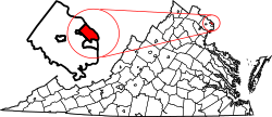
Arlington Forest is a suburban neighborhood and historic district in Arlington County, Virginia, about 3.5mi (5.6km) from Washington, D.C.[4][5]:4As of 2022[update], the 219-acre neighborhood comprised 852 single-family detached houses, each on small lots of approximately 6,000sqft (560m2).[5]:4 At the time of its addition to the National Register of Historic Places in 2005, the historic district comprised 810 contributing structures and three contributing sites, as well as 293 non-contributing buildings.[3] The bordering neighborhoods of Barcroft, Bluemont, and Glencarlyn are alike Arlington Forest in primarily being single-family residences, while the northeastern neighbor of Ballston has high-density and mixed-used zoning around the Ballston–MU Metro station.[5]:21
Arlington Boulevard, the line that divides North and South Arlington, cuts east–west through Arlington Forest. With Lubber Run– a stream which runs north-south through the neighborhood– Arlington Forest can be divided four sections: Northside in the northeast, Greenbrier in the northwest, Southside to the southeast, and Broyhill's Addition to the southwest.[5]:4–5[3]:5As of 2022[update], there were 282 houses in Northside, 399 houses in Greenbrier, and a combined 171 houses in Southside and Broyhill's Addition.[5] The residences were mostly constructed between 1939 and 1948 as a planned community. The original Colonial Revival two-story brick houses are arranged in rows.[3]:1 Colonial Revival houses still comprise the majority of structures in the neighborhood, but other styles have since been introduced.[5]:4
A mix-use development, the neighborhood includes a shopping center built in the 1940s. Fronting to Arlington Boulevard, the Arlington Forest Shopping Center was constructed to the contemporary recommendations of the Federal Housing Administration (FHA). The shopping center centers on a building configured in an L-shape and follows the surrounding residential architecture by being completed in brick with Colonial Revival styling. A parking lot is located in front of the complex and along the service road parallel to Arlington Boulevard.[3]:1,15–18As of 2022[update], eleven businesses operated in the shopping center.[5]:72–73
A citizens association operates within Arlington Forest.[6] The Arlington Forest Citizens Association represents the neighborhood in advocacy action and collaboration with the Arlington County government.[7]
Residential architecture
The FHA published the bulletin Principles of Planning Small Houses in 1936, in which five house designs were described as samples for use in future planned communities. The designs– labeled A, B, C, D, and E– were intended as simple and inexpensive models that could be modified to accommodate a variety of building materials. The FHA issued a revised edition of the bulletin in 1940 that promoted both standardization and variation in construction and materials. Arlington Forest's original construction followed models from the 1936 edition, with the construction and materials reflecting the 1940 edition.[3]:6–7
History
Pre-European contact, Native American lived in the area that is now Arlington Forest. During the Colonial period, the region was divided into large land grants. The majority of the modern Arlington Forest neighborhood was once part of land owned by the planter and merchant John Colville, who had purchased a 1,400-acre plot along Lubber Run in 1731. Colville received permission to construct a grist mill along Four Mile Run in 1754 and several other grist mills followed. An 165-acre plot on Lubber Run was purchased from Colville by William Carlin, George Washington's tailor, in 1772.[3]:2,174
Three houses from the 19th century survive in Arlington Forest. William Carlin built the Mary Carlin House on what is now the western edge of the neighborhood for his daughter c.1800. Broyhill's Addition contains both the one-story Ann Carlin Cottage (built c.1850) and a two-story frame farmhouse (built sometime between the 1820s and 1840s). During the American Civil War, the farmhouse belonged to Charles Eli Mix, the chief clerk of the Bureau of Indian Affairs. The farmhouse's carriage house also survives.[3]:2 An 1878 map of Arlington County indicates that the majority of what later became Arlington Forest was occupied by the families of Mix and William Sypher (spelled incorrectly as "Cypher" on the map).[3]:175[8]
Natural features
Arlington Forest is located on the eastern edge of Virginia's Piedmont, where it meets the Atlantic Plain along the Fall Line.[9] The Piedmont is defined by its crystalline metamorphic and igneous rocks and hilly surface,[3]:174 producing streams with fast-moving water.[5]:8 Several grist mills were once present along the Fall Line on Four Mile Run.[3]:174
Water from the neighborhood drains into Four Mile Run, as well as its tributaries Lubber Run and the Arlington Forest Branch.[5]:4 Four Mile Run crosses the Fall Line during its run along Arlington Forest, and the middle of the stream functions as the border between the Arlington Forest Citizens Association and the Glencarlyn Citizens Association.[10]
The Arlington Forest area had been mostly forested prior to the neighborhood's construction. These woods were mostly destroyed during the development, but the maturation of subsequent plantings has restored the tree canopy.[4] On Arlington Forest's edges are wooded areas.[5]:4 In front of the shopping center is the one-acre Arlington Forest Park. This is the smallest of seven Natural Resource Conservation Areas designated by Arlington County. The park is covered by largely undisturbed native soil, despite the surrounding development. The park's plants form a oak–heath forest remnant plant community known as a dry gravel cap poverty oat grass glade.[10][11]
This page is based on this Wikipedia article Text is available under the CC BY-SA 4.0 license; additional terms may apply. Images, videos and audio are available under their respective licenses.