National Register of Historic Places listings in Giles County, Virginia

Last updated

Location of Giles County in Virginia Map of Virginia highlighting Giles County.svg
Location of Giles County in Virginia

This is a list of the National Register of Historic Places listings in Giles County, Virginia.

Contents

This is intended to be a complete list of the properties and districts on the National Register of Historic Places in Giles County, Virginia, United States. The locations of National Register properties and districts for which the latitude and longitude coordinates are included below, may be seen in an online map. [1]

There are 11 properties and districts listed on the National Register in the county.


    This National Park Service list is complete through NPS recent listings posted March 4, 2022. [2]

Map all coordinates using: OpenStreetMap  
Download coordinates as: KML

Current listings

[3] Name on the Register [4] ImageDate listed [5] Location City or townDescription
1 Doe Creek Farm
Doe Creek Farm Doe Creek Farm driveway.jpg
Doe Creek Farm
June 12, 2017
(#100001079)
412 Doe Creek Rd.
37°19′40″N80°34′36″W / 37.327778°N 80.576667°W / 37.327778; -80.576667 (Doe Creek Farm)
Pearisburg
2 Giles County Courthouse
Giles County Courthouse Giles County Courthouse - Front View.jpg
Giles County Courthouse
September 9, 1982
(#82004560)
U.S. Route 460 and State Route 100
37°19′37″N80°44′06″W / 37.326944°N 80.735000°W / 37.326944; -80.735000 (Giles County Courthouse)
Pearisburg
3 Greater Newport Rural Historic District
Greater Newport Rural Historic District GREATER NEWPORT RURAL H.D., GILES COUNTY, VA.jpg
Greater Newport Rural Historic District
December 14, 2000
(#00000489)
Roughly bounded by U.S. Route 460, State Route 42, and Clover Hollow, Lucas, Zells Mills, Spruce Run, and Mountain Lake Rds.
37°17′39″N80°29′44″W / 37.294167°N 80.495444°W / 37.294167; -80.495444 (Greater Newport Rural Historic District)
Newport
4 Andrew Johnston House
Andrew Johnston House Andrew Johnston House.JPG
Andrew Johnston House
February 11, 1993
(#93000041)
208 N. Main St.
37°19′42″N80°44′09″W / 37.328472°N 80.735833°W / 37.328472; -80.735833 (Andrew Johnston House)
Pearisburg
5 Narrows Commercial Historic District
Narrows Commercial Historic District Annas Restaurant (309988589).jpg
Narrows Commercial Historic District
June 4, 2014
(#14000301)
100-300 blocks of Main St. and 100 blocks of Mary St., Monroe St., Center St., and MacArthur Ln.
37°19′53″N80°48′41″W / 37.331389°N 80.811389°W / 37.331389; -80.811389 (Narrows Commercial Historic District)
Narrows
6 Newport Historic District
Newport Historic District Newport-Mount Olivet United Methodist Church.jpg
Newport Historic District
February 25, 1994
(#94000059)
Area surrounding Greenbriar Branch Rd. and State Route 42
37°17′36″N80°29′46″W / 37.293333°N 80.496111°W / 37.293333; -80.496111 (Newport Historic District)
Newport
7 Pearisburg Historic District
Pearisburg Historic District Giles courthouse, Pearisburg.jpg
Pearisburg Historic District
January 30, 1992
(#92000004)
Roughly, Wenonah Ave. from Tazewell St. to Main St. and adjacent parts of N. and S. Main
37°19′35″N80°44′06″W / 37.326389°N 80.735°W / 37.326389; -80.735 (Pearisburg Historic District)
Pearisburg
8 The People's Bank of Eggleston
The People's Bank of Eggleston People's Bank of Eggleston.jpg
The People's Bank of Eggleston
June 5, 2017
(#100001043)
181 Village St.
37°17′17″N80°37′07″W / 37.288167°N 80.618611°W / 37.288167; -80.618611 (The People's Bank of Eggleston)
Eggleston
9 Q. M. Pyne Store
Q. M. Pyne Store Q. M. Pyne Store.JPG
Q. M. Pyne Store
March 13, 2009
(#09000121)
168 Village St.
37°17′16″N80°37′06″W / 37.287778°N 80.618333°W / 37.287778; -80.618333 (Q. M. Pyne Store)
Eggleston
10 Shannon Cemetery
Shannon Cemetery Shannon Cemetery near Staffordsville.jpg
Shannon Cemetery
May 4, 2006
(#06000350)
Junction of State Routes 42 and 100
37°13′05″N80°44′30″W / 37.218056°N 80.741667°W / 37.218056; -80.741667 (Shannon Cemetery)
Pearisburg
11 Walker's Creek Presbyterian Church
Walker's Creek Presbyterian Church Walker's Creek Presbyterian Church.JPG
Walker's Creek Presbyterian Church
October 22, 2003
(#03001088)
State Route 42; also Walker's Creek Cemetery
37°11′35″N80°50′20″W / 37.193056°N 80.838889°W / 37.193056; -80.838889 (Walker's Creek Presbyterian Church)
Pearisburg Cemetery represents a boundary increase of February 1, 2006

See also

Related Research Articles

National Register of Historic Places listings in Alleghany County, Virginia

This is a list of the National Register of Historic Places listings in Alleghany County, Virginia.

National Register of Historic Places listings in Amelia County, Virginia

This is a list of the National Register of Historic Places listings in Amelia County, Virginia.

National Register of Historic Places listings in Bath County, Virginia

This is a list of the National Register of Historic Places listings in Bath County, Virginia.

National Register of Historic Places listings in Bedford County, Virginia

This is a list of the National Register of Historic Places listings in Bedford County, Virginia.

National Register of Historic Places listings in Washington County, Virginia

This is a list of the National Register of Historic Places listings in Washington County, Virginia.

National Register of Historic Places listings in Clarke County, Virginia

This is a list of the National Register of Historic Places listings in Clarke County, Virginia.

National Register of Historic Places listings in Culpeper County, Virginia Wikimedia list article

This is a list of the National Register of Historic Places listings in Culpeper County, Virginia.

National Register of Historic Places listings in Cumberland County, Virginia

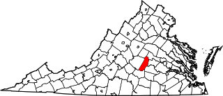
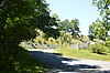
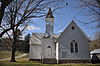
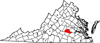
This is a list of the National Register of Historic Places listings in Cumberland County, Virginia.

National Register of Historic Places listings in Essex County, Virginia

This is a list of the National Register of Historic Places listings in Essex County, Virginia.

National Register of Historic Places listings in Goochland County, Virginia Wikimedia list article

This is a list of the National Register of Historic Places listings in Goochland County, Virginia.

National Register of Historic Places listings in Greene County, Virginia

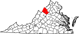
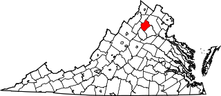
This is a list of the National Register of Historic Places listings in Greene County, Virginia.

National Register of Historic Places listings in Rockingham County, Virginia

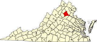
This is a list of the National Register of Historic Places listings in Rockingham County, Virginia.

National Register of Historic Places listings in New Kent County, Virginia

This is a list of the National Register of Historic Places listings in New Kent County, Virginia.

National Register of Historic Places listings in Orange County, Virginia

This is a list of the National Register of Historic Places listings in Orange County, Virginia.

National Register of Historic Places listings in Rappahannock County, Virginia

This is a list of the National Register of Historic Places listings in Rappahannock County, Virginia.

National Register of Historic Places listings in Shenandoah County, Virginia

This is a list of the National Register of Historic Places listings in Shenandoah County, Virginia.

National Register of Historic Places listings in Nottoway County, Virginia

This is a list of the National Register of Historic Places listings in Nottoway County, Virginia.

National Register of Historic Places listings in Prince Edward County, Virginia

This is a list of the National Register of Historic Places listings in Prince Edward County, Virginia.

National Register of Historic Places listings in Lee County, Virginia

This is a list of the National Register of Historic Places listings in Lee County, Virginia.

National Register of Historic Places listings in Grayson County, Virginia Wikimedia list article

This is a list of the National Register of Historic Places listings in Grayson County, Virginia.

References

  1. The latitude and longitude information provided in this table was derived originally from the National Register Information System, which has been found to be fairly accurate for about 99% of listings. Some locations in this table may have been corrected to current GPS standards.
  2. National Park Service, United States Department of the Interior, "National Register of Historic Places: Weekly List Actions", retrieved March 4, 2022.
  3. Numbers represent an alphabetical ordering by significant words. Various colorings, defined here, differentiate National Historic Landmarks and historic districts from other NRHP buildings, structures, sites or objects.
  4. "National Register Information System". National Register of Historic Places . National Park Service. April 24, 2008.
  5. The eight-digit number below each date is the number assigned to each location in the National Register Information System database, which can be viewed by clicking the number.