National Register of Historic Places listings in Madison County, Virginia

Last updated
Location of Madison County in Virginia Map of Virginia highlighting Madison County.svg
Location of Madison County in Virginia

This is a list of the National Register of Historic Places listings in Madison County, Virginia.

Contents

This is intended to be a complete list of the properties and districts on the National Register of Historic Places in Madison County, Virginia, United States. The locations of National Register properties and districts for which the latitude and longitude coordinates are included below, may be seen in an online map. [1]

There are 21 properties and districts listed on the National Register in the county, including 2 National Historic Landmarks.

This National Park Service list is complete through NPS recent listings posted October 23, 2020. [2]
Map all coordinates using: OpenStreetMap  
Download coordinates as: KML  ·  GPX

Current listings

[3] Name on the Register [4] ImageDate listed [5] Location City or townDescription
1 Belle Plaine
Belle Plaine Belle Plaine.jpg
Belle Plaine
August 15, 2016
(#16000532)
2488 S. U.S. Route 15
38°19′01″N78°07′13″W / 38.3169°N 78.1203°W / 38.3169; -78.1203 (Belle Plaine)
Locust Dale
2 Big Meadows Site
Big Meadows Site Bigmeadow.jpg
Big Meadows Site
December 13, 1985
(#85003172)
Head of Hogcamp Branch at Big Meadows [6] :117
38°31′00″N78°25′52″W / 38.5167°N 78.4311°W / 38.5167; -78.4311 (Big Meadows Site)
Luray
3 Brampton
Brampton Brampton from a distance.jpg
Brampton
December 12, 1985
(#85003350)
Brampton Rd.
38°17′55″N78°06′43″W / 38.2985°N 78.1119°W / 38.2985; -78.1119 (Brampton)
Orange
4 Camp Hoover
Camp Hoover Camphoover.jpg
Camp Hoover
June 7, 1988
(#88001825)
Shenandoah National Park
38°29′28″N78°25′13″W / 38.4911°N 78.4203°W / 38.4911; -78.4203 (Camp Hoover)
Graves Mill
5 Cliff Kill Site
Cliff Kill Site Cliff Kill Site.jpg
Cliff Kill Site
December 15, 1985
(#85003153)
Source of Hogcamp Branch at the edge of Big Meadows [7] :113
38°30′58″N78°25′46″W / 38.5161°N 78.4294°W / 38.5161; -78.4294 (Cliff Kill Site)
Luray
6 Coates Barn
Coates Barn Coates Barn (near Etlan, Virginia) 01.jpg
Coates Barn
August 12, 2020
(#100005442)
934 Champe Plain Rd.
38°32′27″N78°16′04″W / 38.5407°N 78.2679°W / 38.5407; -78.2679 (Coates Barn)
Etlan vicinity
7 George T. Corbin Cabin
George T. Corbin Cabin Corbin Cabin.jpg
George T. Corbin Cabin
January 13, 1989
(#88003067)
1.5 miles off Skyline Dr. at the junction of Corbin Cabin and Nicholson Hollow Trails
38°36′07″N78°20′41″W / 38.6019°N 78.3447°W / 38.6019; -78.3447 (George T. Corbin Cabin)
Nethers
8 Gentle Site
Gentle Site Gentle Site.jpg
Gentle Site
December 13, 1985
(#85003174)
Confluence of Hogcamp Branch and the Rose River below Big Meadows [8]
38°31′36″N78°24′28″W / 38.5267°N 78.4078°W / 38.5267; -78.4078 (Gentle Site)
Luray
9 Graves Mill
Graves Mill Graves Mill Madison County Virginia-1.jpg
Graves Mill
August 30, 2006
(#06000754)
29 Graves Rd.
38°25′27″N78°22′09″W / 38.4242°N 78.3692°W / 38.4242; -78.3692 (Graves Mill)
Wolftown
10 Greenway
Greenway Greenway.jpg
Greenway
November 16, 1988
(#88002385)
U.S. Route 15
38°17′10″N78°08′31″W / 38.2860°N 78.1419°W / 38.2860; -78.1419 (Greenway)
Madison Mills
11 Hebron Lutheran Church
Hebron Lutheran Church Hebron Lutheran Church.jpg
Hebron Lutheran Church
July 2, 1971
(#71000986)
1 mile northeast of Madison off U.S. Route 29
38°24′27″N78°14′50″W / 38.4074°N 78.2472°W / 38.4074; -78.2472 (Hebron Lutheran Church)
Madison
12 Hoffman Round Barn
Hoffman Round Barn Hoffman Round Bard.jpg
Hoffman Round Barn
April 20, 2009
(#09000242)
4864 Wolftown-Hood Rd.
38°20′46″N78°19′56″W / 38.3461°N 78.3322°W / 38.3461; -78.3322 (Hoffman Round Barn)
Wolftown
13 The Homeplace
The Homeplace The Homeplace.jpg
The Homeplace
August 5, 1999
(#99000959)
U.S. Route 29 at its junction with Hebron Valley Rd.
38°24′14″N78°13′17″W / 38.4039°N 78.2214°W / 38.4039; -78.2214 (The Homeplace)
Madison
14 James City Historic District
James City Historic District Environmental view of the James City Historic District, looking to the north elevation of the Feed Store and School - Feed Store-School, Route 29 and Route 631, Madison, Madison County, HABS VA-1417-1.tif
James City Historic District
July 13, 2001
(#01000691)
U.S. Route 29
38°26′14″N78°08′16″W / 38.4372°N 78.1378°W / 38.4372; -78.1378 (James City Historic District)
Madison
15 Locust Hill
Locust Hill Locust Hill Madison VA.jpg
Locust Hill
May 30, 2002
(#02000590)
Junction of U.S. Route 15 with Oak Park and Locust Dale Rds.
38°20′09″N78°07′36″W / 38.3358°N 78.1267°W / 38.3358; -78.1267 (Locust Hill)
Locust Dale
16 Madison County Courthouse
Madison County Courthouse Madison County Courthouse (Built 1829), Madison, Virginia.jpg
Madison County Courthouse
November 12, 1969
(#69000258)
Old U.S. Route 29
38°22′49″N78°15′29″W / 38.3803°N 78.2581°W / 38.3803; -78.2581 (Madison County Courthouse)
Madison
17 Madison County Courthouse Historic District
Madison County Courthouse Historic District Madison County Courthouse (VA) Historic District - Masonic Hall.JPG
Madison County Courthouse Historic District
August 16, 1984
(#84003549)
Main St.
38°22′39″N78°15′36″W / 38.3775°N 78.2600°W / 38.3775; -78.2600 (Madison County Courthouse Historic District)
Madison
18 The Residence
The Residence The Residence WoodberryForest.jpg
The Residence
June 19, 1979
(#79003052)
Woodberry Forest School
38°17′33″N78°07′08″W / 38.2925°N 78.1189°W / 38.2925; -78.1189 (The Residence)
Woodberry Forest
19 Robertson Mountain Site
Robertson Mountain Site Mountain from skyline dr.JPG
Robertson Mountain Site
December 13, 1985
(#85003173)
Address Restricted
Luray
20 Skyline Drive Historic District
Skyline Drive Historic District Wildwood Cabin Skyland VA NPS.jpg
Skyline Drive Historic District
April 28, 1997
(#97000375)
Shenandoah National Park, from the northern entrance station at Front Royal to the southern entrance station at Rockfish Gap
38°32′36″N78°23′36″W / 38.5433°N 78.3933°W / 38.5433; -78.3933 (Skyline Drive Historic District)
Luray
21 Woodbourne
Woodbourne Woodbourne.jpg
Woodbourne
June 28, 1999
(#99000727)
Thrift Rd., 1.5 miles (2.4 km) west of its junction with U.S. Route 29 Alternate
38°22′50″N78°16′41″W / 38.3806°N 78.2781°W / 38.3806; -78.2781 (Woodbourne)
Madison

See also

Related Research Articles

National Register of Historic Places listings in Augusta County, Virginia

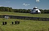
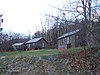
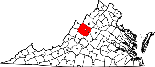
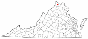
This is a list of the National Register of Historic Places listings in Augusta County, Virginia.

National Register of Historic Places listings in Chesterfield County, Virginia

This is a list of the National Register of Historic Places listings in Chesterfield County, Virginia.

National Register of Historic Places listings in Dinwiddie County, Virginia

This is a list of the National Register of Historic Places listings in Dinwiddie County, Virginia.

National Register of Historic Places listings in Winchester, Virginia

This is a list of the National Register of Historic Places listings in Winchester, Virginia.

National Register of Historic Places listings in Gloucester County, Virginia

This is a list of the National Register of Historic Places listings in Gloucester County, Virginia.

National Register of Historic Places listings in King William County, Virginia

This is a list of the National Register of Historic Places listings in King William County, Virginia.

National Register of Historic Places listings in Pocahontas County, West Virginia

This is a list of the National Register of Historic Places listings in Pocahontas County, West Virginia.

National Register of Historic Places listings in Mecklenburg County, Virginia

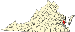
This is a list of the National Register of Historic Places listings in Mecklenburg County, Virginia.

National Register of Historic Places listings in York County, Virginia

This is a list of the National Register of Historic Places listings in York County, Virginia.

National Register of Historic Places listings in Shenandoah County, Virginia

This is a list of the National Register of Historic Places listings in Shenandoah County, Virginia.

National Register of Historic Places listings in Suffolk, Virginia

This is a list of the National Register of Historic Places listings in Suffolk, Virginia.

National Register of Historic Places listings in Westmoreland County, Virginia

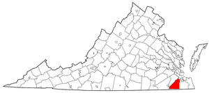
This is a list of the National Register of Historic Places listings in Westmoreland County, Virginia.

This is a list of the National Register of Historic Places listings in Shenandoah National Park.

Archeological Site No. AU-154 United States historic place

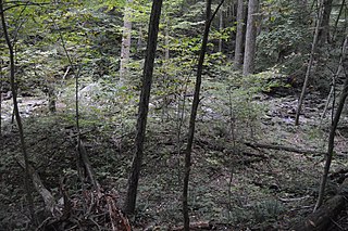
Site AU-154 is an archaeological site in Shenandoah National Park, in Augusta County, Virginia, United States.

Blackrock Springs Site United States historic place

The Blackrock Springs Site (44-AU-167) is an archaeological site in Shenandoah National Park, in Augusta County, Virginia, United States.

Cliff Kill Site United States historic place

The Cliff Kill Site (44-MD-138) is an archaeological site in Shenandoah National Park, in Madison County, Virginia, United States. Its name derives from the discoverers' supposition that it was originally used as a buffalo jump.

Gentle Site United States historic place

The Gentle Site (44-MD-112) is an archaeological site in Shenandoah National Park, in Madison County, Virginia, United States.

Paine Run Rockshelter United States historic place

The Paine Run Rockshelter (44-AU-158) is an archaeological site in Shenandoah National Park, in Augusta County, Virginia, United States.

National Register of Historic Places listings in Mississippi County, Missouri

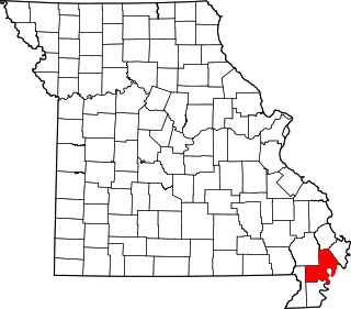
This is a list of the National Register of Historic Places listings in Mississippi County, Missouri.

National Register of Historic Places listings in New Madrid County, Missouri

This is a list of the National Register of Historic Places listings in New Madrid County, Missouri.

References

  1. The latitude and longitude information provided in this table was derived originally from the National Register Information System, which has been found to be fairly accurate for about 99% of listings. Some locations in this table may have been corrected to current GPS standards.
  2. "National Register of Historic Places: Weekly List Actions". National Park Service, United States Department of the Interior. Retrieved on October 23, 2020.
  3. Numbers represent an alphabetical ordering by significant words. Various colorings, defined here, differentiate National Historic Landmarks and historic districts from other NRHP buildings, structures, sites or objects.
  4. "National Register Information System". National Register of Historic Places . National Park Service. April 24, 2008.
  5. The eight-digit number below each date is the number assigned to each location in the National Register Information System database, which can be viewed by clicking the number.
  6. Foss, Robert Ward. Man and Mountain: An Archaeological Overview of the Shenandoah National Park. Thesis U of Virginia, 1977.
  7. Foss, Robert Ward. Man and Mountain: An Archaeological Overview of the Shenandoah National Park. Thesis U of Virginia, 1977.
  8. Foss, Robert Ward. Man and Mountain: An Archaeological Overview of the Shenandoah National Park. Thesis U of Virginia, 1977, 117.