National Register of Historic Places listings in Westmoreland County, Virginia

Last updated

Location of Westmoreland County in Virginia Map of Virginia highlighting Westmoreland County.svg
Location of Westmoreland County in Virginia

This is a list of the National Register of Historic Places listings in Westmoreland County, Virginia.

Contents

This is intended to be a complete list of the properties and districts on the National Register of Historic Places in Westmoreland County, Virginia, United States. The locations of National Register properties and districts for which the latitude and longitude coordinates are included below, may be seen in an online map. [1]

There are 25 properties and districts listed on the National Register in the county, including 2 National Historic Landmarks.


    This National Park Service list is complete through NPS recent listings posted September 15, 2023. [2]

Map all coordinates using: OpenStreetMap

Current listings

[3] Name on the Register [4] ImageDate listed [5] Location City or townDescription
1 Bell House
Bell House Alexander Graham Bell's Summer Home in Colonial Beach, Virginia.JPG
Bell House
September 21, 1987
(#87000692)
821 Irving Ave.
38°14′27″N76°57′27″W / 38.240833°N 76.957500°W / 38.240833; -76.957500 (Bell House)
Colonial Beach
2 Blenheim
Blenheim Blenheim, State Route 204 vicinity, Oak Grove (Westmoreland County, Virginia).jpg
Blenheim
June 5, 1975
(#75002042)
North of Wakefield Corner off State Route 204
38°10′51″N76°56′56″W / 38.180833°N 76.948750°W / 38.180833; -76.948750 (Blenheim)
Wakefield Corner
3 Bushfield
Bushfield Bushfield from Clubhouse Loop.jpg
Bushfield
February 11, 2004
(#04000053)
367 Club House Loop
38°08′00″N76°42′50″W / 38.133333°N 76.713889°W / 38.133333; -76.713889 (Bushfield)
Mount Holly
4 Chantilly
Chantilly Chantilly cornfield.jpg
Chantilly
December 16, 1971
(#71000990)
Address Restricted
Montross
5 Colonial Beach Commercial Historic District September 16, 2021
(#100006984)
Colonia Ave from Lynnhaven Ave to Potomac R.; Washington Ave. from Boundary St., Irving Ave., Wilder Ave, and Hawthorn St.; and Boundary Ave to Beach Terrace from Hawthorn St. with exclusions.
38°15′17″N76°57′49″W / 38.2547°N 76.9636°W / 38.2547; -76.9636 (Colonial Beach Commercial Historic District)
Colonial Beach
6 Ingleside
Ingleside Ingleside plantation-and-vineyard entrance.jpg
Ingleside
March 15, 1979
(#79003094)
South of Oak Grove on Leedstown Rd.
38°09′01″N77°00′14″W / 38.150278°N 77.003889°W / 38.150278; -77.003889 (Ingleside)
Oak Grove
7 Armstead T. Johnson High School
Armstead T. Johnson High School Armstead T. Johnson High School.jpg
Armstead T. Johnson High School
August 14, 1998
(#98001071)
0.2 miles northwest of the junction of State Routes 3 and 202
38°04′39″N76°46′54″W / 38.077500°N 76.781667°W / 38.077500; -76.781667 (Armstead T. Johnson High School)
Montross
8 Morgan Jones 1677 Pottery Kiln
Morgan Jones 1677 Pottery Kiln Morgan Jones Pottery Site.jpg
Morgan Jones 1677 Pottery Kiln
October 16, 1974
(#74002150)
Southwestern section of the Glebe Harbor subdivision peninsula [6]
38°08′01″N76°39′13″W / 38.133611°N 76.653611°W / 38.133611; -76.653611 (Morgan Jones 1677 Pottery Kiln)
Hague
9 Kinsale Historic District
Kinsale Historic District Bank of Kinsale.jpg
Kinsale Historic District
July 22, 2005
(#05000476)
Roughly along Kinsale Rd., Kinsale Bridge Rd., Sigouney Dr., Great House Rd., and Yeocomico Ln.
38°01′46″N76°34′48″W / 38.029444°N 76.580000°W / 38.029444; -76.580000 (Kinsale Historic District)
Kinsale
10 Kirnan - China Hall August 5, 2019
(#100004257)
498 Zion Church Road
38°03′49″N76°37′19″W / 38.0636°N 76.6220°W / 38.0636; -76.6220 (Kirnan - China Hall)
Hague
11 James Monroe Family Home Site
James Monroe Family Home Site James Monroe Family Home Site - Stierch.JPG
James Monroe Family Home Site
July 24, 1979
(#79003095)
4460 State Route 205
38°14′31″N76°59′25″W / 38.241944°N 76.990278°W / 38.241944; -76.990278 (James Monroe Family Home Site)
Colonial Beach Specific location represents a boundary increase of April 10, 2008; the site was originally listed as "Address Restricted"
12 Montross Historic District September 22, 2023
(#100009072)
Bounded by VA 3/Kings Hwy., Alma and Ames Lns., Court Sq., Polk St., and Rectory Rd.
38°05′43″N76°49′39″W / 38.0953°N 76.8276°W / 38.0953; -76.8276 (Montross Historic District)
Montross
13 Mount Pleasant
Mount Pleasant Mount Pleasant woodlands on Coles Point Road.jpg
Mount Pleasant
November 27, 2002
(#02001440)
317 Coles Point Rd.
38°04′32″N76°38′41″W / 38.075417°N 76.644722°W / 38.075417; -76.644722 (Mount Pleasant)
Hague
14 Panorama
Panorama Panorama glance.jpg
Panorama
January 31, 2011
(#10001186)
1006 Panorama Rd.
38°06′09″N76°50′33″W / 38.102500°N 76.842500°W / 38.102500; -76.842500 (Panorama)
Montross
15 Rochester House
Rochester House Rochester farmstead wooden building.jpg
Rochester House
January 25, 1991
(#90002205)
Beulah Ln., 1 mile (1.6 km) northeast of Lyells off State Route 3
38°00′05″N76°43′02″W / 38.001389°N 76.717222°W / 38.001389; -76.717222 (Rochester House)
Lyells
16 Roxbury
Roxbury Roxbury near Oak Grove.jpg
Roxbury
March 15, 1979
(#79003096)
1.7 miles (2.7 km) south of Oak Grove
38°09′27″N77°00′10″W / 38.157500°N 77.002778°W / 38.157500; -77.002778 (Roxbury)
Oak Grove
17 St. Peter's Episcopal Church
St. Peter's Episcopal Church Oak Grove St. Peter's Episcopal Church.jpg
St. Peter's Episcopal Church
January 16, 2004
(#03001445)
Junction of State Routes 3 and 205
38°10′56″N76°59′45″W / 38.182222°N 76.995833°W / 38.182222; -76.995833 (St. Peter's Episcopal Church)
Oak Grove
18 Siele (motor yacht)
Siele (motor yacht) Miss Ann (5374298716).jpg
Siele (motor yacht)
November 12, 1998
(#98001310)
Colonial Beach Yacht Center
38°13′56″N76°57′56″W / 38.232222°N 76.965417°W / 38.232222; -76.965417 (Siele (motor yacht))
Colonial Beach
19 Spence's Point
Spence's Point Spence's Point, John Dos Passos Farm, (Westmoreland County, Virginia).jpg
Spence's Point
November 11, 1971
(#71000991)
On Sandy Point Neck, on Spences Point Rd.
38°05′13″N76°33′46″W / 38.087083°N 76.562778°W / 38.087083; -76.562778 (Spence's Point)
Westmoreland
20 Spring Grove
Spring Grove Spring Grove dwg HABS VA1.jpg
Spring Grove
October 10, 1985
(#85003130)
State Route 202
38°05′10″N76°42′22″W / 38.086111°N 76.706111°W / 38.086111; -76.706111 (Spring Grove)
Mount Holly
21 Stratford Hall
Stratford Hall Stratford hall habs 1.jpg
Stratford Hall
October 15, 1966
(#66000851)
North of Lerty on State Route 214
38°09′07″N76°50′22″W / 38.151944°N 76.839444°W / 38.151944; -76.839444 (Stratford Hall)
Lerty
22 George Washington Birthplace National Monument
George Washington Birthplace National Monument Geo Washington birthplace.jpg
George Washington Birthplace National Monument
October 15, 1966
(#66000850)
East of Fredericksburg off U.S. Route 301 and State Route 3
38°11′09″N76°55′05″W / 38.185833°N 76.918056°W / 38.185833; -76.918056 (George Washington Birthplace National Monument)
Colonial Beach
23 Westmoreland State Park Historic District
Westmoreland State Park Historic District WE Cabin7 ABB (11310266054).jpg
Westmoreland State Park Historic District
November 16, 2005
(#05001265)
1650 State Park Rd.
38°10′12″N76°51′46″W / 38.170000°N 76.862778°W / 38.170000; -76.862778 (Westmoreland State Park Historic District)
Montross
24 Wirtland
Wirtland Wirtland fields.jpg
Wirtland
March 15, 1979
(#79003097)
South of Oak Grove on Leedstown Rd.
38°09′23″N77°00′28″W / 38.156389°N 77.007778°W / 38.156389; -77.007778 (Wirtland)
Oak Grove
25 Yeocomico Church
Yeocomico Church Yeocomico Church, State Route 606, Tucker Hill, Westmoreland County, VA HABS VA,97- ,1-1.tif
Yeocomico Church
November 12, 1969
(#69000331)
Old Yeocomico Rd.
38°03′45″N76°35′49″W / 38.062500°N 76.596944°W / 38.062500; -76.596944 (Yeocomico Church)
Tucker Hill

See also

Related Research Articles

<span class="mw-page-title-main">National Register of Historic Places listings in Alleghany County, Virginia</span>

This is a list of the National Register of Historic Places listings in Alleghany County, Virginia.

<span class="mw-page-title-main">National Register of Historic Places listings in Amelia County, Virginia</span>

This is a list of the National Register of Historic Places listings in Amelia County, Virginia.

<span class="mw-page-title-main">National Register of Historic Places listings in Bedford County, Virginia</span>

This is a list of the National Register of Historic Places listings in Bedford County, Virginia.

<span class="mw-page-title-main">National Register of Historic Places listings in Botetourt County, Virginia</span>

This is a list of the National Register of Historic Places listings in Botetourt County, Virginia.

<span class="mw-page-title-main">National Register of Historic Places listings in Washington County, Virginia</span>

This is a list of the National Register of Historic Places listings in Washington County, Virginia.

<span class="mw-page-title-main">National Register of Historic Places listings in Charlotte County, Virginia</span>

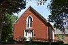
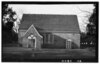
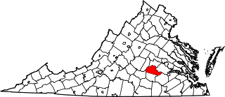
This is a list of the National Register of Historic Places listings in Charlotte County, Virginia.

<span class="mw-page-title-main">National Register of Historic Places listings in Pittsylvania County, Virginia</span>

This is a list of the National Register of Historic Places listings in Pittsylvania County, Virginia.

<span class="mw-page-title-main">National Register of Historic Places listings in Westmoreland County, Pennsylvania</span>

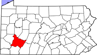
This is a list of the National Register of Historic Places listings in Westmoreland County, Pennsylvania.

<span class="mw-page-title-main">National Register of Historic Places listings in Fredericksburg, Virginia</span>

This is a list of the National Register of Historic Places listings in Fredericksburg, Virginia.

<span class="mw-page-title-main">National Register of Historic Places listings in Goochland County, Virginia</span>

This is a list of the National Register of Historic Places listings in Goochland County, Virginia.

<span class="mw-page-title-main">National Register of Historic Places listings in Greene County, Virginia</span>

This is a list of the National Register of Historic Places listings in Greene County, Virginia.

<span class="mw-page-title-main">National Register of Historic Places listings in Rockingham County, Virginia</span>

This is a list of the National Register of Historic Places listings in Rockingham County, Virginia.

<span class="mw-page-title-main">National Register of Historic Places listings in New Kent County, Virginia</span>

This is a list of the National Register of Historic Places listings in New Kent County, Virginia.

<span class="mw-page-title-main">National Register of Historic Places listings in Orange County, Virginia</span>

This is a list of the National Register of Historic Places listings in Orange County, Virginia.

<span class="mw-page-title-main">National Register of Historic Places listings in Shenandoah County, Virginia</span>

This is a list of the National Register of Historic Places listings in Shenandoah County, Virginia.

<span class="mw-page-title-main">National Register of Historic Places listings in Wythe County, Virginia</span>

This is a list of the National Register of Historic Places listings in Wythe County, Virginia.

<span class="mw-page-title-main">National Register of Historic Places listings in Prince Edward County, Virginia</span>

This is a list of the National Register of Historic Places listings in Prince Edward County, Virginia.

<span class="mw-page-title-main">National Register of Historic Places listings in Sussex County, Virginia</span>

This is a list of the National Register of Historic Places listings in Sussex County, Virginia.

<span class="mw-page-title-main">National Register of Historic Places listings in Lewis County, West Virginia</span>

This is a list of the National Register of Historic Places listings in Lewis County, West Virginia.

<span class="mw-page-title-main">National Register of Historic Places listings in Grayson County, Virginia</span>

This is a list of the National Register of Historic Places listings in Grayson County, Virginia.

References

  1. The latitude and longitude information provided in this table was derived originally from the National Register Information System, which has been found to be fairly accurate for about 99% of listings. Some locations in this table may have been corrected to current GPS standards.
  2. National Park Service, United States Department of the Interior, "National Register of Historic Places: Weekly List Actions", retrieved September 15, 2023.
  3. Numbers represent an alphabetical ordering by significant words. Various colorings, defined here, differentiate National Historic Landmarks and historic districts from other NRHP buildings, structures, sites or objects.
  4. "National Register Information System". National Register of Historic Places . National Park Service. April 24, 2008.
  5. The eight-digit number below each date is the number assigned to each location in the National Register Information System database, which can be viewed by clicking the number.
  6. Kelson, William M., and Edward A. Chappell. "Excavation of a Seventeenth Century Pottery Kiln at Glebe Harbor, Westmoreland County, Virginia". Historical Archaeology 8 (1974), 53-63: 53.