National Register of Historic Places listings in Accomack County, Virginia

Last updated

Location of Accomack County in Virginia Map of Virginia highlighting Accomack County.svg
Location of Accomack County in Virginia

This is a list of the National Register of Historic Places listings in Accomack County, Virginia.

Contents

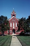
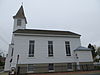
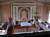
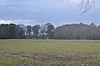
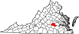
This is intended to be a complete list of the properties and districts on the National Register of Historic Places in Accomack County, Virginia, United States. The locations of National Register properties and districts for which the latitude and longitude coordinates are included below, may be seen in an online map. [1]

There are 30 properties and districts listed on the National Register in the county. Another property was once listed but has been removed.


    This National Park Service list is complete through NPS recent listings posted May 19, 2023. [2]

Map all coordinates using: OpenStreetMap  
Download coordinates as: KML

Current listings

[3] Name on the Register [4] ImageDate listed [5] Location City or townDescription
1 Accomac Historic District
Accomac Historic District Accomack County Courthouse (Built 1899), Accomac ( Accomack County, Virginia).jpg
Accomac Historic District
July 21, 1982
(#82004529)
U.S. Route 13 Business
37°43′11″N75°40′11″W / 37.719722°N 75.669722°W / 37.719722; -75.669722 (Accomac Historic District)
Accomac
2 Arbuckle Place
Arbuckle Place Arbuckle Place closeup.jpg
Arbuckle Place
May 22, 1986
(#86001136)
Atlantic Rd.
37°52′27″N75°31′37″W / 37.874167°N 75.526944°W / 37.874167; -75.526944 (Arbuckle Place)
Assawoman
3 Assateague Beach Coast Guard Station
Assateague Beach Coast Guard Station AssateagueBeachCoastGuardStation.jpg
Assateague Beach Coast Guard Station
November 2, 2015
(#15000766)
Beach Rd., Assateague Island National Seashore
37°51′51″N75°22′05″W / 37.864167°N 75.368056°W / 37.864167; -75.368056 (Assateague Beach Coast Guard Station)
Chincoteague
4 Assateague Lighthouse
Assateague Lighthouse Assateague Light May 2015.jpg
Assateague Lighthouse
June 4, 1973
(#73001989)
South of Chincoteague at the southern end of Assateague Island
37°54′40″N75°21′22″W / 37.911111°N 75.356111°W / 37.911111; -75.356111 (Assateague Lighthouse)
Chincoteague
5 Bank Building
Bank Building Mercantile Bldg (Accomac VA) from WNW 1.JPG
Bank Building
July 23, 1974
(#74002099)
23321 Courthouse Ave. [6]
37°43′10″N75°40′15″W / 37.719583°N 75.670833°W / 37.719583; -75.670833 (Bank Building)
Accomac
6 Edmund Bayly House June 28, 1982
(#82004530)
Sheppard Rd.
37°34′37″N75°53′06″W / 37.577083°N 75.885000°W / 37.577083; -75.885000 (Edmund Bayly House)
Craddockville
7 Bowman's Folly
Bowman's Folly Bowman's Folly, Folly Creek, Accomac vicinity (Accomack County, Virginia).jpg
Bowman's Folly
November 12, 1969
(#69000216)
Southeast of the junction of U.S. Route 13 and Joynes Neck Rd.
37°41′45″N75°37′29″W / 37.695833°N 75.624722°W / 37.695833; -75.624722 (Bowman's Folly)
Accomac
8 Bunting Place April 11, 2003
(#03000210)
31181 Drummondtown Rd.
37°37′16″N75°41′32″W / 37.621111°N 75.692222°W / 37.621111; -75.692222 (Bunting Place)
Wachapreague
9 Central High School
Central High School Central High School (Accomack Co VA) from S 1.JPG
Central High School
August 16, 2010
(#10000561)
32308 U.S. Route 13
37°35′58″N75°46′36″W / 37.599444°N 75.776667°W / 37.599444; -75.776667 (Central High School)
Painter
10 Cokesbury Church
Cokesbury Church Onancock-Cokesbury-churchside.JPG
Cokesbury Church
November 27, 2004
(#04001265)
13 Market St.
37°42′43″N75°45′08″W / 37.712083°N 75.752361°W / 37.712083; -75.752361 (Cokesbury Church)
Onancock
11 Debtors' Prison
Debtors' Prison AccomacPrison.jpg
Debtors' Prison
November 7, 1976
(#76002087)
Courthouse Ave.
37°43′13″N75°40′15″W / 37.720278°N 75.670972°W / 37.720278; -75.670972 (Debtors' Prison)
Accomac
12 Captain Timothy Hill House
Captain Timothy Hill House Capt Timothy Hill House VA1.jpg
Captain Timothy Hill House
August 22, 2011
(#11000547)
5122 Main St.
37°56′49″N75°21′25″W / 37.947083°N 75.357083°W / 37.947083; -75.357083 (Captain Timothy Hill House)
Chincoteague Island
13 Hills Farm September 12, 2008
(#08000872)
19065 Hills Farm Rd.
37°46′55″N75°42′15″W / 37.781944°N 75.704167°W / 37.781944; -75.704167 (Hills Farm)
Greenbush
14 Hopkins and Brother Store
Hopkins and Brother Store Onancock-Hopkins&bro.JPG
Hopkins and Brother Store
November 12, 1969
(#69000217)
Market St.
37°42′43″N75°45′19″W / 37.711944°N 75.755278°W / 37.711944; -75.755278 (Hopkins and Brother Store)
Onancock Est. 1842, served as bank and community meeting place; in 1970 deeded to Assoc. for the Preservation of Virginia Antiquities
15 Locustville Academy
Locustville Academy Locustville Academy.jpg
Locustville Academy
November 22, 2016
(#16000792)
28055 Drummondtown Rd.
37°39′29″N75°40′30″W / 37.657917°N 75.675138°W / 37.657917; -75.675138 (Locustville Academy)
Locustville
16 Ker Place
Ker Place Onancock-Ker-Place.JPG
Ker Place
February 26, 1970
(#70000780)
Northeastern corner of the junction of Crockett Ave. and Market St.
37°42′47″N75°44′49″W / 37.712917°N 75.746944°W / 37.712917; -75.746944 (Ker Place)
Onancock 
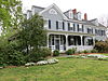
Built 1799-1802 by John Shepard Ker in Federal architecture style; originally called Ker's Place; Virginia Historic Landmark; now a museum and headquarters of Eastern Shore of Virginia Historical Society
17 Mason House
Mason House Mason House HABS VA1.jpg
Mason House
November 21, 1974
(#74002100)
North of Guilford off Winterville Rd.
37°50′01″N75°39′13″W / 37.833611°N 75.653611°W / 37.833611; -75.653611 (Mason House)
Guilford
18 Onancock Historic District
Onancock Historic District Onancock-Hopkins-Beechlawn-house.JPG
Onancock Historic District
October 8, 1992
(#92001266)
Roughly bounded by Joynes Branch, Onancock Creek, and Lake, Kerr, Jackson, Market, Justice, Johnson, and Holly Sts.
37°42′42″N75°44′48″W / 37.711667°N 75.746667°W / 37.711667; -75.746667 (Onancock Historic District)
Onancock
19 Samuel D. Outlaw Blacksmith Shop May 17, 2023
(#100008968)
5 Boundary Ave.
37°42′36″N75°44′03″W / 37.7101°N 75.7341°W / 37.7101; -75.7341 (Samuel D. Outlaw Blacksmith Shop)
Onancock
20 Pitts Neck
Pitts Neck Pitts Neck Farm, State Route 709, New Church vicinity, (Accomack County, Virginia).jpg
Pitts Neck
October 21, 1976
(#76002088)
6 miles west of New Church on Pitts Creek Rd.
37°58′14″N75°37′37″W / 37.970556°N 75.626944°W / 37.970556; -75.626944 (Pitts Neck)
New Church
21 Pocomoke Farm
Pocomoke Farm Francis Makemie.jpg
Pocomoke Farm
February 15, 2007
(#07000054)
7492 Monument Rd.
37°55′58″N75°38′06″W / 37.932778°N 75.635000°W / 37.932778; -75.635000 (Pocomoke Farm)
Sanford Now known as Makemie Monument Park
22 St. George's Church
St. George's Church Saint Georges Episcopal Church Pungoteague.jpg
St. George's Church
September 15, 1970
(#70000781)
State Route 178 northeast of its junction with State Route 180
37°38′02″N75°48′38″W / 37.633889°N 75.810694°W / 37.633889; -75.810694 (St. George's Church)
Pungoteague
23 St. James Church
St. James Church St. James Episcopal (Accomac VA) interior 5.JPG
St. James Church
June 11, 1969
(#69000215)
Daugherty Rd. between Back St. and Ocean Hwy.
37°43′03″N75°40′20″W / 37.717500°N 75.672222°W / 37.717500; -75.672222 (St. James Church)
Accomac
24 Saxis Island Historic District November 24, 2017
(#100001848)
Saxis Rd. and feeder lanes
37°55′28″N75°43′18″W / 37.924444°N 75.721667°W / 37.924444; -75.721667 (Saxis Island Historic District)
Saxis
25 Scarborough House Archaeological Site (44AC4)
Scarborough House Archaeological Site (44AC4) Scarborough House Site.jpg
Scarborough House Archaeological Site (44AC4)
May 16, 1985
(#85001125)
Scarborough Gut [7]
37°33′41″N75°54′42″W / 37.561389°N 75.911667°W / 37.561389; -75.911667 (Scarborough House Archaeological Site (44AC4))
Davis Wharf Site of the estate house of Edmund Scarborough
26 Shepherd's Plain
Shepherd's Plain Shepherd's Plain HABS VA1.jpg
Shepherd's Plain
June 28, 1982
(#82004531)
West of Pungoteague
37°37′40″N75°50′25″W / 37.627778°N 75.840278°W / 37.627778; -75.840278 (Shepherd's Plain)
Pungoteague
27 Tangier Island Historic District
Tangier Island Historic District SwainMemorialUMC.jpg
Tangier Island Historic District
June 27, 2014
(#14000384)
Most of Tangier Island; also an area south of Tangier Island in Chesapeake Bay
37°49′39″N75°59′32″W / 37.827500°N 75.992222°W / 37.827500; -75.992222 (Tangier Island Historic District)
Tangier Boundary increase August 24, 2015
28 Wessells Root Cellar February 26, 1970
(#70000779)
Northeast of the junction of Savannah and Wessells Farm Rds.
37°53′54″N75°37′34″W / 37.898333°N 75.626111°W / 37.898333; -75.626111 (Wessells Root Cellar)
Hallwood
29 Wharton Place
Wharton Place Wharton Place fields with house dimly visible.jpg
Wharton Place
November 3, 1972
(#72001378)
0.7 miles northeast of the junction of Metompkin and Pettit Rds.
37°50′58″N75°32′01″W / 37.849306°N 75.533611°W / 37.849306; -75.533611 (Wharton Place)
Mappsville
30 Willowdale May 2, 2007
(#07000401)
18412 Willowdale Dr.
37°33′31″N75°45′41″W / 37.558611°N 75.761389°W / 37.558611; -75.761389 (Willowdale)
Painter

Former listing

[3] Name on the RegisterImageDate listedDate removedLocationCity or townDescription
1 Corbin Hall November 9, 1972
(#72001377)
June 10, 2005E of Horntown on VA 679
Horntown Destroyed by fire on February 14, 2000. [8]

See also

Related Research Articles

<span class="mw-page-title-main">National Register of Historic Places listings in Amelia County, Virginia</span>

This is a list of the National Register of Historic Places listings in Amelia County, Virginia.

<span class="mw-page-title-main">National Register of Historic Places listings in Waynesboro, Virginia</span>

This is a list of the National Register of Historic Places listings in Waynesboro, Virginia.

<span class="mw-page-title-main">National Register of Historic Places listings in Caroline County, Virginia</span>

This is a list of the National Register of Historic Places listings in Caroline County, Virginia.

<span class="mw-page-title-main">National Register of Historic Places listings in Prince George County, Virginia</span>

This is a list of the National Register of Historic Places listings in Prince George County, Virginia.

<span class="mw-page-title-main">National Register of Historic Places listings in Hanover County, Virginia</span>

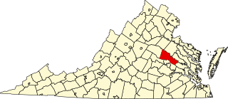
This is a list of the National Register of Historic Places listings in Hanover County, Virginia.

<span class="mw-page-title-main">National Register of Historic Places listings in Clarke County, Virginia</span>

This is a list of the National Register of Historic Places listings in Clarke County, Virginia.

<span class="mw-page-title-main">National Register of Historic Places listings in Cumberland County, Virginia</span>

This is a list of the National Register of Historic Places listings in Cumberland County, Virginia.

<span class="mw-page-title-main">National Register of Historic Places listings in Pittsylvania County, Virginia</span>

This is a list of the National Register of Historic Places listings in Pittsylvania County, Virginia.

<span class="mw-page-title-main">National Register of Historic Places listings in Goochland County, Virginia</span>

This is a list of the National Register of Historic Places listings in Goochland County, Virginia.

<span class="mw-page-title-main">National Register of Historic Places listings in Greene County, Virginia</span>

This is a list of the National Register of Historic Places listings in Greene County, Virginia.

<span class="mw-page-title-main">National Register of Historic Places listings in Rockingham County, Virginia</span>

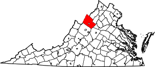
This is a list of the National Register of Historic Places listings in Rockingham County, Virginia.

<span class="mw-page-title-main">National Register of Historic Places listings in Lancaster County, Virginia</span>

This is a list of the National Register of Historic Places listings in Lancaster County, Virginia.

<span class="mw-page-title-main">National Register of Historic Places listings in Louisa County, Virginia</span>

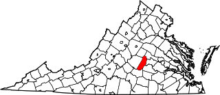
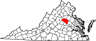
This is a list of the National Register of Historic Places listings in Louisa County, Virginia.

<span class="mw-page-title-main">National Register of Historic Places listings in Lunenburg County, Virginia</span>

This is a list of the National Register of Historic Places listings in Lunenburg County, Virginia.

<span class="mw-page-title-main">National Register of Historic Places listings in Montgomery County, Virginia</span>

This is a list of the National Register of Historic Places listings in Montgomery County, Virginia.

<span class="mw-page-title-main">National Register of Historic Places listings in Rappahannock County, Virginia</span>

This is a list of the National Register of Historic Places listings in Rappahannock County, Virginia.

<span class="mw-page-title-main">National Register of Historic Places listings in Smyth County, Virginia</span>

This is a list of the National Register of Historic Places listings in Smyth County, Virginia.

<span class="mw-page-title-main">National Register of Historic Places listings in Westmoreland County, Virginia</span>

This is a list of the National Register of Historic Places listings in Westmoreland County, Virginia.

<span class="mw-page-title-main">National Register of Historic Places listings in Patrick County, Virginia</span>

This is a list of the National Register of Historic Places listings in Patrick County, Virginia.

<span class="mw-page-title-main">National Register of Historic Places listings in Lewis County, West Virginia</span>

This is a list of the National Register of Historic Places listings in Lewis County, West Virginia.

References

  1. The latitude and longitude information provided in this table was derived originally from the National Register Information System, which has been found to be fairly accurate for about 99% of listings. Some locations in this table may have been corrected to current GPS standards.
  2. National Park Service, United States Department of the Interior, "National Register of Historic Places: Weekly List Actions", retrieved May 19, 2023.
  3. 1 2 Numbers represent an alphabetical ordering by significant words. Various colorings, defined here, differentiate National Historic Landmarks and historic districts from other NRHP buildings, structures, sites or objects.
  4. "National Register Information System". National Register of Historic Places . National Park Service. April 24, 2008.
  5. The eight-digit number below each date is the number assigned to each location in the National Register Information System database, which can be viewed by clicking the number.
  6. When photographed in December 2014, the front (west-southwest) door bore the number "23321", with a sign for "Eastern Shore Bail Bonds"; a Facebook page for Eastern Shore Bail Bonds gives its address as 23321 Courthouse Avenue.
  7. Loth, Calder. The Virginia Landmarks Register. 4th ed. Charlottesville: UP of Virginia, 1999, 5.
  8. "Fire destroys a piece of Accomack history". The Daily Times (Salisbury, Maryland) . February 16, 2000. p. 1. Retrieved September 3, 2022 via Newspapers.com.