Temperanceville, Virginia

Last updated

Temperanceville, Virginia
U.S. Route 13 with Temperanceville USPO.jpg
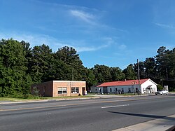
U.S. Route 13 and the Temperanceville post office, July 2018
Accomack County Virginia incorporated and unincorporated areas Temperanceville highlighted.svg
Location in Accomack County and the state of Virginia.
Coordinates: 37°53′57″N75°33′10″W / 37.89917°N 75.55278°W / 37.89917; -75.55278 [1]
CountryUnited States
State Virginia
County Accomack
Elevation
[1]
43 ft (13 m)
Population
 (2020)
  Total
308
Time zone UTC−5 (Eastern (EST))
  Summer (DST) UTC−4 (EDT)
FIPS code 51-48776
GNIS feature ID2584929 [1]

Temperanceville is a census-designated place (CDP) in Accomack County, Virginia, United States. [1] It was first listed as a CDP in 2010. [1] As of the 2020 census, it had a population of 308. [2]

Contents

Temperanceville was originally built up chiefly by Quakers. [3]

It lies at an elevation of 43 feet. [1]

Demographics

Historical population
CensusPop.Note
2010 358
2020 308−14.0%
U.S. Decennial Census [4]
2010 [5] 2020 [6]

Temperanceville was first listed as a census designated place in the 2010 U.S. Census. [5]

2020 census

Temperanceville CDP, Virginia – Racial and ethnic composition
Note: the US Census treats Hispanic/Latino as an ethnic category. This table excludes Latinos from the racial categories and assigns them to a separate category. Hispanics/Latinos may be of any race.
Race / Ethnicity (NH = Non-Hispanic)Pop 2010 [7] Pop 2020 [6] % 2010% 2020
White alone (NH)22217162.01%55.52%
Black or African American alone (NH)1078829.89%28.57%
Native American or Alaska Native alone (NH)120.28%0.65%
Asian alone (NH)010.00%0.32%
Pacific Islander alone (NH)000.00%0.00%
Some Other Race alone (NH)020.00%0.65%
Mixed Race or Multi-Racial (NH)4141.12%4.55%
Hispanic or Latino (any race)24306.70%9.74%
Total358308100.00%100.00%

References

  1. 1 2 3 4 5 6 "Temperanceville Census Designated Place". Geographic Names Information System . United States Geological Survey, United States Department of the Interior.
  2. "Temperanceville CDP, Virginia". United States Census Bureau . Retrieved December 25, 2022.
  3. Federal Writers' Project (1938). The Ocean Highway: New Brunswick, New Jersey to Jacksonville, Florida. Works Progress Administration. p. 64.
  4. "Decennial Census by Decade". United States Census Bureau .
  5. 1 2 "2010 Census of Population - Population and Housing Unit Counts - Virginia" (PDF). United States Census Bureau .
  6. 1 2 "P2 Hispanic or Latino, and Not Hispanic or Latino by Race – 2020: DEC Redistricting Data (PL 94-171) - Temperanceville CDP, Virginia". United States Census Bureau .
  7. "P2 Hispanic or Latino, and Not Hispanic or Latino by Race – 2010: DEC Redistricting Data (PL 94-171) - Temperanceville CDP, Virginia". United States Census Bureau .