Related Research Articles

Adair is a city in Adair and Guthrie counties of Iowa in the United States. The population was 791 at the 2020 census.

Saddle Butte is a census-designated place (CDP) in Hill County, Montana, United States. The population was 128 at the 2010 census.
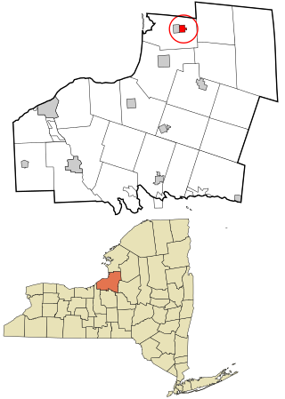
Lacona is a village in Oswego County, New York, United States. The population was 582 at the 2010 census.

Gaston is a town in Northampton County, North Carolina, United States. The population was 1,152 at the 2010 census. It is part of the Roanoke Rapids, North Carolina Micropolitan Statistical Area.

Roper is a town in Washington County, North Carolina, United States. The population was 485 at the 2020 Census. It was known as Lee's Mill until 1890, when the John L. Roper Lumber Company was established in the town and its name changed to Roper.

Burkettsville is a village in Darke and Mercer counties in the U.S. state of Ohio. The population was 244 at the 2010 census. The current mayor is Joe Stammen.
Wings Neck is a peninsula that juts out into Buzzards Bay on the south side of the Cape Cod Canal, in Bourne, Massachusetts, USA.
The Athinais Cultural Center is a "multi-purpose" conference complex in Athens, Greece. It hosts business events, cultural activities, and entertainment. It also contains an art gallery with a permanent exhibition of contemporary Greek art. The building was originally a silk factory, since renovated.

Hopeton is an unincorporated community in Accomack County, Virginia.
Coocheyville is an unincorporated community in Accomack County, Virginia, United States.
Miona is an unincorporated community in Accomack County, Virginia.
Winterville is an unincorporated community in Accomack County, Virginia.

Beech Grove is an unincorporated community in Nelson County, Virginia, United States.

Limerstone is a hamlet on the Isle of Wight in England. It is located on the B3399 road between Brighstone and Shorwell, approximately 5 miles (8km) southwest of Newport. Public transport is provided by Southern Vectis buses on route 12. The hamlet features around 25 houses and a farm, called Limerstone Farm.
Kingsville is an unincorporated community in El Dorado County, California. It is located 5 miles (8 km) southwest of Placerville, at an elevation of 1532 feet.
Seaford Hundred is a hundred in Sussex County, Delaware, United States. Seaford Hundred was formed in 1869 from Northwest Fork Hundred. Its primary community is Seaford.
Stonefort Precinct, formerly township, is Congressional Township 10 South, Range 4 East of the Third Principal Meridian located in Williamson County, Illinois. It is named for the community of Stonefort, Illinois.

Wilmot is an unincorporated community in Cowley County, Kansas, United States.
Fearnot is an unincorporated community in Schuylkill County, in the U.S. state of Pennsylvania.
Walnut Creek is an intermittent stream in Hidalgo County, New Mexico. It has its source in the Animas Mountains on the east slope of the Continental Divide at an elevation of 6,720 feet at 31°33′15″N108°41′37″W. Its mouth is located at an elevation of 4,524 feet where it subsides into the Playas Valley.
References
- ↑ "Poulson". Geographic Names Information System . United States Geological Survey, United States Department of the Interior . Retrieved February 9, 2014.

Coordinates: 37°52′33″N75°38′38″W / 37.87583°N 75.64389°W
| | This Accomack County, Virginia state location article is a stub. You can help Wikipedia by expanding it. |