Wattsville, Virginia

Last updated

Wattsville, Virginia
Intersection in Wattsville with diner and businesses.jpg
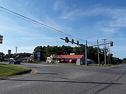
Businesses in Wattsville, July 2018
Accomack County Virginia incorporated and unincorporated areas Wattsville highlighted.svg
Location in Accomack County and the state of Virginia.
Coordinates: 37°55′48″N75°29′40″W / 37.93000°N 75.49444°W / 37.93000; -75.49444 [1]
CountryUnited States
State Virginia
County Accomack
Elevation
[1]
3 ft (0.9 m)
Population
 (2020)
  Total
1,341
Time zone UTC−5 (Eastern (EST))
  Summer (DST) UTC−4 (EDT)
FIPS code 51-48776
GNIS feature ID2584935 [1]

Wattsville is a census-designated place (CDP) in Accomack County, Virginia, United States. It was first listed as a CDP in 2010. [1] As of the 2020 census, it had a population of 1,341. [2]

Contents

Geography

It lies at an elevation of 3 feet. [1]

Demographics

Historical population
CensusPop.Note
2010 1,128
2020 1,34118.9%
U.S. Decennial Census [3]
2010 [4] 2020 [5]

Wattsville was first listed as a census designated place in the 2010 U.S. Census. [4]

2020 census

Wattsville CDP, Virginia – Racial and ethnic composition
Note: the US Census treats Hispanic/Latino as an ethnic category. This table excludes Latinos from the racial categories and assigns them to a separate category. Hispanics/Latinos may be of any race.
Race / Ethnicity (NH = Non-Hispanic)Pop 2010 [6] Pop 2020 [5] % 2010% 2020
White alone (NH)72383264.10%62.04%
Black or African American alone (NH)31335627.75%26.55%
Native American or Alaska Native alone (NH)560.44%0.45%
Asian alone (NH)12111.06%0.82%
Pacific Islander alone (NH)300.27%0.00%
Some Other Race alone (NH)270.18%0.52%
Mixed Race or Multi-Racial (NH)29542.57%4.03%
Hispanic or Latino (any race)41753.63%5.59%
Total1,1281,341100.00%100.00%
Dream Roller Rink, now abandoned, in Wattsville in 2008 Dream Roller Rink (Oblique View) 01.jpg
Dream Roller Rink, now abandoned, in Wattsville in 2008

Transportation

Major highway

Public transportation

STAR Transit provides public transit services, linking Wattsville with Onley, Oak Hall, and other communities in Accomack and Northampton counties on the Eastern Shore.

References

  1. 1 2 3 4 5 "Wattsville Census Designated Place". Geographic Names Information System . United States Geological Survey, United States Department of the Interior.
  2. "Wattsville CDP, Virginia". United States Census Bureau . Archived from the original on February 5, 2023. Retrieved December 25, 2022.
  3. "Decennial Census by Decade". United States Census Bureau .
  4. 1 2 "2010 Census of Population - Population and Housing Unit Counts - Virginia" (PDF). United States Census Bureau .
  5. 1 2 "P2 Hispanic or Latino, and Not Hispanic or Latino by Race – 2020: DEC Redistricting Data (PL 94-171) - Wattsville CDP, Virginia". United States Census Bureau . Archived from the original on February 5, 2023. Retrieved February 5, 2023.
  6. "P2 Hispanic or Latino, and Not Hispanic or Latino by Race – 2010: DEC Redistricting Data (PL 94-171) - Wattsville CDP, Virginia". United States Census Bureau . Archived from the original on February 5, 2023. Retrieved February 5, 2023.