
Stockton is a census-designated place (CDP) in Worcester County, Maryland, United States. The population was 92 at the 2010 census. It is part of the Salisbury, Maryland-Delaware Metropolitan Statistical Area.

Atlantic is a census-designated place (CDP) in Accomack County, Virginia. It was first listed as a CDP in 2010. Per the 2020 census, the population was 808.

Deep Creek is a census-designated place (CDP) in Accomack County, Virginia, United States. Per the 2020 census, the population was 94.

Gargatha is a census-designated place (CDP) in Accomack County, Virginia, United States. Per the 2020 census, the population was 415.

Greenbush is a census-designated place (CDP) in Accomack County, Virginia, United States. Per the 2020 census, the population was 224.

Harborton is a census-designated place (CDP) in Accomack County, Virginia, United States. Per the 2020 census, the population was 130.

Horntown is a census-designated place (CDP) in Accomack County, Virginia, United States. Per the 2020 census, the population was 912.

Lee Mont is a census-designated place (CDP) in Accomack County, Virginia, United States. Per the 2020 census, the population was 102.

Savageville is a census-designated place (CDP) in Accomack County, Virginia, United States. It was first listed as a CDP in 2010. Per the 2020 census, the population was 175.

Bayside is a census-designated place (CDP) in Accomack County, Virginia, United States. Per the 2020 census, the population was 107.

Boston is a census-designated place (CDP) in Accomack County, Virginia, United States. Per the 2020 census, the population was 454.

Cats Bridge is a census-designated place (CDP) in Accomack County, Virginia, United States. Per the 2020 census, the population was 184.

Chase Crossing is a census-designated place (CDP) in Accomack County, Virginia, United States. Per the 2020 census, the population was 335.
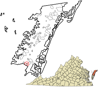
Locust Mount is an unincorporated community and census-designated place (CDP) in Accomack County, Virginia, United States. It was first listed as a CDP in the 2020 census with a population of 52. The CDP is in southeastern Accomack County, on the north side of Virginia State Route 180, which leads east 1.1 kilometres (0.7 mi) to Wachapreague and west 3.5 miles (5.6 km) to U.S. Route 13 at Keller.

Pastoria is a census-designated place (CDP) in Accomack County, Virginia, United States. It was first listed as a CDP in 2010. Per the 2020 census, the population was 627.
Savage Town is a census-designated place (CDP) in Accomack County, Virginia, United States. It was first listed as a CDP in 2010. Per the 2020 census, the population was 72.

South Chesconessex is an unincorporated community and census-designated place (CDP) in Accomack County, Virginia, United States. The census uses the name Southside Chesconessex. It was first listed as a CDP in 2010. As of the 2020 census, it had a population of 115.

Captains Cove is a census-designated place in Accomack County, Virginia. Per the 2020 census, the population was 1,544. Known as Captain's Cove Golf & Yacht Club, it is a recreational community located on the west shore of Chincoteague Bay, bordering Maryland to the north. While numerous families with children live here, it's largely a retirement community, with a median age of 51 and the largest age group being 60–64.

Makemie Park is a census-designated place in Accomack County, Virginia. Per the 2020 census, the population was 138.
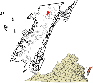
Oak Hall is a census-designated place in Accomack County, Virginia. It was first listed as a CDP on March 31, 2010. Per the 2020 census, the population was 226.


