Related Research Articles

Spillertown is a village in Williamson County, Illinois, United States. The population was 203 at the 2010 census and as of 2018, the population has grown to an estimated 272.

Highland Township, officially the Charter Township of Highland, is a charter township of west Oakland County, Michigan. The population was 19,202 at the time of the 2010 census.

Aberdeen is a village in Huntington Township, Brown County, Ohio, United States, along the Ohio River 50 miles (80 km) southeast of Cincinnati. The population was 1,638 at the 2010 census.

Farmington is a town in Jefferson County, Wisconsin, United States. The population as of the 2010 census was 1,380.
Sand Lake is an unorganized territory in Saint Louis County, Minnesota, United States, located within the unincorporated area of Britt. The population was 1,130 at the 2020 census.

Mazomanie is a town in Dane County, Wisconsin. The population was 1,185 at the time of the 2000 census. The Village of Mazomanie is located within the town.

Hazelgreen is an unincorporated community in eastern Laclede County, Missouri, United States. It lies along historic U.S. Route 66, now an outer road of Interstate 44. The town is split by I-44, one mile west of the I-44 - Missouri Route 133 junction in adjacent Pulaski County. The Gasconade River is just north and west of the site.
Gascozark is an unincorporated community in western Pulaski County, Missouri, United States. The town site is on Missouri Supplemental Route AB.
Big Piney is an unincorporated community in Pulaski County, Missouri, United States on the southeastern edge of Fort Leonard Wood and one mile west of a bend in the Big Piney River. The community is on Missouri Route TT four miles northeast of Palace. Licking is seventeen miles to the southeast. Its former K-8 school has closed; students attend the Plato R-V School District.

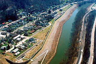
South Williamson is a census-designated place (CDP) in the Appalachian Mountains of northeastern Pike County, Kentucky, United States, on the border with West Virginia. It is separated from Williamson, West Virginia by the Tug Fork River. The community is located near U.S. Route 119 about 23 miles (37 km) east of Pikeville, Kentucky and 28 miles (45 km) southwest of Logan, West Virginia.
Lovett is an unincorporated community in eastern Laurens County, Georgia, United States. It is part of the Dublin Micropolitan Statistical Area.

Assumption is a small unincorporated community and also a historically Irish (Catholic) community in southern Amboy Township, Fulton County, Ohio, United States. A part of the Toledo Metropolitan Area, it lies seven miles from the northern edge of Swanton. It is located at roughly 41°40'N, 83°55'W.

Hamburg is an unincorporated community in Silver Creek Township, Clark County, Indiana. Parts of Hamburg are within the municipal boundaries of Clarksville and Sellersburg.
Prosperity is an unincorporated community in Lafayette Township, Madison County, Indiana.
Cranberry Lake (Nova Scotia) may refer to:

Lorca-Sutullena railway station is a station in Lorca, Spain. It was damaged in the 2011 Lorca earthquake.
Santa Cruz is a census-designated place (CDP) in Starr County, Texas, United States. It is a new CDP for 2010 census with a population of 54. There is a former CDP of the same name that was split into the El Chaparral and Santa Rosa CDPs.
Buckeye Creek is a stream in northern Cape Girardeau County in the U.S. state of Missouri. It is a tributary of Apple Creek.
Randles is an unincorporated community in Cape Girardeau County, in the U.S. state of Missouri.
Little is a populated place in Seminole County, Oklahoma at an elevation of 968 feet. It is north of the City of Seminole and east of Shawnee, Oklahoma, located at the intersection of US Route 377 and Oklahoma State Highway 99A, just south of Interstate 40. It had a post office from August 14, 1902 to November 30, 1916. It was named for Thomas Little, a prominent Seminole and second chief of the tribe.
References
- ↑ "Locksville". Geographic Names Information System . United States Geological Survey, United States Department of the Interior . Retrieved February 9, 2014.
Coordinates: 37°40′19″N75°46′03″W / 37.67194°N 75.76750°W
