Penrose Historic District | |
 A Penrose streetscape | |
   | |
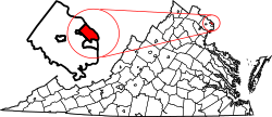
| Location | Roughly bounded by Arlington Blvd., S. Courthouse Rd., S. Fillmore St., S. Barton St. S, and Columbia Pike, Arlington, Virginia |
|---|---|
| Coordinates | 38°52′07″N77°5′8″W / 38.86861°N 77.08556°W |
| Area | 125 acres (51 ha) |
| Built | 1882-1943 |
| Architectural style | Late Victorian, Late 19th And 20th Century Revivals |
| NRHP reference No. | 04000112 [1] |
| VLR No. | 000-8823 |
| Significant dates | |
| Added to NRHP | November 15, 2004 |
| Designated VLR | December 3, 2003 [2] |
The Penrose Historic District is a national historic district located at Arlington County, Virginia within the Penrose, Arlington, Virginia neighborhood. It contains 486 contributing buildings, 2 contributing sites, and 2 contributing object in a residential neighborhood in South Arlington. The area was created with the integration of 12 distinct subdivisions platted between 1882 and 1943. The dwelling styles include the late-19th and early-20th-century vernacular, Queen Anne, Italianate, and Colonial Revival farm dwellings. A notable number of these dwellings are prefabricated kit or mail-order houses. [3]
It was listed on the National Register of Historic Places in 2004. [1]