Related Research Articles

Highlands is a borough in northern Monmouth County, in the U.S. state of New Jersey. An historic waterfront community located on the Raritan Bay within the Raritan Valley region, this scenic borough is a commuter town of New York City in the New York metropolitan area. As of the 2020 United States census, the borough's population was 4,621, a decrease of 384 (−7.7%) from the 2010 census count of 5,005, which in turn reflected a decline of 92 (−1.8%) from the 5,097 counted in the 2000 census. The eastern part of the town is on a high bluff that overlooks Sandy Hook Bay, the entrance to New York Harbor, and the Atlantic Ocean, from which the borough derives its name. Atop this bluff are the Navesink Twin Lights.
Lower New York Bay is a section of New York Bay south of the Narrows. The eastern end of the Bay is marked by two spits of land, Sandy Hook, New Jersey, and Rockaway, Queens. The waterway between the spits connects the Bay to the Atlantic Ocean at the New York Bight. Traversing the floor of the Bay southeasterly from the Narrows to the Bight and beyond is Hudson Canyon.

The Raritan refers to two groups of Lenape people who lived around the lower Raritan River and the Raritan Bay, in what is now northeastern New Jersey, in the 16th century.

The Navesink River is an estuary, approximately 8 mi (12 km) long in Monmouth County, New Jersey, United States. It is surrounded by the communities of Middletown, Red Bank, Fair Haven, and Rumson.
The Navesink tribe were a group of Lenape who inhabited the Raritan Bayshore near Sandy Hook and Mount Mitchill in northern North Jersey in the United States.
European colonization of New Jersey started soon after the 1609 exploration of its coast and bays by Henry Hudson. Dutch and Swedish colonists settled parts of the present-day state as New Netherland and New Sweden.

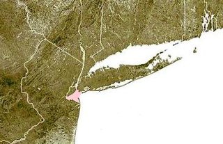
The Raritan Bayshore is a region in central sections in the state of New Jersey. It is the area around Raritan Bay from The Amboys to Sandy Hook, in Middlesex and Monmouth counties, including the towns of Woodbridge, Perth Amboy, South Amboy, Sayreville, Old Bridge, Matawan, Aberdeen, Keyport, Union Beach, Hazlet, Keansburg, Middletown, Atlantic Highlands, and Highlands. It is the northernmost part of the Jersey Shore, located just south of New York City. At Keansburg is a traditional amusement park while at Sandy Hook are found ocean beaches. The Sadowski Parkway beach area in Perth Amboy, which lies at the mouth of the Raritan River, was deemed the "Riviera of New Jersey" by local government. In recent years many of the beaches on the Bayshore area have been rediscovered and upgraded.

Kieft's War (1643–1645), also known as the Wappinger War, was a conflict between the colonial province of New Netherland and the Wappinger and Lenape Indians in what is now New York and New Jersey. It is named for Director-General of New Netherland Willem Kieft, who had ordered an attack without the approval of his advisory council and against the wishes of the colonists. Dutch colonists attacked Lenape camps and massacred the inhabitants, which encouraged unification among the regional Algonquian tribes against the Dutch and precipitated waves of attacks on both sides. This was one of the earliest conflicts between settlers and Indians in the region. The Dutch West India Company was displeased with Kieft and recalled him, but he died in a shipwreck while returning to the Netherlands; Peter Stuyvesant succeeded him in New Netherland. Numerous Dutch settlers returned to the Netherlands because of the continuing threat from the Algonquians, and growth slowed in the colony.

Pavonia was the first European settlement on the west bank of the North River that was part of the seventeenth-century province of New Netherland in what would become the present Hudson County, New Jersey.

Achter Kol was the name given to the region around the Newark Bay and Hackensack River in northeastern New Jersey by the first European settlers to it and was part of the 17th century province of New Netherland, administered by the Dutch West India Company. At the time of their arrival, the area was inhabited by the Hackensack and Raritan groups of Lenape natives.
Bergen was a part of the 17th century province of New Netherland, in the area in northeastern New Jersey along the Hudson and Hackensack Rivers that would become contemporary Hudson and Bergen Counties. Though it only officially existed as an independent municipality from 1661, with the founding of a village at Bergen Square, Bergen began as a factory at Communipaw circa 1615 and was first settled in 1630 as Pavonia. These early settlements were along the banks of the North River across from New Amsterdam, under whose jurisdiction they fell.
Hackensack was the exonym given by the Dutch colonists to a band of the Lenape, or Lenni-Lenape, a Native American tribe. The name is a Dutch derivation of the Lenape word for what is now the region of northeastern New Jersey along the Hudson and Hackensack rivers. While the Lenape people occupied much of the mid-Atlantic area, Europeans referred to small groups of native people by the names associated with the places where they lived.
Communipaw is a neighborhood in Jersey City in Hudson County, in the U.S. state of New Jersey. It is located west of Liberty State Park and east of Bergen Hill, and the site of one of the earliest European settlements in North America. It gives its name to the historic avenue which runs from its eastern end near Liberty State Park Station through the neighborhoods of Bergen-Lafayette and the West Side that then becomes the Lincoln Highway. Communipaw Junction, or simply The Junction, is an intersection where Communipaw, Summit Avenue, Garfield Avenue, and Grand Street meet, and where the toll house for the Bergen Point Plank Road was situated. Communipaw Cove at Upper New York Bay, is part of the 36-acre (150,000 m2) state nature preserve in the park and one of the few remaining tidal salt marshes in the Hudson River estuary.
The Tappan were a Lenape people who inhabited the region radiating from Hudson Palisades and New York – New Jersey Highlands in at the time of European colonialization in the 17th century.
The Rumanchenank were a Lenape people who inhabited the region radiating from the Palisades in New York and New Jersey at the time of European colonialization in the 17th century. Settlers to the provincial colony of New Netherland called them the Haverstroo meaning oat straw, which became Haverstraw in English, and still used to describe part of their territory.

New Netherlanders were residents of New Netherland, the seventeenth-century colonial province of the Republic of the Seven United Netherlands on the northeastern coast of North America, centered on the Hudson River and New York Bay, and in the Delaware Valley. Their descendants are the New York Dutch.

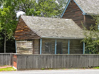
Penelope Prince and her husband Richard Stout were among the original settlers of Middletown, colonial New Jersey's second English settlement, in 1664. As “Penelope Van Prince”, she is the central figure in a popular legend that claims she survived a ship stranding and deadly Lenape attack.
The Monmouth Tract, also known as the Monmouth Patent, Navesink Tract or Navesink Patent was a large triangular tract of land granted as a land patent to settlers of New Jersey during the early American colonial period.
References
Raritan Valley | |||||
|---|---|---|---|---|---|
| |||||
| |||||
| |||||
| |||||

- ↑ The Origin of New Jersey Place Names: P, GetNJ.com.
- 1 2 Ruttenber, E.M (2001). Indian Tribes of Hudson's River (3rd ed.). Hope Farm Press. ISBN 0-910746-98-2.
- ↑ Keansburg Historical Society, accessed April 10, 2007.
- ↑ "Welcome to the Throckmorton-Lippit-Taylor Burying Ground On Penelope Lane in Middletown, New Jersey" Archived 2006-11-06 at the Wayback Machine , Atlantic Highlands Herald, Spring 2003