Nelson Commonwealth Marine Reserve

Last updated

Nelson Commonwealth Marine Reserve
IUCN category VI (protected area with sustainable use of natural resources)
Map showing the Nelson Commonwealth Marine Reserve
Location Indian Ocean, Australia
Nearest town Port Macdonnell, South Australia
Coordinates 39°19′S139°51′E / 39.31°S 139.85°E / -39.31; 139.85 Coordinates: 39°19′S139°51′E / 39.31°S 139.85°E / -39.31; 139.85 [1]
Area6,123 km2 (2,364 sq mi)
EstablishedAugust 31, 2007 (2007-08-31)
Governing body Parks Australia (Commonwealth of Australia)
environment.gov.au/topics/marine/marine-reserves/south-east/nelson

Nelson Commonwealth Marine Reserve is a 6,123 km2 marine protected area within Australian waters located in the Southern Ocean [2] near the South Australia-Victoria border. The reserve was established in 2007 [3] and is part of the South-east Commonwealth Marine Reserve Network.

Marine protected area Protected areas of seas, oceans, estuaries or large lakes

Marine protected areas (MPA) are protected areas of seas, oceans, estuaries or large lakes. These marine areas can come in many forms ranging from wildlife refuges to research facilities. MPAs restrict human activity for a conservation purpose, typically to protect natural or cultural resources. Such marine resources are protected by local, state, territorial, native, regional, national, or international authorities and differ substantially among and between nations. This variation includes different limitations on development, fishing practices, fishing seasons and catch limits, moorings and bans on removing or disrupting marine life. In some situations, MPAs also provide revenue for countries, potentially equal to the income that they would have if they were to grant companies permissions to fish.

Australia Country in Oceania

Australia, officially the Commonwealth of Australia, is a sovereign country comprising the mainland of the Australian continent, the island of Tasmania and numerous smaller islands. It is the largest country in Oceania and the world's sixth-largest country by total area. The neighbouring countries are Papua New Guinea, Indonesia and East Timor to the north; the Solomon Islands and Vanuatu to the north-east; and New Zealand to the south-east. The population of 25 million is highly urbanised and heavily concentrated on the eastern seaboard. Australia's capital is Canberra, and its largest city is Sydney. The country's other major metropolitan areas are Melbourne, Brisbane, Perth and Adelaide.

Southern Ocean The ocean around Antarctica

The Southern Ocean, also known as the Antarctic Ocean or the Austral Ocean, and the "Southern Icy Ocean".</ref> comprises the southernmost waters of the World Ocean, generally taken to be south of 60° S latitude and encircling Antarctica. As such, it is regarded as the fourth largest of the five principal oceanic divisions: smaller than the Pacific, Atlantic, and Indian Oceans but larger than the Arctic Ocean. This oceanic zone is where cold, northward flowing waters from the Antarctic mix with warmer subantarctic waters.

Contents

The reserve spans deepwater ecosystems (below 3,000 m (9,800 ft)) and encloses geological features including plateaus, knolls, canyons and the abyssal plain. It is an important migration area for humpback, blue, fin and possibly sei whales. [4]

Plateau An area of a highland, usually of relatively flat terrain

In geology and physical geography, a plateau, also called a high plain or a tableland, is an area of a highland, usually consisting of relatively flat terrain, that is raised significantly above the surrounding area, often with one or more sides with steep slopes. Plateaus can be formed by a number of processes, including upwelling of volcanic magma, extrusion of lava, and erosion by water and glaciers. Plateaus are classified according to their surrounding environment as intermontane, piedmont, or continental.

A hillock or knoll is a small hill, usually separated from a larger group of hills such as a range. Hillocks are similar in their distribution and size to small mesas or buttes. The term is largely a British one. This particular formation occurs often in Great Britain and China. A similar type of landform in the Scandinavian countries goes by the name ”kulle” or ”bakke” and is contrary to the above phenomena formed when glaciers polish down hard, crystalline bedrock of gneiss or granites, leaving a rounded rocky hillock with sparse vegetation.

Canyon Deep ravine between cliffs

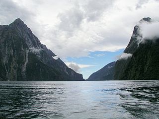
A canyon or gorge is a deep cleft between escarpments or cliffs resulting from weathering and the erosive activity of a river over geologic timescales. Rivers have a natural tendency to cut through underlying surfaces, eventually wearing away rock layers as sediments are removed downstream. A river bed will gradually reach a baseline elevation, which is the same elevation as the body of water into which the river drains. The processes of weathering and erosion will form canyons when the river's headwaters and estuary are at significantly different elevations, particularly through regions where softer rock layers are intermingled with harder layers more resistant to weathering.

Protection

The entirety of the Nelson marine reserve area is IUCN protected area category VI and is zoned as 'Special Purpose'. [4]

ZoneIUCNActivities permittedArea
(km2)
Recreational fishingCommercial fishingMining
Special PurposeVIYesNowith approval6,123
[Note 1]

See also

Protected areas of Australia

Protected areas of Australia include Commonwealth and off-shore protected areas managed by the Australian government, as well as protected areas within each of the six states of Australia and two self-governing territories, the Australian Capital Territory and the Northern Territory, which are managed by the eight state and territory governments.

Great Australian Bight Oceanic bight off the central and western portions of the southern coastline of mainland Australia

The Great Australian Bight is a large oceanic bight, or open bay, off the central and western portions of the southern coastline of mainland Australia.

Notes

  1. Summary of permitted activities only, see source for details [5]

Related Research Articles

Huon Commonwealth Marine Reserve is a 9,991 km2 marine protected area within Australian waters. The former Tasmanian Seamounts Marine Reserve created in 1999 was incorporated into the Huon reserve in 2007, and is part of the South-east Commonwealth Marine Reserve Network.

Murray Commonwealth Marine Reserve is a 25,803 km2 marine protected area within Australian waters located off the coast of South Australia. The reserve was established in 2007 and is part of the South-east Commonwealth Marine Reserve Network.

Zeehan Commonwealth Marine Reserve is a 19,897 km2 marine protected area within Australian waters located west of Tasmania and extending to near King Island. The reserve was established in 2007 and is part of the South-east Commonwealth Marine Reserve Network.

Franklin Commonwealth Marine Reserve is a 671 km2 marine protected area within Australian waters located off the west coast of north-west Tasmania. The reserve was established in 2007 and is part of the South-east Commonwealth Marine Reserve Network.

Tasman Fracture Commonwealth Marine Reserve is a 42,502 km2 marine protected area within Australian waters located off the coast of south-west Tasmania. It extends to the southerly limits of the Australian exclusive economic zone in the Indian Ocean and encompasses the Tasman Fracture. The reserve was established in 2007 and is part of the South-east Commonwealth Marine Reserve Network.

South Tasman Rise Commonwealth Marine Reserve is a 27,704 km2 marine protected area located at the southerly limit of Australia's exclusive economic zone near Tasmania. The reserve was established in 2007 and is part of the South-east Commonwealth Marine Reserve Network.

Freycinet Commonwealth Marine Reserve is a 57,942 km2 marine protected area within Australian waters located off the east coast of Tasmania. It extends to the outer limits of the Australian exclusive economic zone in the Tasman Sea. The reserve was established in 2007 and is part of the South-east Commonwealth Marine Reserve Network. It is the largest reserve of the South-east Network, the area covered is approximately equivalent to about 86% of the land area of Tasmania.

Flinders Commonwealth Marine Reserve is a 27,043km2 marine protected area within Australian waters located off the coast of north-east Tasmania. It extends to the outer limits of the Australian exclusive economic zone in the Tasman Sea. The reserve was established in 2007 and is part of the South-east Commonwealth Marine Reserve Network.

East Gippsland Commonwealth Marine Reserve is a 4,137 km2 marine protected area within Australian waters located in the Tasman Sea near the New South Wales-Victoria border. The reserve was established in 2007 and is part of the South-east Commonwealth Marine Reserve Network.

Beagle Commonwealth Marine Reserve is a 2,928km2 marine protected area within Australian waters located in Bass Strait off the coast of Victoria and near Tasmania's Flinders Island. The reserve was established in 2007 and is part of the South-east Commonwealth Marine Reserve Network.

Boags Commonwealth Marine Reserve is a 537 km2 marine protected area within Australian waters located off the coast of north-west Tasmania in Bass Strait. The reserve was established in 2007 and is the smallest reserve of the South-east Commonwealth Marine Reserve Network.

The Apollo Marine Park is an Australian Marine Park located in Bass Strait off the coast of Victoria and near Tasmania's King Island. The marine park was established in 2007 and covers an area of 1,184 km2 (457 sq mi). It is managed as part of the South-east Marine Parks Network.

Western Eyre Marine Park Protected area in Australia

Western Eyre Marine Park is a marine protected area located in the Great Australian Bight south of South Australia in waters within the Australian Exclusive economic zone.

Australian marine parks are marine protected areas located within Australian waters and are managed by the Australian government. These waters generally extend from three nautical miles off the coast to the outer limit of Australia’s Exclusive Economic Zone at 200 nautical miles while marine protected areas located closer in-shore are the responsibility of the states or the Northern Territory.

The Lord Howe Marine Park is an Australian marine park located about 550 km (340 mi) offshore of New South Wales, near Lord Howe Island. The marine park covers an area of 110,126 km2 (42,520 sq mi), encompassing the smaller Lord Howe Island Marine Park, and is assigned IUCN category IV. It is one of 8 parks managed under the Temperate East Marine Parks Network.

The Central Eastern Marine Park is an Australian marine park that extends from the edge of the continental shelf, offshore of New South Wales and 30 km (19 mi) from Coffs Harbour, to about 200 km (120 mi) offshore into deep ocean waters. The marine park covers an area of 70,054 km2 (27,048 sq mi) and is assigned IUCN category IV. It is one of 8 parks managed under the Temperate East Marine Parks Network.

The Oceanic Shoals Marine Park is an Australian marine park offshore of the Northern Territory, near of Darwin. The marine park covers an area of 71,743 km2 (27,700 sq mi) and is assigned IUCN category VI. It is the largest of the 8 parks managed under the North Marine Parks Network.

The Macquarie Island Marine Park is an Australian marine park near Macquarie Island in the southwest Pacific. The marine park covers an area of 162,000 km2 (63,000 sq mi) and is assigned IUCN category IV. It is the largest of the 14 parks managed under the South-east Marine Parks Network.

The Cod Grounds Marine Park is an Australian marine park located approximately 5.5 km offshore of New South Wales, near Laurieton. The marine park covers an area of 4 km2 (1.5 sq mi) and is assigned IUCN category II. It is one of 8 parks managed under the Temperate East Marine Parks Network.

The Ningaloo Marine Park is an Australian marine park offshore of Western Australia, and west of the Ningaloo Coast. The marine park covers an area of 2,435 km2 (940 sq mi) and is assigned IUCN category IV. It is one of the 13 parks managed under the North-west Marine Parks Network.

References

  1. "Nelson Commonwealth Marine Reserve on OpenStreetMap". openstreetmap.org. © OpenStreetMap contributors. Retrieved 18 June 2017.
  2. See Southern Ocean and Indian Ocean regarding differing recognitions of the boundaries
  3. "Collaborative Australian Protected Areas Database (CAPAD) 2014 - Marine". environment.gov.au. © Commonwealth of Australia . Retrieved 16 June 2017.
  4. 1 2 "Nelson Commonwealth Marine Reserve". environment.gov.au. © Commonwealth of Australia . Retrieved 18 June 2017.
  5. "South-east Commonwealth Marine Reserves Network - Zoning and activities". environment.gov.au. © Commonwealth of Australia . Retrieved 18 June 2017.