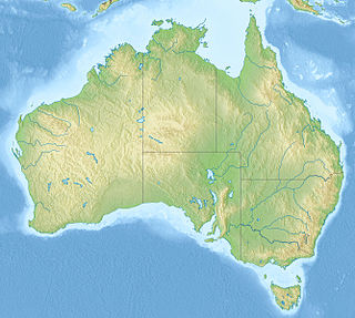
Protected areas of Australia include Commonwealth and off-shore protected areas managed by the Australian government, as well as protected areas within each of the six states of Australia and two self-governing territories, the Australian Capital Territory and the Northern Territory, which are managed by the eight state and territory governments.

Protected areas of South Australia consists of protected areas located within South Australia and its immediate onshore waters and which are managed by South Australian Government agencies. As of March 2018, South Australia contains 359 separate protected areas declared under the National Parks and Wildlife Act 1972, the Crown Land Management Act 2009 and the Wilderness Protection Act 1992 which have a total land area of 211,387.48 km2 (81,617.16 sq mi) or 21.5% of the state's area.
A marine park is a designated park consisting of an area of sea set aside to achieve ecological sustainability, promote marine awareness and understanding, enable marine recreational activities, and provide benefits for Indigenous peoples and coastal communities. Most marine parks are managed by national governments, and organized like 'watery' national parks, whereas marine protected areas and marine nature reserves are often managed by a subnational entity or non-governmental organization, such as conservation authority.

Lord Howe Island Marine Park is a former marine protected area managed by the Commonwealth Department of the Environment, protecting the waters surrounding Lord Howe Island. It was adjacent to the 465.45 km² Lord Howe Island Marine Park managed by the Marine Parks Authority New South Wales. On 8 November 2012, it was replaced by a new protected area known as the Lord Howe Commonwealth Marine Reserve.

Seal Bay Conservation Park is a protected area located on the south coast of Kangaroo Island in the Australian state of South Australia. It is the home of the third largest Australian sea lion colony in Australia.

Cape du Couedic is a headland in the Australian state of South Australia located on the southwest tip of Kangaroo Island in the locality of Flinders Chase. It was named after a French naval officer, Charles Louis du Couëdic, the Seigneur de Kergoualer (1740–1780), by the Baudin expedition to Australia during January 1803. It is the site for the Cape du Couedic Lighthouse. It is currently located within the Flinders Chase National Park.

Pelican Lagoon is a seawater lagoon in the Australian state of South Australia located on the north coast of Kangaroo Island about 18.7 kilometres south east of Kingscote. It was named by Matthew Flinders on 4 April 1802 after the large population of pelicans present in its waters and adjoining shorelines. Its role as fishery hatchery had been identified by the early 20th century with the result that fishing in its waters has been restricted in varying degrees.

The South-west Corner Marine Park is a marine protected area on the lower south west and southern coast of Western Australia, one of 14 in the South-west Marine Parks Network.

Cape Gantheaume is a headland located on the south coast of Kangaroo Island in South Australia. It was named after Vice admiral Honoré Joseph Antoine Ganteaume (1755–1818) by the Baudin expedition to Australia during 1803. It is currently located within the protected area known as the Cape Gantheaume Wilderness Protection Area.

Pelorus Islet is an islet in the Australian state of South Australia located in Great Australian Bight off the south coast of Kangaroo Island approximately 7 kilometres east south-east of Cape Gantheaume. It was named by Captain Francis Harding, RN after HMS Pelorus.

Great Australian Bight Marine Park is a marine protected area located in the Great Australian Bight south of South Australia in waters within the Australian Exclusive economic zone.

Murat Marine Park is a marine protected area located in the Great Australian Bight south of South Australia in waters within the Australian Exclusive economic zone to the west of the island group known as the Nuyts Archipelago and ranging in depth from 15 metres to 70 metres.

Western Kangaroo Island Marine Park is a marine protected area located south of South Australia in waters within the Australian Exclusive economic zone to the south-west of Kangaroo Island and ranging in depth from 15 metres to 165 metres.

Western Eyre Marine Park is a marine protected area located in the Great Australian Bight south of South Australia in waters within the Australian Exclusive economic zone.

Seal Bay Aquatic Reserve was a marine protected area in the Australian state of South Australia located in waters off the south coast of Kangaroo Island immediately adjoining and including the intertidal zone within the locality of Seal Bay which is also part of the Seal Bay Conservation Park.

West Island Encounter Bay Aquatic Reserve is a marine protected area in the Australian state of South Australia located in waters adjoining West Island immediately south of Fleurieu Peninsula and to the west of the town of Victor Harbor.
Australian marine parks are marine protected areas located within Australian waters and are managed by the Australian government. These waters generally extend from three nautical miles off the coast to the outer limit of Australia’s Exclusive Economic Zone at 200 nautical miles while marine protected areas located closer in-shore are the responsibility of the states or the Northern Territory.
Director of National Parks is a government-owned corporation of the Australian government responsible for the management of a portfolio of terrestrial and marine protected areas proclaimed under the Environment Protection and Biodiversity Conservation Act 1999. The agency is a corporation sole.

Southern Kangaroo Island Marine Park is a marine protected area in the Australian state of South Australia located in state coastal waters adjoining both the south coast of Kangaroo Island and a group of islets located to the south of Kangaroo Island.

Western Kangaroo Island Marine Park is a marine protected area in the Australian state of South Australia located in the state’s coastal waters adjoining both the west coast of Kangaroo Island and Lipson Reef, an islet located to the south of Kangaroo Island.


