Ballsbridge is an affluent neighbourhood of the city of Dublin, the capital of Ireland. The area is largely north and west of a three-arch stone bridge across the River Dodder, on the south side of the city. The sign on the bridge still proclaims it as "Ball's Bridge", in recognition of the fact that the original bridge on that location was built and owned by the Ball family, a well-known Dublin merchant family in the 1500s and the 1600s. The current bridge was built in 1791.
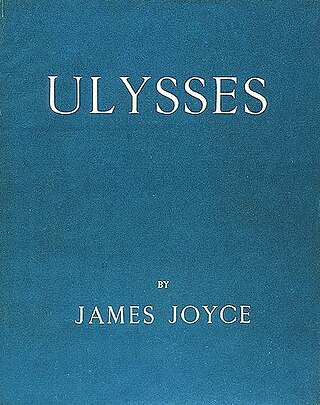
Ulysses is a modernist novel by Irish writer James Joyce. Parts of it were first serialized in the American journal The Little Review from March 1918 to December 1920, and the entire work was published in Paris by Sylvia Beach on 2 February 1922, Joyce's fortieth birthday. It is considered one of the most important works of modernist literature and has been called "a demonstration and summation of the entire movement." According to Declan Kiberd, "Before Joyce, no writer of fiction had so foregrounded the process of thinking."

Leopold Bloom is the fictional protagonist and hero of James Joyce's 1922 novel Ulysses. His peregrinations and encounters in Dublin on 16 June 1904 mirror, on a more mundane and intimate scale, those of Ulysses/Odysseus in Homer's epic poem: The Odyssey.

Drumcondra is a residential area and inner suburb on the Northside of Dublin, Ireland. It is administered by Dublin City Council. The River Tolka and the Royal Canal flow through the area.
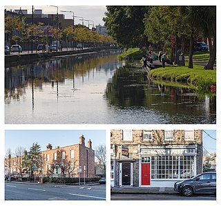
Portobello is an area of Dublin in Ireland, within the southern city centre and bounded to the south by the Grand Canal. It came into existence as a small suburb south of the city in the 18th century, centred on Richmond Street. During the following century it was completely developed, transforming an area of private estates and farmland into solid Victorian red-bricked living quarters for the middle classes on the larger streets, and terraced housing bordering the canal for the working classes.

Park Avenue in the suburb of Sandymount, Dublin 4, Ireland is the name of a road joining Sydney Parade Avenue to Gilford Road. It is home to a number of cricket and rugby union grounds including Pembroke Cricket Club, the Railway Union Sports Club and Monkstown Rugby Club. Of architectural note is the Church of St John, noted for its French Bath stone's decay due to its proximity to the sea. The church is on an island at the junction of Park Avenue and St Johns Road, which continues east towards the sea at Sandymount Strand.

Phibsborough, also spelled Phibsboro, is a mixed commercial and residential neighbourhood on the Northside of Dublin, Ireland.
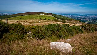
Kilmashogue or Kilmashoge is a mountain in Dún Laoghaire–Rathdown county in Ireland. It is 408 metres high and forms part of the group of hills in the Dublin Mountains which comprises Two Rock, Three Rock, Kilmashogue and Tibradden Mountains. The forest plantation on its northern slope, which is composed mainly of Sitka spruce, Scots pine and beech, is a habitat for Sika deer, hares, rabbits and foxes. A number of prehistoric monuments can be found on the slopes of the mountain.

Ballybough is an inner city district of northeast Dublin city, Ireland. Adjacent areas include the North Strand and Clonliffe.

The South Circular Road, designated as the R811 regional road, is a road in Dublin, Ireland. One of the longest in the city, it runs from Islandbridge in the west, through Rialto and Dolphin's Barn to Portobello, near the centre. It runs mainly through residential areas and is used by numerous bus routes. It is the southside equivalent of the North Circular Road.

Heytesbury Street is a tree-lined inner city street north of the South Circular Road, in Portobello, Dublin, Ireland.

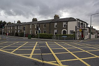
Herbert Road in Ballsbridge, Ireland is a mostly residential road that links Tritonville Road with Lansdowne Road. Newbridge Avenue joins by the bridge, in front of Marian College and the former site of Sandymount High School next door. There are several hotels on the road. Noteworthy is the Mount Herbert Hotel which is a conversion of a terrace of stately homes. The road extends to the roundabout at the junction, which is part of Lansdowne Road. Both this road, and Newbridge Avenue, are built on the former site of Haigs' distillery.
Tritonville Road, Sandymount, Dublin 4, is connected to Lansdowne Road by both Herbert Road and Newbridge Avenue. At its southern end, it meets Serpentine Avenue. The northern side of Tritonville road is considered to be part of Irishtown by the locals even though the postcode is Sandymount.

Tibradden Mountain is a mountain in County Dublin in Ireland. Other former names for the mountain include "Garrycastle" and "Kilmainham Begg". It is 467 metres high and is the 561st highest mountain in Ireland. It forms part of the group of hills in the Dublin Mountains which comprises Two Rock, Three Rock, Kilmashogue and Tibradden Mountains. The views from the summit encompass Dublin to the north, Two Rock to the east and the Wicklow Mountains to the south and west. The geological composition is mainly granite and the southern slopes are strewn with granite boulders. The summit area is a habitat for heather, furze, gorse and bilberry as well as Sika deer, foxes and badgers. The forestry plantation on the slopes – known as the Pine Forest – contains Scots pine, Japanese larch, European larch, Sitka spruce, oak and beech. The mountain is also a site of archaeological interest with a prehistoric burial site close to the summit.

D'Olier Street is a street in the southern city-centre of Dublin, the capital of Ireland. It and Westmoreland Street are two broad streets whose northern ends meet at the southern end of O'Connell Bridge over the River Liffey. Its southern end meets Fleet Street, Townsend Street, College Street and Pearse Street.

Clanbrassil Street is a street in Dublin south of the city centre. It runs from Robert Emmet Bridge on the Grand Canal to New Street. It is served by several bus routes. It is divided into Clanbrassil Street Upper and Clanbrassil Street Lower.
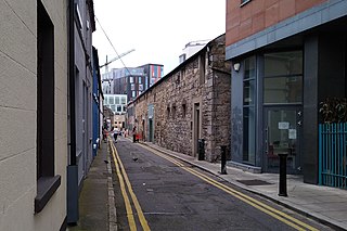
Fumbally Lane is a narrow and historic street in Dublin, Ireland, south of the city centre in The Liberties, 'In name and character perhaps the most evocative of all the Liberties' streets.' It connects Blackpitts to New Street and is close to St Patrick’s Cathedral.

Store Street is a short street in Dublin, Ireland, running from Amiens Street at right angles to Beresford Place.

Eccles Street is a street in Dublin, Ireland.