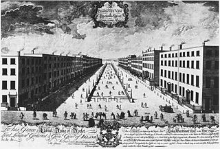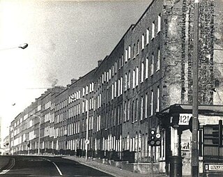
Georgian Dublin is a phrase used in terms of the history of Dublin that has two interwoven meanings:
- to describe a historic period in the development of the city of Dublin, Ireland, from 1714 to the death in 1830 of King George IV. During this period, the reign of the four Georges, hence the word Georgian, covers a particular and unified style, derived from Palladian Architecture, which was used in erecting public and private buildings
- to describe the modern day surviving buildings in Dublin erected in that period and which share that architectural style

The Wide Streets Commission was established by an Act of Parliament in 1758, at the request of Dublin Corporation, as a body to govern standards on the layout of streets, bridges, buildings and other architectural considerations in Dublin. The commission was abolished by the Dublin Improvement Act of 1849, with the final meeting of the Commission taking place on 2 January 1851.
The architecture of Ireland is one of the most visible features in the Irish countryside – with remains from all eras since the Stone Age abounding. Ireland is famous for its ruined and intact Norman and Anglo-Irish castles, small whitewashed thatched cottages and Georgian urban buildings. What are unaccountably somewhat less famous are the still complete Palladian and Rococo country houses which can be favourably compared to anything similar in northern Europe, and the country's many Gothic and neo-Gothic cathedrals and buildings.
Benburb ) is a village and townland in County Tyrone, Northern Ireland. It lies 7.5 miles from Armagh and 8 miles from Dungannon. The River Blackwater runs alongside the village as does the Ulster Canal.

Dublin is one of the oldest capital cities in Europe – dating back over a thousand years. Over the centuries and particularly in the 18th century or Georgian era, it acquired a distinctive style of architecture. Since the 1960s, Dublin has been extensively re-developed, sometimes resulting in the replacement of earlier buildings. Some of this has been controversial with preservationists regarding the development as unwelcome.

Dame Street is a large thoroughfare in Dublin, Ireland.

This article deals with the streets and squares in Dublin and the Greater Dublin Area of Ireland.

Summerhill is a primarily residential area of inner city Dublin, Ireland, on the Northside of the city. It is located about 500 m to 1,5 km to the east of the O'Connell Street area, roughly in the area bordered by Gardiner Street in the West, Mountjoy Square, Ballybough in the North, Northeast and East, and Talbot Street and Amiens Street in the South and South East. It also encompasses the historical "Five Lamps" landmark and is located in the East of the Dublin 1 postal district. It is one of the most densely populated and economically deprived areas of the city.

Thomas Bryan was an Irish republican and member of the Irish Republican Army who was one of six men hanged in Mountjoy Prison on 14 March 1921.

The Dublin quays refers to the two roadways and quays that run along the north and south banks of the River Liffey in Dublin, Ireland. The stretches of the two continuous streets have several different names. However, all but two of the names share the same "quay" designation. The quays have played an important part in Dublin's history.

Grangegorman is an inner suburb on the northside of Dublin city, Ireland. The area is administered by Dublin City Council. It was best known for decades as the location of St Brendan's Hospital, which was the main psychiatric hospital serving the greater Dublin region. As of 2020, the area is the subject of a major redevelopment plan, running for more than a decade, under the aegis of the Grangegorman Development Agency, including the new Technological University Dublin campus.

Newtown Pery is an area of central Limerick, Ireland, and forms the main city centre of the city. The district is known for its Georgian architectural heritage and is the core area of Limerick's Georgian Quarter. It is one of the three towns that make up modern-day Limerick City Centre, the other two being the older Englishtown and Irishtown, which date from the medieval period. Newtown Pery houses the largest collection of Georgian townhouses in Ireland outside of Dublin. In 1837, Samuel Lewis in his Topographical Dictionary of Ireland described Newtown Pery as "one of the handsomest towns in Ireland".
Students Against the Destruction of Dublin (SADD) was a student campaigning group active in Dublin, Ireland, between 1987 and 1991.

The Bradogue River is a small river in Dublin that rises in Cabra and flows into the River Liffey, with its primary outfall at Ormond Quay. It is culverted for its entire course.

High Street is a street in the medieval area of Dublin, Ireland.

Buckingham Street is a street in Dublin running from Summerhill to Amiens Street. It is divided into Buckingham Street Lower and Buckingham Street Upper.

Benburb Street is a street in Dublin, Ireland.

Blackhall Place is a street in Dublin, Ireland.
Chancery House is an apartment building located between Chancery Place and Charles Street West in Dublin city centre. The complex was built by Dublin Corporation as part of a corporation housing scheme in 1934-5. Built in the art deco style, both the house and park have been noted as adding "an element of variety to the architectural tone of the area". The complex is bounded by Chancery Street to the north, along which the Luas Red Line runs.


