
The Shire of Hepburn is a local government area in Victoria, Australia, located in the central part of the state. It covers an area of 1,473 square kilometres (569 sq mi) and, in the 2021 Census the shire had a population of 16,604.

Broadmeadows is a suburb in Melbourne, Victoria, Australia, 15 km (9.3 mi) north of Melbourne's Central Business District and the council seat of the City of Hume local government area. Broadmeadows recorded a population of 12,524 at the 2021 census.
Bannockburn is a rural township near Geelong, Victoria, Australia, 88 km southwest of Melbourne. It is located in Golden Plains Shire. In the 2021 census, Bannockburn had a population of 6,470.

St Arnaud is a town in the Wimmera region of Victoria, Australia, 244 kilometres north west of the capital Melbourne. It is in the Shire of Northern Grampians local government area. At the 2021 census, St Arnaud had a population of 2,318.

Meredith is a town in Victoria, Australia, located on the Midland Highway between Ballarat and Geelong, in the local government area of the City of Greater Geelong. At the 2016 census, Meredith had a population of 788.

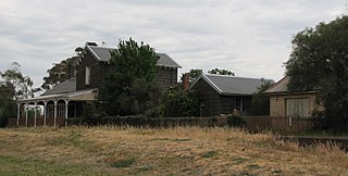
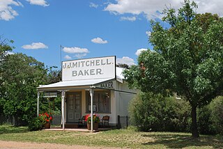
Allendale is a town in Victoria, Australia, located north-east of Creswick, in the Shire of Hepburn. At the 2016 census, Allendale and the surrounding area had a population of 166.

Waubra is a town in Victoria, Australia. The town is on the Sunraysia Highway, 33 kilometres (21 mi) north west of Ballarat and split between the Pyrenees Shire and City of Ballarat local government areas. At the 2021 census, Waubra and the surrounding area had a population of 308.

Ballarat East is a suburb of Ballarat in Victoria, Australia. From 1857 until 1921 the suburb had its own council. The suburb covers a large area east of the city centre. It is the oldest urban area in Ballarat and was the site of many goldmines, as well as of the Eureka Rebellion.

Cressy is a town in Victoria, Australia, approximately 38 kilometres (24 mi) north of Colac on the Ballarat road. It is divided between Golden Plains Shire, the Shire of Colac Otway, and Corangamite Shire. At the 2016 census, Cressy and the surrounding area had a population of 175.

Ballan is a small town in the state of Victoria, Australia located on the Werribee River, 80 kilometres (50 mi) northwest of Melbourne. At the 2021 census, Ballan had a population of 3,392.

Creswick railway station is located on the Mildura line in Victoria, Australia. It serves the town of Creswick, and the original station opened on 7 July 1874.

Linville is a rural town and locality in the Somerset Region, Queensland, Australia. In the 2016 census, Linville had a population of 156 people.

Newlyn is a town in the Shire of Hepburn, in Victoria, Australia. It is situated on the Midland Highway between Creswick and Daylesford. At the 2021 census, Newlyn had a population of 136.

Learmonth is a picturesque township, located in Central Victoria, Australia, 136 kilometres (85 mi) west of the state capital Melbourne, and 23 kilometres north west of the regional city centre of Ballarat. Learmonth is located on the Sunraysia Highway, on the road to Avoca, St Arnaud and the Pyrenees wine region, and is surrounded by an agricultural, pastoral and dairy region. At the 2021 census, Learmonth had a population of 396.

Leonards Hill is a village located in the Shire of Hepburn, Victoria, Australia. At the 2016 census, Leonards Hill had a population of 45.
Glenorchy is a town in the Wimmera district of the Australian state of Victoria. The town in located in the Northern Grampians Shire and on the Wimmera River, 257 kilometres (160 mi) north-west of the state capital, Melbourne. At the 2021 census, Glenorchy had a population of 131.

Navarre is a town in the Wimmera region of the Australian state of Victoria. The town is in the Shire of Northern Grampians and Shire of Pyrenees local government areas, 227 kilometres (141 mi) north west of the state capital, Melbourne and 37 kilometres (23 mi) north east of the regional centre of Stawell. At the 2021 census, Navarre and the surrounding area had a population of 99.
Mount Moriac is a rural locality in the Surf Coast Shire, Victoria, Australia. In the 2016 census, Mount Moriac had a population of 240 people.
Flynn is a locality in Victoria, Australia, situated on the border of the City of Latrobe and Shire of Wellington. In the 2016 census, Flynn had a population of 180.
Strangways is a locality within the local government area of Mount Alexander, in Central Victoria, Australia. It covers an area of 20.105 square kilometres between the townships of Guidford to the east, Newstead to the north-west and Clydesdale to the south.
