Ngaumutawa

Last updated

Ngaumutawa
Ngaumutawa
Coordinates: 40°56′31″S175°38′17″E / 40.942°S 175.638°E / -40.942; 175.638 Coordinates: 40°56′31″S175°38′17″E / 40.942°S 175.638°E / -40.942; 175.638
CountryNew Zealand
City Masterton
Local authority Masterton District Council
Area
[1]
  Land85 ha (210 acres)
Population
 (June 2022) [2]
  Total1,720
Fernridge Mikimiki Ōpaki
Pfeil oben.svg
Pfeil links.svgNgaumutawaPfeil rechts.svg
Pfeil unten.svg
Masterton Central
Solway Kuripuni Masterton West

Ngaumutawa is a suburb of Masterton, New Zealand.

Ngaumutawa is a Māori language word meaning an oven of the tawa tree. [3] Ngaumutawa was a Māori village or in 1853. [4] The Native Land Court assigned title to the land in 1866, and most was sold to pākehā settlers by the end of the decade. [5] Ngaumutawa Road was created about 1904. [6] The area was still rural in 1973 [7] but was under development in 1980. [8]

The rural area southeast of Ngaumutawa is marked as a "Future Development Area" by the Masterton District Council. [9] The plan was criticised for not explicitly including provision for affordable housing. [10]

Demographics

Ngaumutawa statistical area covers 0.85 km2 (0.33 sq mi). [1] It had an estimated population of 1,720 as of June 2022, [2] with a population density of 2,024 people per km2.

Historical population
YearPop.±% p.a.
20061,380    
20131,377−0.03%
20181,491+1.60%
Source: [11]

Ngaumutawa had a population of 1,491 at the 2018 New Zealand census, an increase of 114 people (8.3%) since the 2013 census, and an increase of 111 people (8.0%) since the 2006 census. There were 654 households. There were 681 males and 810 females, giving a sex ratio of 0.84 males per female. The median age was 46.6 years (compared with 37.4 years nationally), with 270 people (18.1%) aged under 15 years, 228 (15.3%) aged 15 to 29, 585 (39.2%) aged 30 to 64, and 408 (27.4%) aged 65 or older.

Ethnicities were 87.3% European/Pākehā, 19.9% Māori, 3.0% Pacific peoples, 2.6% Asian, and 1.2% other ethnicities (totals add to more than 100% since people could identify with multiple ethnicities).

The proportion of people born overseas was 11.9%, compared with 27.1% nationally.

Although some people objected to giving their religion, 49.3% had no religion, 40.0% were Christian, 0.8% were Hindu, 0.2% were Buddhist and 2.2% had other religions.

Of those at least 15 years old, 129 (10.6%) people had a bachelor or higher degree, and 339 (27.8%) people had no formal qualifications. The median income was $27,200, compared with $31,800 nationally. The employment status of those at least 15 was that 510 (41.8%) people were employed full-time, 174 (14.3%) were part-time, and 27 (2.2%) were unemployed. [11]

Related Research Articles

<span class="mw-page-title-main">Carterton, New Zealand</span> Minor urban area in Wellington, New Zealand

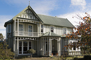
Carterton is a small town in the Wellington Region of New Zealand and the seat of the Carterton District. It lies in a farming area of the Wairarapa in New Zealand's North Island. It is located 14 km (8.7 mi) southwest of Masterton and 80 km (50 mi) northeast of Wellington. The town has a population of 5,930, out of a total district population of 10,250.

<span class="mw-page-title-main">Pongaroa</span> Place in Manawatū-Whanganui, New Zealand

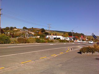
Pongaroa is a town in the Tararua District, in the southeast of the North Island of New Zealand, 110 kilometres southwest of Hastings and 200 kilometres northeast of Wellington. The nearest town is Pahiatua, 50 kilometres to the west. Popular Akitio Beach is 30 kilometres to the east. The township straddles Route 52, a road between Masterton and Waipukurau.

<span class="mw-page-title-main">Konini</span> Suburb in Auckland, New Zealand

Konini is a suburb in the West Auckland, New Zealand, under the local governance of Auckland Council. Kōnini is the Māori language name for the fruit of the tree fuchsia.

<span class="mw-page-title-main">Wai o Taiki Bay</span> Suburb in Auckland, New Zealand

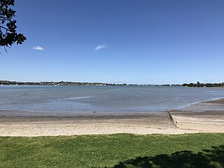
Wai o Taiki Bay is a suburb in Auckland, New Zealand. It is under the local governance of Auckland Council.

<span class="mw-page-title-main">Frasertown</span> Settlement in Hawkes Bay Region, New Zealand

Frasertown is a small settlement in the northern Hawke's Bay Region of New Zealand's eastern North Island.

Rawhiti is a small beachfront town about 27km from Russell in the Bay of Islands of New Zealand.

<span class="mw-page-title-main">Waihola</span> Town in Otago, New Zealand

The township of Waihola lies between Dunedin and Milton, New Zealand in Otago, in New Zealand's South Island. It lies close to the southeast shore of the shallow tidal lake which shares its name.

Rawhitiroa is a locality in South Taranaki, New Zealand. It is approximately 6.5 km east of Eltham.

<span class="mw-page-title-main">Tauhoa</span> Place in Auckland Region, New Zealand

Tauhoa is a rural community in the Auckland Region of New Zealand's North Island.

<span class="mw-page-title-main">Matapouri</span> Place in Northland Region, New Zealand

Matapouri is a coastal settlement in the Whangarei District of Northland, New Zealand. It is 7 km north of Tutukaka and 35 km north-east of Whangarei, in an area known as the Tutukaka Coast. Matapouri was described by Whangarei District Council in 2010 as "an archetypal Kiwi bach settlement". Holiday homes make up 90 per cent of the houses and at holiday times the number of residents swells to seven times its permanent population.

Waipatu is a semi-rural suburb of Hastings, in the Hastings District and Hawke's Bay Region of New Zealand's North Island.

Waitahanui is a village in the Taupō District, Waikato region, New Zealand. The village is on the eastern shore of Lake Taupō, 14 km (9 mi) south of the district seat of Taupō.

<span class="mw-page-title-main">Masterton East</span> Suburb in Masterton, New Zealand

Masterton East is a suburb of Masterton, a town on New Zealand's North Island.

Fairview Heights is a suburb located on the North Shore of Auckland, New Zealand. It is under local governance of Auckland Council. The area is defined by Lonely Track Road on the north, East Coast Road on the east, Oteha Valley Road on the south, and the Auckland Northern Motorway on the west. Until the end of the 20th century, the area was rural.

Oteha is an Auckland suburb, which is under local governance of Auckland Council. The area is defined by Oteha Valley Road on the north, East Coast Road on the east, Spencer Road on the south, and the Auckland Northern Motorway on the west. Until the very end of the 20th century, the area was rural.

Northpark is an eastern suburb of the city of Auckland, New Zealand. Most of the houses were built in the 1990s. Before 1990, the area was rural.

Huntington Park is an eastern suburb of the city of Auckland, New Zealand. The area is bounded on the north by Ti Rakau Drive, on the east by Te Irirangi Drive, and to the south and west by the Greenmount Drainage Reserve. The area is called Greenmount on some maps. The northeast corner contains The Hub shopping mall.

Shamrock Park is an eastern suburb of the city of Auckland, New Zealand. The area is bounded on the northwest by Chapel Road and Kilkenny Drive, on the northeast by Whitford Road, and on the east by Mangemangeroa Creek. Shamrock Park has many of its streets named after Irish Towns.

East Tāmaki Heights is an eastern suburb of Auckland, New Zealand.

<span class="mw-page-title-main">Homebush, Masterton</span> Locality in Wellington Region, New Zealand

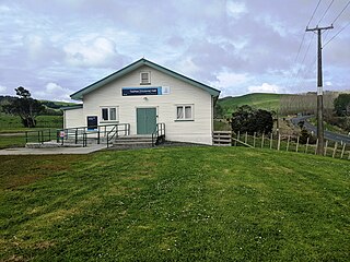
Homebush is a rural area in the Masterton District and Wellington Region of New Zealand's North Island. It is about 3 km southeast of Masterton.

References

  1. 1 2 "ArcGIS Web Application". statsnz.maps.arcgis.com. Retrieved 4 July 2021.
  2. 1 2 "Population estimate tables - NZ.Stat". Statistics New Zealand . Retrieved 25 October 2022.
  3. "Akura Road and Ngaumutawa Road". Masterton District Library and Archive. Retrieved 4 July 2021.
  4. Craig Innes; Bob Metcalf (January 2003). "Te Karaitiana Te Korou Report Wai 770" (PDF). pp. 26, 62–63.
  5. Craig Innes; Bob Metcalf (January 2003). "Te Karaitiana Te Korou Report Wai 770" (PDF). p. 89.
  6. "Masterton Loan Proposal". Wairarapa Daily Times. 29 September 1904.
  7. "N158" (Map). Masterton. 1:63360. NZMS1. LINZ / Lands and Survey. 1973.
  8. "T26" (Map). Masterton. 1:50000. NZMS260. LINZ / Lands and Survey. 1980.
  9. "Chamberlain Road Future Development Area" (PDF). Masterton District Council. 7 November 2018.
  10. "Opportunity for affordable homes 'squandered' - businessman". Radio New Zealand. 18 August 2020.
  11. 1 2 "Statistical area 1 dataset for 2018 Census". Statistics New Zealand. March 2020. Ngaumutawa (255600). 2018 Census place summary: Ngaumutawa