
Antsirabe is the third largest city in Madagascar and the capital of the Vakinankaratra region, with a population of 265,018 in 2014. In Madagascar, Antsirabe is known for its relatively cool climate, its industry and the high concentration of pulled rickshaws or pousse-pousse. It attracts around 30,000 tourists a year.
Androy is the most southerly region of Madagascar. It covers an area of 19,540 km2, and had a population of 903,376 inhabitants in 2018. The administrative capital is Ambovombe-Androy.

Ankazobe is a municipality in Analamanga Region, in the Central Highlands of Madagascar. It is the administrative capital of Ankazobe District and is situated at 75 km north of the capital Antananarivo.

The Canal des Pangalanes is a canal that consists of a series of natural rivers, waterways and human-made lakes that extends for over 654 kilometres (410 mi) and runs down the east coast of Madagascar from Toamasina to Farafangana. It is used primarily for transportation and fishing, and it has unspoiled natural beaches that are visited by tourists. An initial area of the canal in Toamasina is straight, while subsequent areas have curves, lagoons, connected lakes and swamps.
Saint-Blancard is a commune in the Gers department in the Occitanie region in southwestern France.

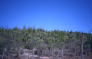
Atsinanana is a coastal region in eastern Madagascar. It borders Analanjirofo region in the north, Alaotra-Mangoro in the west, Vakinankaratra and Amoron'i Mania in the southwest, and Vatovavy in the south. The region contains over 285km of coastline, which includes many beaches and cultural heritage sites.
Milamaina is a rural municipality in Madagascar. It belongs to the district of Fandriana, which is a part of Amoron'i Mania Region. The population of the commune was estimated to be approximately 7,000 in 2001 commune census.
Sahamadio is a rural municipality in Madagascar. It belongs to the district of Fandriana, which is a part of Amoron'i Mania Region. The population of the commune was estimated to be approximately 17,000 in 2001 commune census.

Rivière-à-Pierre is a municipality of the Portneuf Regional County Municipality, in the administrative region of the Capitale-Nationale. This area of the Laurentian Mountains is part of the Batiscanie and has more than 200 lakes. The village of Rivière-à-Pierre was developed on each side of the river that bears its name. Rivière-à-Pierre is the second largest municipality in the Portneuf RCM in terms of area.

Antsirabe I is a district in, and capital of, Vakinankaratra Region, Madagascar. The borders of the district are identical to those of the city and urban commune of Antsirabe.

Antsampanana is a village in Atsinanana Region, Madagascar. It belongs to the municipality of Mahatsara. It is located along Route Nationale (RN) 2, at the northern terminus of RN 11. A memorial dedicated to the victims of the Malagasy Uprising of 1947 was erected in the village centre. There is a small mosque in Main Street. Antsampanana's market area is a common stopping point for trips.
Maintinandry is a small village and commune in the Vatomandry District, Atsinanana Region, Madagascar.

Tropical Cyclone Manou was a relatively rare May tropical cyclone that affected southeastern Madagascar. The final named storm of the 2002–03 South-West Indian Ocean cyclone season, Manou formed on May 2 to the southwest of Diego Garcia. It moved generally to the southwest for much of its duration, steered by a ridge to the southeast. Manou affected Saint Brandon and Mauritius with gusty winds. After an initial strengthening phase, the storm weakened but later re-intensified as it approached Madagascar. Manou developed a well-defined eye and reached peak winds only 19 km (12 mi) from the eastern Madagascar coastline. For about 12 hours, the cyclone stalled before turning to the south and weakening. Manou became extratropical on May 10 and dissipated three days later.

Vatomandry is a district located in Atsinanana Region, Madagascar.

Brickaville District is an administrative district in Atsinanana Region, Madagascar; also known as Ampasimanolotra and Vohibinany. Brickaville is located along Route nationale 2, 105 km south of Toamasina and 220 km east of Antananarivo. It is also situated alongside the Rianila river. It is a railway station on the Antananarivo - East Coast line. Its main industries revolve around sugar. The district has an estimated population in 2020 was 218,727.
Route nationale 11a is a secondary highway in Madagascar of 204 km, running from Antsampanana to Mahanoro, to the Mangoro River. It crosses the region of Atsinanana.
Ilaka Est is a rural municipality located in the Atsinanana region of eastern Madagascar, and belongs to the Vatomandry (district).
'Amboditavolo is a village and commune in the Vatomandry (district) in the Atsinanana Region, Madagascar.
Tankafatra is a rural municipality in Analamanga Region, in the Central Highlands of Madagascar. It belongs to the district of Andramasina and its populations numbers to 6,867 in 2019.
Sabotsy Manjakavahoaka is a rural municipality in Analamanga Region, in the Central Highlands of Madagascar. It belongs to the district of Andramasina and its populations numbers to 9,658 in 2019.

