Paved and unpaved roadways, as well as railways, provide the main forms of transport in Madagascar. Madagascar has approximately 31,640 km (19,660 mi) of paved roads and 836 km of rail lines. In 2010, Madagascar had 432 km (270 mi) of navigable waterways.

Antananarivo, also known by its colonial shorthand form Tana, is the capital and largest city of Madagascar. The administrative area of the city, known as Antananarivo-Renivohitra, is the capital of Analamanga region. The city sits at 1,280 m (4,199 ft) above sea level in the center of the island, the highest national capital by elevation among the island countries. It has been the country's largest population center since at least the 18th century. The presidency, National Assembly, Senate and Supreme Court are located there, as are 21 diplomatic missions and the headquarters of many national and international businesses and NGOs. It has more universities, nightclubs, art venues, and medical services than any city on the island. Several national and local sports teams, including the championship-winning national rugby team, the Makis, are based here.
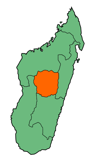
Antananarivo Province is a former province of Madagascar with an area of 58,283 square kilometres (22,503 sq mi). It had a population of 5,370,900 in 2004. Its capital was Antananarivo, which is also the capital of the country. Established in 1965, it was the most important province of Madagascar in terms of industrial production. It was one of the most literate provinces and was dominated by the Merina people. Along with the other five provinces, it was abolished in 2007 after a referendum in favour of creation of smaller regions to help in development was approved. It was badly affected by plagues in the 20th century. In 2002 a state of emergency was proclaimed by the then president Didier Ratsiraka. The events that followed led to the other five provinces announcing the creation of a new republic that would have excluded Antananarivo Province. Peace was restored only when Marc Ravalomanana was installed as the country's president.

The Toamasina Province is a former province of Madagascar with an area of 71,911 km². It had a population of 2,855,600 (2004). Its capital was Toamasina, the most important seaport of the country. The province was also known as Tamatave Province.

Mission Aviation Fellowship (MAF) is a Christian organization that provides aviation, communications, and learning technology services to more than 1,000 Christian and humanitarian agencies, as well as thousands of isolated missionaries and indigenous villagers in the world's most remote areas. There are three major operational centers – Nampa, Idaho, United States, Ashford, United Kingdom, and Cairns, Australia. These centres provide operational support to programs in the Americas, Africa and Asia Pacific regions. In 2010, MAF served in more than 55 countries, flying 201,710 passengers with a fleet of some 130 aircraft.

Antsirabe is the third largest city in Madagascar and the capital of the Vakinankaratra region, with a population of 265,018 in 2014. In Madagascar, Antsirabe is known for its relatively cool climate, its industry and the high concentration of pulled rickshaws or pousse-pousse. It attracts around 30,000 tourists a year.

The Sakalava are an ethnic group of Madagascar. They are found on the western and northwest region of the island, in a band along the coast. The Sakalava are one of the smallest ethnic groups, constituting about 6.2 percent of the total population, that is about 2,079,000 in 2018. Their name means "people of the long valleys." They occupy the western edge of the island from Toliara in the south to the Sambirano River in the north.
Shell is a city located on the western edge of the Ecuadorian Amazon and in the eastern foothills of the Andes. It is located about 94 miles (151 km) southeast of Quito, and roughly 4 miles (6.4 km) west of the provincial capital, Puyo. Its name comes from the Royal Dutch Shell corporation.
Oxylapia is a genus of freshwater fish in the family Cichlidae. It contains the single species Oxylapia polli, known locally as the songatana. It is an endangered species, endemic to the Marolambo Rapids in the Nosivolo River in east-central Madagascar. It is threatened by habitat loss and sedimentation caused by deforestation. The only other monotypic cichlid genus in Madagascar is Katria, and it is restricted to the same region as Oxylapia. In 2010, the Nosivolo River was designated as a Ramsar Site. The Oxylapia is the conservation flagship species for the district capital Marolambo.
Atsinanana is a coastal region in eastern Madagascar. It borders Analanjirofo region in the north, Alaotra-Mangoro in the west, Vakinankaratra and Amoron'i Mania in the southwest, and Vatovavy in the south. The region contains over 285km of coastline, which includes many beaches and cultural heritage sites.

Anosy is one of the 22 regions of Madagascar. It is located in the southeast of the country, on the eastern side of what was once the Toliara Province. The name Anosy means "island(s)" in Malagasy.
Marovato is a town and commune in Madagascar. It belongs to the district of Boriziny, which is a part of Sofia Region. The population of the commune was estimated to be approximately 23,000 in 2001 commune census.
Ankilizato is a town and commune in Madagascar. It belongs to the district of Mahabo, which is a part of Menabe Region.

Mahaboboka is a town and commune in Madagascar. It belongs to the district of Sakaraha, which is a part of Atsimo-Andrefana Region. The population of the commune was estimated to be approximately 13,115 in 2018.

Ampasinambo is a town and commune in Madagascar. It belongs to the district of Nosy Varika, which is a part of the region Vatovavy. The population of the commune was 13,774 in 2018.

The Betsimisaraka are the second largest ethnic group in Madagascar after the Merina and make up approximately fifteen percent of the Malagasy people. They occupy a large stretch of the eastern coastal region of Madagascar, from Mananjary in the south to Antalaha in the north. The Betsimisaraka have a long history of extensive interaction with European seafarers, pirates and bourgeois traders, which produced a significant subset with mixed European-Malagasy origins, termed the zana-malata. European influence is evident in the local valse (waltz) and basesa musical genres, which are typically performed on the accordion. Tromba ceremonies feature strongly in Betsimisaraka culture.

Illegal logging has been a problem in Madagascar for decades and is perpetuated by extreme poverty and government corruption. Often taking the form of selective logging, the trade has been driven by high international demand for expensive, fine-grained lumber such as rosewood and ebony. Historically, logging and exporting in Madagascar have been regulated by the Malagasy government, although the logging of rare hardwoods was explicitly banned from protected areas in 2000. Since then, government orders and memos have intermittently alternated between permitting and banning exports of precious woods. The most commonly cited reason for permitting exports is to salvage valuable wood from cyclone damage, although this reasoning has come under heavy scrutiny. This oscillating availability of Malagasy rosewood and other precious woods has created a market of rising and falling prices, allowing traders or "timber barons" to stockpile illegally sourced logs during periodic bans and then flood the market when the trade windows open and prices are high. Over 350,000 trees were illegally felled in Madagascar between 2010 and 2015, according to TRAFFIC.

The Zafimaniry are a sub-group of the Betsileo ethnic group of Madagascar. They live in the forested mountains of the southern central highlands southeast of Ambositra, between the neighboring Betsileo and Tanala peoples. There are approximately 100 Zafimaniry villages, which support a population of approximately 25,000. The Zafimaniry speak a dialect of the Malagasy language, which is a branch of the Malayo-Polynesian language group which comes from the Barito languages, that are spoken in southern Borneo.

The Nosivolo River is a river in eastern Madagascar and a primary tributary of the Mangoro River. It begins east of Fandriana. The village of Marolambo, capital of the Marolambo District in the Atsinanana region, is located along the river at the junction with the Sandranamby River.

The Marohita mouse lemur is a species of mouse lemur known only from the Marohita Forest in eastern Madagascar, near the village of Marolambo. Specimens were first collected in December 2003, and its discovery was announced in 2013 along with the Anosy mouse lemur. It is a large mouse lemur, weighing up to 89 g (3.1 oz), and lives within the same area as the Goodman's mouse lemur (M. lehilahytsara), Simmons' mouse lemur (M. simmonsi), and the brown mouse lemur (M. rufus), all four of which are nearly identical in appearance. Its fur is rufous on its back and grayish-beige on its underside. Nothing is known about its behavior. Its conservation status was evaluated as Endangered by the International Union for Conservation of Nature (IUCN) in 2012, before it was formally described, because its only known habitat had severely degraded between 2003 and 2012.

