
The Toamasina Province is a former province of Madagascar with an area of 71,911 km². It had a population of 2,855,600 (2004). Its capital was Toamasina, the most important seaport of the country. The province was also known as Tamatave Province.

Toamasina, meaning "like salt" or "salty", unofficially and in French Tamatave, is the capital of the Atsinanana region on the east coast of Madagascar on the Indian Ocean. The city is the chief seaport of the country, situated 215 km (134 mi) northeast of its capital and biggest city Antananarivo. In 2018 Toamasina had a population of 325,857.

Mahavelona, is a town in the district of Toamasina II, in the region of Atsinanana, on the northern part of the east coast of Madagascar.

Analamanga is a region in central Madagascar, containing the capital Antananarivo and its surrounding metropolitan area. The region has an area of 17,488 square kilometres, and had a population of 4,325.226 in 2018.

The Canal des Pangalanes is a canal that consists of a series of natural rivers, waterways and human-made lakes that extends for over 654 kilometres (410 mi) and runs down the east coast of Madagascar from Toamasina to Farafangana. It is used primarily for transportation and fishing, and it has unspoiled natural beaches that are visited by tourists. An initial area of the canal in Toamasina is straight, while subsequent areas have curves, lagoons, connected lakes and swamps.
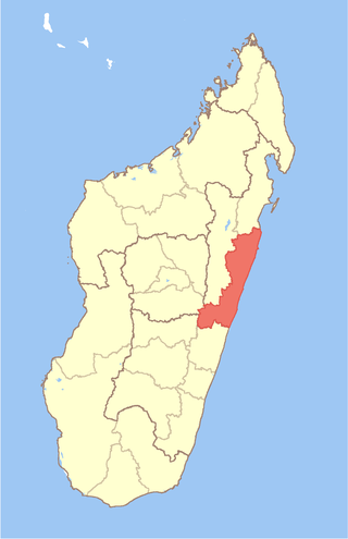
Atsinanana is a coastal region in eastern Madagascar. It borders Analanjirofo region in the north, Alaotra-Mangoro in the west, Vakinankaratra and Amoron'i Mania in the southwest, and Vatovavy in the south. The region contains over 285km of coastline, which includes many beaches and cultural heritage sites.

Districts are second-level administrative divisions of Madagascar below the regions. There are 114 districts in Madagascar. Districts are in their turn divided into communes; while some of the districts in urban areas and offshore islands each consist of only one commune, most of the districts are divided typically into 5–20 communes.
Toamasina II is a district of Atsinanana in Madagascar. It covers the outskirts of the city of Toamasina and the surrounding rural communes.
Sahambala is a rural municipality in the district of Toamasina II (district), in the region of Atsinanana, on east coast of Madagascar.
Ampasimadinika is a rural commune in the district of Toamasina II (district), in the region of Atsinanana, on the northern part of the east coast of Madagascar. It is situated along the National road RN 2.
Antetezambaro is a rural commune in the district of Toamasina II (district), in the region of Atsinanana, on the east coast of Madagascar. It is situated along the National road RN 5, 12 km north of Toamasina.
Ambodilazana is a rural commune in the district of Toamasina II (district), in the region of Atsinanana, on the east coast of Madagascar.

Fanandrana is a rural commune in the district of Toamasina II (district), in the region of Atsinanana, on the east coast of Madagascar. It is situated at the National road RN 2 at 26 km from Toamasina. The Ivondro River flows through the center of Fanandrana, and the Fanandrana river in its south.
Andranobolaha is a rural commune in the district of Toamasina II (district), in the region of Atsinanana, on the east coast of Madagascar.
Amboditandroho is a rural commune in the district of Toamasina II (district), in the region of Atsinanana, on the east coast of Madagascar. It is situated at the National road RN 2 at 15 km from Toamasina.

Ambodiriana is a rural commune in the district of Toamasina II (district), in the region of Atsinanana, on the east coast of Madagascar.
Antenina is a rural municipality in the district of Toamasina II (district), in the region of Atsinanana, on east coast of Madagascar.
Mangabe is a rural municipality in the district of Toamasina II (district), in the region of Atsinanana, on east coast of Madagascar.
Toamasina suburbaine is a municipality in the district of Toamasina II (district), in the region of Atsinanana, on east coast of Madagascar. It covers the rural villages in the surroundings of the city of Toamasina with 46,859 inhabitants (2019).
Ifito is a rural municipality in the district of Toamasina II (district), in the region of Atsinanana, on east coast of Madagascar.

