
The Toamasina Province is a former province of Madagascar with an area of 71,911 km2. It had a population of 2,855,600 (2004). Its capital was Toamasina, the most important seaport of the country. The province was also known as Tamatave Province.

Vatomandry is a town in and the administrative center of the Vatomandry District, Atsinanana Region, Madagascar. An airport serves the city.
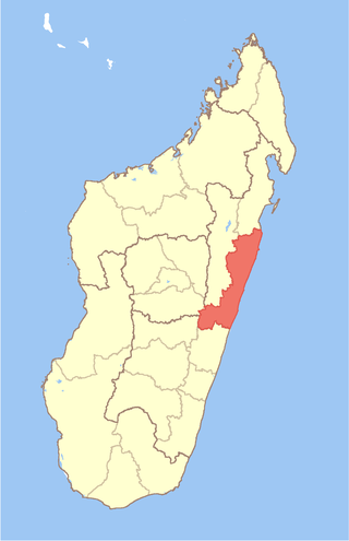
Atsinanana is a coastal region in eastern Madagascar. It borders Analanjirofo region in the north, Alaotra-Mangoro in the west, Vakinankaratra and Amoron'i Mania in the southwest, and Vatovavy in the south. The region contains over 285km of coastline, which includes many beaches and cultural heritage sites.
Ambalabe may refer to one of the following locations in Madagascar:
Maintinandry is a small village and commune in the Vatomandry District, Atsinanana Region, Madagascar.

Tropical Cyclone Manou was a relatively rare May tropical cyclone that affected southeastern Madagascar. The final named storm of the 2002–03 South-West Indian Ocean cyclone season, Manou formed on May 2 to the southwest of Diego Garcia. It moved generally to the southwest for much of its duration, steered by a ridge to the southeast. Manou affected Saint Brandon and Mauritius with gusty winds. After an initial strengthening phase, the storm weakened but later re-intensified as it approached Madagascar. Manou developed a well-defined eye and reached peak winds only 19 km (12 mi) from the eastern Madagascar coastline. For about 12 hours, the cyclone stalled before turning to the south and weakening. Manou became extratropical on May 10 and dissipated three days later.
Vatomandry is a district located in Atsinanana Region, Madagascar.

Brickaville District is an administrative district in Atsinanana Region, Madagascar; also known as Ampasimanolotra and Vohibinany. Brickaville is located along Route nationale 2, 105 km south of Toamasina and 220 km east of Antananarivo. It is also situated alongside the Rianila river. It is a railway station on the Antananarivo - East Coast line. Its main industries revolve around sugar. The district has an estimated population in 2020 was 218,727.
Ilaka Est is a rural municipality located in the Atsinanana region of eastern Madagascar, and belongs to the Vatomandry (district).
Tsivangiana is a rural municipality located in the Atsinanana region of eastern Madagascar, and belongs to the Vatomandry (district).
Ambalavolo is a rural commune located in the Atsinanana region of eastern Madagascar, and belongs to the Vatomandry (district).

Ifasina I is a small village and commune in the Vatomandry District, in Atsinanana, Madagascar.

Antanambao Mahatsara is a rural commune (municipality) located in the Atsinanana region of eastern Madagascar, and belongs to the Vatomandry (district).
'Amboditavolo is a village and commune in the Vatomandry (district) in the Atsinanana Region, Madagascar.
' Ambodivoananto is a village and commune in the Vatomandry (district) in the Atsinanana Region, Madagascar.
Ambodinonoka Rangalana is a rural municipality located in the Atsinanana region of eastern Madagascar. It belongs to the Vatomandry District.
Ambalabe is a rural municipality located in the Atsinanana region of eastern Madagascar, and belongs to the Vatomandry (district).
Nierenana is a rural municipality located in the Atsinanana region of eastern Madagascar, and belongs to the Vatomandry (district).
Sahamatevina is a rural municipality located in the Atsinanana region of eastern Madagascar, and belongs to the Vatomandry (district).
Ifasina II is a rural municipality located in the Vatomandry district of the Atsinanana region of eastern Madagascar.

