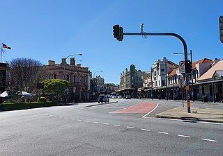
Newtown, a suburb of Sydney's inner west, is located approximately four kilometres south-west of the Sydney central business district, straddling the local government areas of the City of Sydney and Inner West Council in the state of New South Wales, Australia.

The River Itchen in Hampshire, England, rises to the south of New Alresford and flows 26 miles (42 km) to meet Southampton Water below the Itchen Bridge. The Itchen Navigation was constructed in the late 17th and early 18th centuries to enable barges to reach Winchester from Southampton Docks, but ceased to operate in the mid-19th century and is largely abandoned today.

St Mary's Stadium is a seated but also safe-standing football stadium in Southampton, Hampshire, England, which has been the home stadium of Premier League club Southampton since 2001. The stadium has a capacity of 32,384 and is currently the largest football stadium in South East England.
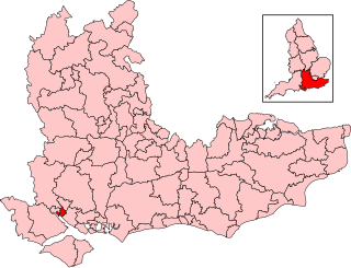
Southampton, Itchen is a constituency represented in the House of Commons of the UK Parliament since 2024 by Darren Paffey from the Labour Party (UK). Before then, it had been held since 2015 by Royston Smith GM of the Conservative Party, who had announced his retirement from frontline politics in 2023 and did not seek re-election in 2024.

The suburbs of Johannesburg are officially demarcated areas within the City of Johannesburg Metropolitan Municipality, South Africa. As in other Commonwealth countries, the term suburb refers to a "neighbourhood", although in South Africa most "suburbs" have legally recognised borders and often separate postal codes. The municipal functions for the area, such as municipal policing and social services, are still managed by the city government.
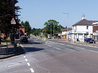
Hedge End is a town and civil parish in Hampshire, England. Situated to the east of the City of Southampton, it adjoins the districts of West End and Botley. Hedge End lies within the Borough of Eastleigh and is part of the Southampton Urban Area. The original hamlet developed on Botley Common after 1250 when it was granted to the men of Botley as common pasture. In 1267, royal charters allowed Botley to hold an annual fair and a weekly market on the common which eventually became a market town.

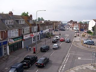
Portswood is a suburb and Electoral Ward of Southampton, England. The suburb lies to the north-north-east of the city centre and is bounded by Freemantle, Highfield, Swaythling, St. Denys and Bevois Valley.

St Mary's is an inner city area of Southampton in England. It consists of two areas separated by Six Dials junction. The northern section of the district is bounded by St Mary's Road and some streets to the west and the area to the east is Nicholstown-Newtown. The northern section is home to the fire station.

Micheldever is a village and civil parish in Hampshire, England, situated 6 miles (10 km) north of Winchester. It lies upon the River Dever.

Northam is a suburb of Southampton in Hampshire. On the West bank of the River Itchen, it shares borders with St Mary's, Bitterne and Bevois Valley. Beside the border with St Mary's is the Chapel area, which has been home to some recent apartment building developments in Northam. The A3024 road runs through the suburb and crosses the Northam Bridge, which links Northam with Bitterne via Bitterne Manor. Although St Mary's Stadium takes its name from the neighbouring St Mary's, the stadium itself is in Northam, and home to Southampton F.C.
St Denys is a partially riverside district of Southampton, England, centred 1.5 miles (2.4 km) north north-east of the city centre facing variously Bitterne Park and quay across the River Itchen estuary. The river is here spanned in the mid-east extreme of the district by Cobden Bridge, one of five within the city's broad boundaries, six including the railway bridge 100 m south. It is separated from the city centre by the districts sometimes known as Bevois Valley and New Town, in turn and to the south a riverside boardwalk allows pedestrian and bicycle access to the Mount Pleasant Industrial Estate and Northam.

Sholing, previously Scholing, is a district on the eastern side of the city of Southampton in Southern England. It is located between the districts of Bitterne, Thornhill and Woolston.
Woolston is a suburb of Southampton, Hampshire, located on the eastern bank of the River Itchen. It is bounded by the River Itchen, Sholing, Peartree Green, Itchen and Weston.

Southampton is a port city and unitary authority in Hampshire, England. It is located approximately 80 miles (130 km) southwest of London, 20 miles (32 km) west of Portsmouth, and 20 miles (32 km) southeast of Salisbury. Southampton had a population of 253,651 at the 2011 census, making it one of the most populous cities in southern England.

The Hampshire and Isle of Wight Fire and Rescue Service (HIWFRS) is the statutory fire and rescue service for the county of Hampshire, including the cities of Southampton and Portsmouth, and the county of the Isle of Wight off the south coast of England. The service was formed on 1 April 2021 from the merger of Hampshire Fire and Rescue Service and the Isle of Wight Fire and Rescue Service. The service's chief fire officer is Neil Odin.
Southampton is a city in Hampshire, England. The area has been settled since the Stone Age. Its history has been affected by its geographical location, on a major estuary on the English Channel coast with an unusual double high-tide, and by its proximity to Winchester and London; the ancient and modern capitals of England. Having been an important regional centre for centuries, Southampton was awarded city status by Queen Elizabeth II in 1964.
Bevois is an Electoral Ward in the Unitary Authority of Southampton, England comprising the suburbs Bevois Valley, Nicholstown and Northam, with a population of 16,844.

Northam railway station served the suburb of Northam in Southampton, England.
The following is a timeline of the history of the city of Southampton, Hampshire, England.

