Amesbury is a town and civil parish in Wiltshire, England. It is known for the prehistoric monument of Stonehenge which is within the parish. The town is claimed to be the oldest occupied settlement in Great Britain, having been first settled around 8820 BC. The parish includes the hamlets of Ratfyn and West Amesbury, and part of Boscombe Down military airfield.

The River Avon is in the south of England, rising in Wiltshire, flowing through that county's city of Salisbury and then west Hampshire, before reaching the English Channel through Christchurch Harbour in the Bournemouth, Christchurch and Poole conurbation of Dorset.
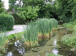
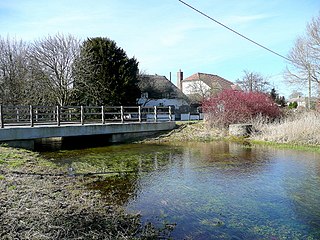
Enford is a village and civil parish in Wiltshire, England, in the northeast of Salisbury Plain. The village lies 10 miles (16 km) southeast of Devizes and 14 miles (23 km) north of Salisbury. The parish includes nine small settlements along both banks of the headwaters of the River Avon. Besides Enford, these are Compton, Coombe, East Chisenbury, Fifield, Littlecott, Longstreet, New Town and West Chisenbury.
Larkhill is a garrison town in the civil parish of Durrington, Wiltshire, England. It lies about 1+3⁄4 miles (2.8 km) west of the centre of Durrington village and 1+1⁄2 mi (2.4 km) north of the prehistoric monument of Stonehenge. It is about 10 mi (16 km) north of Salisbury.

Allington is a village and civil parish in Wiltshire, England, about 3 miles (5 km) southeast of Amesbury and 7 miles (11 km) northeast of Salisbury. The parish includes the village of Boscombe; both villages are on the River Bourne and the A338 road. Most of the west boundary of the parish is also the county boundary with Hampshire.

Sherrington is a small village and civil parish on the River Wylye in Wiltshire, England.

Bulford is a village and civil parish in Wiltshire, England, close to Salisbury Plain. The village is close to Durrington and about 1.5 miles (2.4 km) north of the town of Amesbury. The Bulford Camp army base is separate from the village but within the parish.

Midford Brook is a small river in Somerset, England.
Durrington is a village and civil parish in Wiltshire, England. The village lies about 2 miles (3.2 km) north of the town of Amesbury, 10 miles (16 km) north-northeast of the city of Salisbury, and 2+1⁄2 miles (4 km) northeast of the Stonehenge monument. It is on the eastern part of Salisbury Plain, the largest remaining area of chalk grassland in northwest Europe. The parish includes the hamlet of Hackthorn, on the northern outskirts of Durrington, and the military settlement of Larkhill, 1.5 miles (2.4 km) to the west.

The Bulford Kiwi is a large depiction of a kiwi, carved in the chalk on Beacon Hill above the military town of Bulford on Salisbury Plain in Wiltshire, England. It was created in 1919 by soldiers of the New Zealand Expeditionary Force who were awaiting repatriation following the end of the First World War.

Bulford Camp is a military camp on Salisbury Plain in Wiltshire, England. Established in 1897, the site continues in use as a large British Army base. The camp is close to the village of Bulford and is about 2+1⁄4 miles (3.6 km) north-east of the town of Amesbury. The camp forms part of the Tidworth, Netheravon and Bulford (TidNBul) Garrison.
The Cholderton and District Water Company is a private water supplier, serving an area on the border of Hampshire and Wiltshire in the south of England. Until 1 May 2018 it was by far the smallest licensed water company in England and Wales, but since this time is no longer regulated by Ofwat and its area has formally become part of the area covered by Wessex Water as a licensed water company. It supplies about 2,500 people over an area of around 21 km2 in the parishes of Cholderton and Bulford in Wiltshire, and Shipton Bellinger, Thruxton, Amport and Quarley in Hampshire and is a private limited company with company number 357098.
The Amesbury and Military Camp Light Railway was a branch line in Wiltshire, England, constructed under a light railway order dated 24 September 1898. It was opened for military traffic from Amesbury to the east-facing Newton Tony Junction on 1 October 1901. A west-facing junction, Amesbury Junction, where the branch burrowed under the main line, opened on 2 June 1902. The line closed in 1963.
Damson Brook is a small river in Wiltshire, United Kingdom. It rises in the civil parish of Bulford, just north of Bulford Camp. After two miles it joins Nine Mile River in the civil parish of Milston, which in turn flows into the River Avon.

Milston is a hamlet and civil parish in Wiltshire, England, about 10 miles (16 km) north of Salisbury and separated from Durrington by the River Avon. The parish covers two hamlets, Milston and Brigmerston, along with farm buildings on Salisbury Plain. The population in 2011 was 130 – the same as in 1861.

Rollestone is a small village and former civil parish on Salisbury Plain in Wiltshire, England. It is near the River Till. Its nearest town is Amesbury, about 5 miles (8.0 km) away to the east.
Newton Tony is a rural English village and civil parish in the county of Wiltshire, close to the border with Hampshire. Situated in the Bourne Valley, Newton Tony is about 9 miles (14 km) north-east of its post town, Salisbury. Wilbury House, a Grade I listed 17th-century mansion, stands in parkland in the north of the parish.

Swinton Barracks is a military installation accommodating two engineer regiments at Perham Down in Wiltshire, England. The site is on the east edge of Salisbury Plain, about 1+1⁄2 miles (2.4 km) east of the garrison at Tidworth. The camp forms part of the Tidworth, Netheravon and Bulford (TidNBul) Garrison.

Bulford railway station served the village of Bulford in Wiltshire, England, between 1906 and 1963.