Tidworth

Last updated

Tidworth
Tidworth Camp - geograph.org.uk - 484675.jpg
Tidworth Camp: a view over the garrison from Clarendon Hill
Wiltshire UK location map.svg
Red pog.svg
Tidworth
Location within Wiltshire
Population12,089 (2021 Census) [1]
OS grid reference SU2348
Unitary authority
Ceremonial county
Region
Country England
Sovereign state United Kingdom
Post town TIDWORTH
Postcode district SP9
Dialling code 01980
Police Wiltshire
Fire Dorset and Wiltshire
Ambulance South Western
UK Parliament
Website Town Council
List of places
UK
England
Wiltshire
51°14′13″N1°39′50″W / 51.237°N 1.664°W / 51.237; -1.664

Tidworth is a garrison town and civil parish in south-east Wiltshire, England, on the eastern edge of Salisbury Plain. Lying on both sides of the A338 about 3+12 miles (5.6 km) north of the A303 primary route, the town is approximately 8 miles (13 km) west of Andover, 12 miles (19 km) south of Marlborough, and 13 miles (21 km) north by north-east of Salisbury. The population of the parish at the 2011 census was approximately 10,600. [2]

Contents

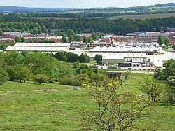
Originally two villages – North Tidworth and South Tidworth – the modern town is dominated by Tidworth Camp, a large British Army site. Swinton Barracks, another Army site, is in the west of the parish.

History

Evidence of prehistoric activity in the area is in the form of several sites with bowl barrows, including a group of seven; [3] and an Iron Age hillfort at Sidbury Hill in the north of the parish. [4]

Domesday Book of 1086 recorded four landowners and 18 households at what is now North Tidworth, in the Amesbury hundred of Wiltshire; and three landowners with 20 households and one church at South Tidworth, in the Broughton hundred of Hampshire. Placenames were written as Todeworde, Tedorde or Todeorde. [5] [6]

The two villages developed in the valley of the small River Bourne, which flows south to join the Hampshire Avon near Salisbury; later the Oxford-Salisbury road also followed the valley. [7]

On John Speed's maps of 1611 the villages are North Tudworth, belonging to Amesbury hundred in "Wilshire", and South Tudworth to Andover hundred in "Hamshire". Before 1650 there was a substantial country house with parkland at South Tidworth; the present Tedworth House is a rebuilding of 18281830. [8]

In 1897 the War Office bought the house and grounds, together with land to the north which gave access to Salisbury Plain for Army training. [9] Extensive barracks were built in the early 20th century, largely in South Tidworth but spreading across the boundary to the north. [10] From 1902 to 1963 there was a railway station at North Tidworth, connected to the main line by a branch from Ludgershall. [11]

North and South were separate ecclesiastical parishes, and therefore became civil parishes in the 19th century. An Ordnance Survey map of 1958 labels the parishes as North Tidworth and South Tedworth. [10] When the boundary between Wiltshire and Hampshire was redrawn in 1992, the entire town became part of Wiltshire, [12] though remaining part of the Hampshire postal county. The two parts remained as separate civil parishes until 1 April 2004.[ citation needed ]

In the 21st century the population of the town increased as the barracks now known as Tidworth Camp expanded, in particular following the return of units from Germany in 2019 and 2020 under the Army Basing Plan. [13]

Religious sites

Parish church

Holy Trinity, North Tidworth Holy Trinity, Tidworth - geograph.org.uk - 1749838.jpg
Holy Trinity, North Tidworth

Holy Trinity, North Tidworth is the Church of England parish church. There may have been a church here in the 12th century but the earliest record is of 1291. [7] The present building, in flint and stone with repairs in red brick, is from the late 14th and 15th centuries. [14] Restoration designed by J. L. Pearson in 1882 included replacement of the roofs and rebuilding of the porch. [7] The church was recorded as Grade II* listed in 1988. [14]

The font is from the 12th century. [15] Three of the six bells were cast in 1619 by John Wallis, and another is from 1700. [16] There are two 17th-century chest tombs in the churchyard. [17] [18] Parish registers from 1700 are held by the Wiltshire and Swindon History Centre, Chippenham. [19]

The Hampshire benefices of South Tidworth and Shipton Bellinger were united in 1926, with the incumbent to live at Tidworth, although the parishes remained separate. [20] In 1972 Shipton Bellinger was made a separate benefice, the parishes of North and South Tidworth were united, and the Victorian church at South Tidworth was declared redundant. [21] The benefice was united with the parish of Ludgershall and Faberstown in 1986. [7]

Others

There was a church dedicated to St Mary at South Tidworth from the 13th or 14th centuries, but by 1784 it was in poor condition and Thomas Assheton Smith the elder, owner of Tedworth House, was given permission to demolish it. [22] Masonry from the church, including a 14th-century window and some monuments, was used to build a small chapel which remains in use as a mortuary chapel for the surrounding cemetery. [23] [24]

St Mary's Church, South Tidworth St Mary's, South Tidworth.jpg
St Mary's Church, South Tidworth

A replacement St Mary's Church was built closer to Tedworth House in 1878 to designs of John Johnson at the expense of Sir John Kelk, who had bought the estate in 1877. It is Grade I listed [25] and is now in the care of the Churches Conservation Trust. [26]

St Michael's Garrison Church (Church of England) and St Patrick's Garrison Church (Roman Catholic), [27] [28] both built in 1912, are the military churches for the garrison. [29]

Governance

The parish elects a town council. It is in the area of Wiltshire Council unitary authority, which is responsible for most local government functions. An electoral ward exists with the same name; the population of the ward taken at the 2011 census was 9,174. [30] For Westminster elections, the parish falls in the Devizes constituency.

Amenities

Tidworth has a small commercial area containing two supermarkets (a Lidl and a large Tesco), two veterinary surgeries, a pharmacy, and other shops and services. A dental surgery serves Tidworth and the surrounding area, covering approximately 5,000 people. In 2003 a new medical centre was completed, the cost being split between the Ministry of Defence and the NHS, as it serves the armed forces and their dependants within the surrounding area.

Castledown FM, a community radio station, broadcasts to Tidworth and Ludgershall from studios in the grounds of Wellington Academy. [31]

Tidworth has one of the lowest crime rates per thousand in Wiltshire, and between 1990 and 2004 only one major crime took place. [32] In 2014, it was rated by the Royal Mail as the most attractive postcode area of England to live in. [33]

Tidworth Garrison Golf Club was constructed in 1904 initially for use by army officers. It was established in 1908 and gradually made available to all ranks and civilians. In 2000 it became a limited company. [34]

Tidworth Polo Club also known as Tedworth Park Polo Club is south of Tedworth House. [35] [36] The ground is central to the British Army Polo Association and is affiliated to the UK Armed Forces Polo Association. [37]

South of Tidworth is a downhill mountain biking venue, first built in secret by the local mountain biking community in 2006. After the landowner discovered the site and forced the issue, Tidworth Freeride was taken over by B1KE, who now operate the site commercially, catering to a wide range of abilities. [38] [39]

Education

The Wellington Academy, a secondary school which was partly sponsored by Wellington College, opened in September 2009, replacing Castledown School. The academy has a sixth form college, an all-weather sports pitch, and dedicated Combined Cadet Force facilities. The parent unit of the CCF is 26 Royal Engineers, housed nearby at Swinton Barracks. [40]

The community is served by three primary schools and an infant school.

Media

Local news and television programmes are provided by BBC South and ITV Meridian. Television signals are received from the Hannington and the local relay transmitters. [41] [42]

Local radio stations are BBC Radio Wiltshire on 103.5 FM, Greatest Hits Radio Salisbury on 102 FM and British Forces Broadcasting Service that provides radio programmes for His Majesty's Armed Forces in nearby Salisbury Plain on 106.8 FM. [43]

The local newspapers that cover the town is the Salisbury Journal and Andover Advertiser. [44]

Notable residents

Duggie Fields, artist, was born in Tidworth, [45] as was musician James Blunt in 1974. [46]

Owners of the South Tidworth estate and Tedworth House include John Smith (1656–1723), Speaker of the House of Commons and Chancellor of the Exchequer; Thomas Assheton Smith (1752–1828), owner of Dinorwic quarry and MP; and his son Thomas (1776–1858), cricketer, foxhunter, yacht designer and MP, who built the present house.

Later, Tedworth House was leased to Edward Studd, father of the Studd brothers cricketers, including CT Studd who played in the match which saw the birth of The Ashes. It was then bought by Sir John Kelk (1816–1886), a building contractor whose public works included the Albert Memorial.

See also

Related Research Articles

<span class="mw-page-title-main">Wiltshire</span> County of England

Wiltshire is a ceremonial county in South West England. It borders Gloucestershire to the north, Oxfordshire to the north-east, Berkshire to the east, Hampshire to the south-east, Dorset to the south, and Somerset to the west. The largest settlement is Swindon, and Trowbridge is the county town.

<span class="mw-page-title-main">Chute Forest</span> Human settlement in England

Chute Forest is a village and civil parish in east Wiltshire, England. The parish is bordered to the east and south by the county of Hampshire. The village is about 5 miles (8 km) northwest of Andover and 3 miles (5 km) to the east of Ludgershall.

<span class="mw-page-title-main">Collingbourne Kingston</span> Village and civil parish in Wiltshire, England

Collingbourne Kingston is a village and civil parish about 8 miles (13 km) south of the market town of Marlborough in Wiltshire, England. The village, which is on the A338 primary route between Andover and Marlborough, is one of several on the River Bourne, a seasonal river which is usually dry in summer. The parish includes the hamlets of Aughton and Brunton.

<span class="mw-page-title-main">Grafton, Wiltshire</span> Human settlement in England

Grafton is a civil parish in Wiltshire, England, in the Vale of Pewsey about 7 miles (11 km) southeast of Marlborough. Its main settlement is the village of East Grafton, on the A338 Burbage - Hungerford road; the parish includes the village of Wilton and the hamlets of West Grafton, Marten and Wexcombe.

<span class="mw-page-title-main">Ludgershall, Wiltshire</span> Human settlement in England

Ludgershall is a town and civil parish 16 miles (26 km) north east of Salisbury, Wiltshire, England. It is on the A342 road between Devizes and Andover. The parish includes Faberstown which is contiguous with Ludgershall, and the hamlet of Biddesden which is 2 miles (3.2 km) to the east on the border with Hampshire.

<span class="mw-page-title-main">Wilton, Wiltshire</span> Town and civil parish in Wiltshire, England

Wilton is a town and civil parish in Wiltshire, England. Lying about 3 miles (5 km) west of the city of Salisbury, and until 1889 the county town of Wiltshire, it has a rich heritage dating back to the Anglo-Saxons.

<span class="mw-page-title-main">Larkhill</span> Army Garrison near Salisbury in Wiltshire, England

Larkhill is a garrison town in the civil parish of Durrington, Wiltshire, England. It lies about 1+34 miles (2.8 km) west of the centre of Durrington village and 1+12 mi (2.4 km) north of the prehistoric monument of Stonehenge. It is about 10 mi (16 km) north of Salisbury.

<span class="mw-page-title-main">John Smith (Chancellor of the Exchequer)</span> English politician

John Smith (1656–1723) of Tedworth House, Hampshire, was an English politician who sat in the English and British House of Commons between 1678 and 1723. He served as Speaker and twice as Chancellor of the Exchequer.

<span class="mw-page-title-main">Perham Down</span> Human settlement in England

Perham Down is a village in Wiltshire, England, in Tidworth parish on the eastern edge of Salisbury Plain. It lies on a minor road about 1+12 miles (2.4 km) east of the town of Tidworth and 1+14 miles (2.0 km) southwest of the town of Ludgershall. The county border with Hampshire is nearby and the nearest large town is Andover, Hampshire, about 7 miles (11 km) to the southeast.

<span class="mw-page-title-main">Shipton Bellinger</span> Human settlement in England

Shipton Bellinger is a village and civil parish in Hampshire, England.

<span class="mw-page-title-main">Thomas Assheton Smith (1776–1858)</span> British cricket player and politician

Thomas Assheton Smith (the younger) (2 August 1776 – 9 September 1858) was an English landowner and all-round sportsman who was notable for being one of the outstanding amateur cricketers of the early 19th century. He was a Tory politician who sat in the House of Commons from 1821 to 1837. He was also known for his pioneering work on the design of steam yachts in conjunction with the Scottish marine engineer Robert Napier.

<span class="mw-page-title-main">West Dean, Wiltshire</span> Human settlement in England

West Dean is a village and civil parish in southeast Wiltshire, England; the Wiltshire/Hampshire border runs through the eastern part of the village. The village is on the River Dun, about 7 miles (11 km) east of Salisbury and the same distance northwest of Romsey.

Kimpton is a village and civil parish in the Test Valley district of Hampshire, England. The village is situated west of Andover, in the north of the county, and has a boundary with Ludgershall, in Wiltshire. South of Kimpton there is Thruxton motor racing circuit, in the parish of Thruxton.

<span class="mw-page-title-main">The Wellington Academy</span> Academy in Wiltshire, England

The Wellington Academy, founded in 2009, is an 11–19 non-selective state-funded school near Ludgershall, Wiltshire, England. The school has academy status and was initially supported by Wellington College, an independent school in Berkshire.

<span class="mw-page-title-main">St Mary's Church, South Tidworth</span> Historic site in Wiltshire, England

St Mary's Church in South Tidworth, Wiltshire, England, was built in 1878. It is recorded in the National Heritage List for England as a designated Grade I listed building, and is now a redundant church in the care of the Churches Conservation Trust.

<span class="mw-page-title-main">Newton Tony</span> Village in Wiltshire, England

Newton Tony is a rural English village and civil parish in the county of Wiltshire, close to the border with Hampshire. Situated in the Bourne Valley, Newton Tony is about 9 miles (14 km) north-east of its post town, Salisbury. Wilbury House, a Grade I listed 17th-century mansion, stands in parkland in the north of the parish.

<span class="mw-page-title-main">Laverstock</span> Human settlement in England

Laverstock is a village and civil parish on the north-east and east outskirts of Salisbury in the ceremonial county of Wiltshire, England. The parish is shaped like a figure 7 and incorporates Ford hamlet, the eastern half of the former manor of Milford, the area near the ancient settlement of Old Sarum, and part of the Hampton Park district on the edge of Salisbury.

<span class="mw-page-title-main">Tidworth Camp</span> Military installation at Tidworth in Wiltshire, England

Tidworth Camp is a military installation at Tidworth in Wiltshire, England. It forms part of the Tidworth, Netheravon and Bulford (TidNBul) Garrison.

<span class="mw-page-title-main">Tedworth House</span> Historic site in Wiltshire, England

Tedworth House, also known as South Tidworth House, is a 19th-century country house in Tidworth, Wiltshire, England. It is a Grade II* listed building.

<span class="mw-page-title-main">Ludgershall railway station, Wiltshire</span> Former railway station in England

Ludgershall railway station was a railway station which served the town of Ludgershall in Wiltshire, England from 1882 to 1961.

References

  1. "Tidworth". City population. Retrieved 25 October 2022.
  2. "Wiltshire Community History – Census". Wiltshire Council. Retrieved 28 March 2022.
  3. Historic England. "Seven Barrows: a barrow cemetery west of Clarendon Hill Reservoir (1015481)". National Heritage List for England . Retrieved 24 May 2020.
  4. Historic England. "Sidbury Hill and associated monuments (1010138)". National Heritage List for England. Retrieved 24 May 2020.
  5. (North) Tidworth in the Domesday Book
  6. (South) Tidworth in the Domesday Book
  7. 1 2 3 4 Baggs, A.P.; Freeman, Jane; Stevenson, Janet H (1995). Crowley, D.A. (ed.). "Victoria County History: Wiltshire: Vol 15 pp153-163 – Parishes: North Tidworth". British History Online. University of London. Retrieved 29 May 2020.
  8. "Tedworth House". Drumbeat. Archived from the original on 18 February 2018.
  9. Page, William, ed. (1911). "Victoria County History: Hampshire: Vol 4 pp391-394 – Parishes: Tidworth, South". British History Online. University of London. Retrieved 30 May 2020.
  10. 1 2 "Ordnance Survey 1:25,000 maps of Great Britain, sheet SU24". National Library of Scotland. 1958. Retrieved 24 May 2020.
  11. Oakley, Mike (2004). Wiltshire Railway Stations. Wimbourne: The Dovecote Press. pp. 133–134. ISBN   1-904349-33-1.
  12. "The Dorset, Hampshire, West Sussex and Wiltshire (County Boundaries) Order 1991". legislation.gov.uk. Retrieved 24 May 2020.
  13. "Army Basing Programme Update" (PDF). Wiltshire Council. Retrieved 22 May 2020.
  14. 1 2 Historic England. "Church of the Holy Trinity (1036009)". National Heritage List for England. Retrieved 31 May 2020.
  15. "Holy Trinity, Tidworth, Wiltshire". Corpus of Romanesque Sculpture in Britain and Ireland. King's College London. Retrieved 31 May 2020.
  16. "North Tidworth". Dove's Guide for Church Bell Ringers. Retrieved 31 May 2020.
  17. Historic England. "Maton monument in churchyard (1181285)". National Heritage List for England. Retrieved 31 May 2020.
  18. Historic England. "Mompessan monument in churchyard (1036010)". National Heritage List for England. Retrieved 31 May 2020.
  19. "Holy Trinity Church, Tidworth". Wiltshire Community History. Wiltshire Council. Retrieved 31 May 2020.
  20. "No. 33188". The London Gazette . 3 August 1926. pp. 5119–5120.
  21. "No. 45753". The London Gazette (Supplement). 17 August 1972. p. 9845.
  22. "Old Church of St. Mary, South Tidworth". Wiltshire Community History. Wiltshire Council. Retrieved 31 May 2020.
  23. Historic England. "St Mary's Chapel of Rest (1093200)". National Heritage List for England. Retrieved 31 May 2020.
  24. "St. Mary's Chapel of Rest, South Tidworth". Wiltshire Community History. Wiltshire Council. Retrieved 31 May 2020.
  25. Historic England. "Church of St Mary, Tidworth (1093240)". National Heritage List for England. Retrieved 30 May 2015.
  26. "St Mary, South Tidworth". Churches Conservation Trust . Retrieved 24 May 2020.
  27. "Roman Catholic Church of St. George and St. Patrick, North Tidworth". Wiltshire Community History. Wiltshire Council. Retrieved 30 May 2015.
  28. "SS Patrick & George, Tidworth". Catholic Directory. Retrieved 30 May 2015.
  29. "Churches – Tidworth". Army Garrisons. Retrieved 23 May 2020.
  30. "Ward population 2011". Office for National Statistics. Retrieved 16 March 2015.
  31. "Our Journey". Castledown FM. Retrieved 4 June 2020.
  32. "Tidworth". UK Crime Stats.
  33. "UK's 'most desirable' postcodes revealed". BBC News. 25 August 2014.
  34. "About Tidworth". Tidworth Garrison Golf Club.
  35. "Tedworth Park Polo Club" . Retrieved 24 March 2021.
  36. "Tidworth Polo Club". Twitter. Retrieved 24 March 2021.
  37. "CSPA Cups and Past Winners". UK Armed Forces Polo Association. Retrieved 1 June 2020.
  38. "Tidworth Freeride / WorldBikeParks". www.worldbikeparks.com. Retrieved 23 June 2020.
  39. "Tidworth Freeride - B1KEPARK". B1ke. Retrieved 23 June 2020.
  40. "Combined Cadet Force (CCF)". The Wellington Academy. Archived from the original on 20 December 2015. Retrieved 20 January 2016.
  41. "Hannington (Hampshire, England) Full Freeview transmitter". May 2004.
  42. "Tidworth (Hampshire, England) Freeview Light transmitter". May 2004.
  43. "Salisbury Plain | BFBS".
  44. "Andover Advertiser | British Newspapers Online". 25 December 2013.
  45. "Duggie Fields - Biography". www.duggiefields.com. Retrieved 6 June 2020.
  46. Thomas, David (31 July 2005). "To be blunt, James, you are a trooper". The Telegraph. ISSN   0307-1235 . Retrieved 6 June 2020.

Further reading