
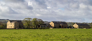
Bulford is a village and civil parish in Wiltshire, England, close to Salisbury Plain. The village is close to Durrington and about 1.5 miles (2.4 km) north of the town of Amesbury. The Bulford Camp army base is separate from the village but within the parish.

Overton is a small village and civil parish in the Hambleton district of North Yorkshire, England, about 4 miles (6.4 km) north-west of York. The population of civil parish taken at the 2011 Census was less than 100. Details are included in the civil parish of Shipton, North Yorkshire. The East Coast Main Line passes to the east, not far from the village.

Crambe is a village and civil parish in the Ryedale district of North Yorkshire, England. It is near the River Derwent and 6 miles (10 km) south-west of Malton. The population as of the 2011 census was less than 100. Details are included in the civil parish of Whitwell-on-the-Hill. The village is located in the Howardian Hills Area of Outstanding Natural Beauty. The father of the renowned mathematician Karl Pearson was born in the village.

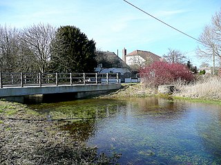
Nine Mile River is a small river in Wiltshire, England. The river is not nine miles long, and its name was derived because carters reckoned they were nine miles from Salisbury when they reached it. The river rises in the civil parish of Milston and joins the River Avon in the village of Bulford. At about halfway through its course, still in the parish of Milston, it is joined by the small Damson Brook.
Saredon is a civil parish in South Staffordshire district, Staffordshire, England, situated to the north east of Wolverhampton, West Midlands, and to the south west of Cannock.

Foston is a small village and civil parish in the Ryedale district of North Yorkshire, England. The population of the civil parish as of the 2011 census was 263. Details are included in the civil parish of Whitwell-on-the-Hill. It is situated close to the A64 road and is approximately 9 miles (14 km) north-east from York.

Stretton is a small village and civil parish in Derbyshire, England. The population of the civil parish as at the 2011 Census was 525. It is located near the towns of Clay Cross and three and a half miles from Alfreton on the A61. The nearest waterways are the River Amber and Smithy Brook. Since 1964, Stretton has been beside Ogston Reservoir which still has the remains of a pub and a light railway within its depths.

Burstall is a village and civil parish in Suffolk, England. Located around 4 miles (6 km) west of Ipswich, it is part of Babergh district. The parish includes the hamlet of Burstallhill. Recorded in the Domesday Book as Burgestala / Burghestala. It is in the Belstead Brook electoral division of Suffolk County Council.
Over Wallop is a small village and civil parish in the Test Valley district of Hampshire, England. The village lies close to the border with Wiltshire, approximately 5.1 miles (8.2 km) northwest of Stockbridge.
Dinckley is a small village and civil parish located in the Ribble Valley, in Lancashire, England. Owing to the limited extent of the population details from the Census 2011 are maintained within the civil parish of Billington and Langho. The parish is situated on the south side of the River Ribble, 6 miles (9.7 km) north of Blackburn. The northern boundary of the parish is formed by the River Ribble, and the eastern boundary by Park Brook and Dinckley Brook. The parish is part of the Langho ward, which is represented on Ribble Valley Borough Council by two councillors, both from the Conservative Party.

Diddlebury is a small village and large civil parish in Shropshire, England. It is situated in the Corvedale on the B4368 road about 5 miles (8 km) north east of Craven Arms. The population of the Civil Ward in 2011 was 670.

The Black Brook is a small river in Calderdale, West Yorkshire, England.
Newton Tony is a rural English village and civil parish in the county of Wiltshire, close to the border with Hampshire. Situated in the Bourne Valley, Newton Tony is about 9 miles (14 km) north-east of its post town, Salisbury. It is the site of Wilbury House, a 17th-century mansion designed by William Benson.

Wentnor is a village and civil parish in Shropshire, England.

Ardington and Lockinge are two civil parishes in the Vale of White Horse district, centred about 2 miles (3 km) east of Wantage, Oxfordshire, that share a single parish council. The two parishes were part of Berkshire until 1974 when they were transferred to Oxfordshire.

Little Milton is a village and civil parish in Oxfordshire, about 6 miles (10 km) southwest of Thame and 7 miles (11 km) southeast of Oxford. The parish is bounded to the west by the River Thame, to the south by Haseley Brook, to the north by field boundaries and to the east by an old track between Great Milton and Rofford that is now a bridleway. Little Milton village is on raised ground above the River Thame floodplain, about 250 feet (76 m) above sea level.

Brooks Green is a hamlet in the Shipley civil parish of the Horsham District of West Sussex, England. It is in the north-west of the parish, approximately 2 miles (3 km) from the parish village of Shipley, and 4.5 miles (7 km) south-west from the district town of Horsham. The hamlet is within the Southwater South and Shipley ward for West Sussex County Council.

Huttons Ambo is a civil parish in the Ryedale district of North Yorkshire, England. It is about 14 miles (22.5 km) north-east of York and 3 miles (4.8 km) south-west of Malton. The civil parish of Huttons Ambo consists of the villages of High Hutton and Low Hutton.

Pincey Brook is a watercourse in the Uttlesford and Epping Forest districts of Essex, England, and is a tributary to the River Stort.

Mearley Brook is a minor river in Lancashire, England. It is approximately 4.5 miles (7.2 km) long and has a catchment area of 8.79 square miles (22.77 km2).