Thomas Hobson was an English carrier, best known as the origin of the expression Hobson's choice.

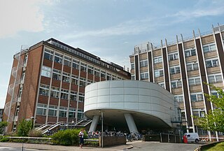
Addenbrooke's Hospital is a large teaching hospital and research centre in Cambridge, England, with strong affiliations to the University of Cambridge. Addenbrooke's Hospital is located on the Cambridge Biomedical Campus. It is run by Cambridge University Hospitals NHS Foundation Trust and is a designated academic health science centre. It is also the East of England's major trauma centre and was the first such centre to be operational in the United Kingdom.

The River Wandle is a right-bank tributary of the River Thames in south London, England. With a total length of about 9 miles (14 km), the river passes through the London boroughs of Croydon, Sutton, Merton and Wandsworth, where it reaches the Thames. A short headwater – the Caterham Bourne – is partially in Surrey, the historic county of the river's catchment. Tributaries of the Wandle include Carshalton Ponds and Norbury Brook.

The name Rea Brook can refer to either of two brooks in Shropshire, England.

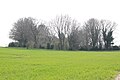
Noar Hill is a 63-hectare (160-acre) biological Site of Special Scientific Interest south of Selborne in Hampshire. It is a Nature Conservation Review site, Grade 2, and part of East Hampshire Hangers Special Area of Conservation. An area of 20 hectares is a nature reserve managed by the Hampshire and Isle of Wight Wildlife Trust.

Hobson's Conduit, also called Hobson's Brook, is a watercourse that was built from 1610 to 1614 by Thomas Hobson and others to bring fresh water into the city of Cambridge, England from springs at Nine Wells, a Local Nature Reserve, near the village of Great Shelford. It is now a Scheduled Ancient Monument and historical relic. The watercourse currently runs overground until Cambridge University Botanic Garden and Brookside, where it is at its widest. At the corner of Lensfield Road stands a hexagonal monument to Hobson, which once formed part of the market square fountain, and was moved to this location in 1856, after a fire in the Market. The flow of water runs under Lensfield Road, and subsequently runs along both sides of Trumpington Street in broad gutters towards Peterhouse and St Catharine's College, and also St Andrew's Street. The conduit currently ends at Silver Street.

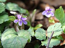
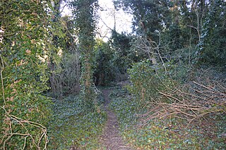
Byron's Pool is a 4.4 hectare Local Nature Reserve in Grantchester in Cambridgeshire. It is managed by Cambridge City Council and the City Greenways Project.

Cherry Hinton Pit is a 12.8-hectare (32-acre) biological Site of Special Scientific Interest (SSSI) on the south-eastern outskirts of Cambridge. The site consists of East Pit and most of the smaller West Pit. East Pit is part of the Limekiln Close and East Pit Local Nature Reserve, which is managed by the Wildlife Trust for Bedfordshire, Cambridgeshire and Northamptonshire under the name Cherry Hinton Chalk Pits. West Pit is a separate Local Nature Reserve (LNR).

Castor Hanglands is an 89.8-hectare (222-acre) biological Site of Special Scientific Interest west of Peterborough in Cambridgeshire. The site is also a National Nature Reserve, and it is a Nature Conservation Review site, Grade I for its woodlands and Grade 2 for its grassland. It is common land managed by Natural England.
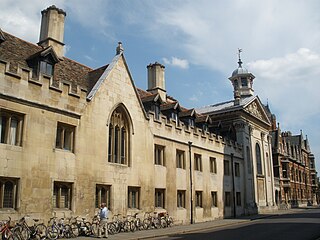
Trumpington Street is a major historic street in central Cambridge, England. At the north end it continues as King's Parade where King's College is located. To the south it continues as Trumpington Road, an arterial route out of Cambridge, at the junction with Lensfield Road.

Trumpington Road is an arterial road in southeast central Cambridge, England. It runs between the junction of Trumpington Street and Lensfield Road at the northern end to the junction of the High Street in the village of Trumpington and Long Road at the southern end. The Fen Causeway leads off to the west near the northern end, over Coe Fen and the River Cam.
Hills Road is an arterial road in southeast Cambridge, England. It runs between Regent Street at the junction with Lensfield Road and Gonville Place to the northwest and a roundabout by the Cambridge Biomedical Campus, continuing as Babraham Road to the southeast.

Market Hill is the location of the marketplace in central Cambridge, England. Operating as a marketplace since Saxon times, a daily outdoor market with stalls continues to run there.
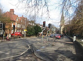
Lensfield Road is a road in southeast central Cambridge, England. It runs between the junction of Trumpington Street and Trumpington Road to the west and the junction of Regent Street and Hills Road to the west. It continues as Gonville Place to the northeast past Parker's Piece, a large grassy area with footpaths.

The Old Addenbrooke's Site is a site owned by the University of Cambridge in the south of central Cambridge, England. It is located on the block formed by Fitzwilliam Street to the north, Tennis Court Road to the east, Lensfield Road to the south, and Trumpington Street to the west.

Great Kneighton is a large housing development and residential area in the southern part of the City of Cambridge district of Cambridgeshire, adjacent to, and integrated with, the neighbouring village of Trumpington. Together with nearby development Trumpington Meadows, it forms part of the southern fringe expansion of the city. Currently nearing completion by developers Countryside Properties, it will ultimately consist of almost 2,300 homes.

The following is a timeline of the history of the city of Cambridge, England.

Limekiln Close and East Pit is a 10 hectare Local Nature Reserve (LNR) in Cherry Hinton, on the south-eastern outskirts of Cambridge. It is managed by the Wildlife Trust for Bedfordshire, Cambridgeshire and Northamptonshire as Cherry Hinton Chalk Pits. East Pit is part of the Cherry Hinton Pit biological Site of Special Scientific Interest, which excludes Limekiln Close but includes the neighbouring West Pit.
West Pit is a 4.3 hectare Local Nature Reserve in Cherry Hinton, on the south-eastern outskirts of Cambridge. It is part of the Cherry Hinton Pit biological Site of Special Scientific Interest (SSSI), which includes the neighbouring East Pit.