Earlton Airport,, is located 1 nautical mile southwest of Earlton, Ontario. The airport has a 5,998 by 150 ft paved runway oriented east-west, and a 3,019 by 150 ft gravel/snow runway oriented north-south.

Kapuskasing Airport,, is located 2 nautical miles west of the town of Kapuskasing in northern Ontario, Canada. The airport formerly handled scheduled passenger service through Bearskin Airlines, which flew to Timmins but that service was discontinued at the end of June 2017. It is an Airport of Entry, providing customs services for general aviation flights arriving directly from the United States.

Burwash Airport is located 2 nautical miles northwest of Burwash Landing, Yukon, Canada, and is operated by the Yukon government.

Grand Falls Airport, is a private airfield located 2.6 nautical miles northeast of Grand Falls, New Brunswick, Canada. The runway is 75 ft (23 m) wide and the centre 40 ft (12 m) is asphalt, while the rest is turf and gravel.

Amherst Airport(TC LID: CCQ4) is an abandoned airport that was located 1 NM west of Amherst, Nova Scotia, Canada. It was a small turf airstrip, located perpendicular to Highway 104 opposite the Amherst Industrial Park.

Trenton Aerodrome is a registered aerodrome located adjacent to Trenton, Nova Scotia, Canada. Since October 2006, the airport has been owned by Sobeys Incorporated.

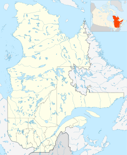
Port-Menier Airport,, is located 2.7 nautical miles east of Port-Menier, Quebec, Canada.

Guelph Airport is located 1.3 nautical miles northeast of Guelph, Ontario, Canada. It consists of two runways, 14/32 and 05/23. Although known to residents as the "Guelph Airport" or "Guelph Airpark", it is actually an aerodrome, being registered, and not certified, by Transport Canada.

Muskrat Dam Airport,, is located 2 nautical miles north of the First Nations community of Muskrat Dam Lake First Nation, Canada.

Rockton Aerodrome,, is located in Flamborough, Ontario 1.5 nautical miles west of Rockton, Ontario, Canada.

Coutts/Ross International Airport is located 0.5 nautical miles west of Coutts, Alberta, Canada and 0.1 NM west of Sweet Grass, Montana, United States.

Whetstone International Airport or Del Bonita/Whetstone International Airport is a public use airport at the Canada–US border, in Port of Del Bonita, Glacier County, Montana, 2 nautical miles south of Del Bonita, Cardston County, Alberta. The airport is owned by the U.S. state of Montana and is operated by the Montana Department of Transportation Aeronautics Division. It is located 31 miles (50 km) northwest of the city of Cut Bank, Montana.

Coronach/Scobey Border Station Airport is located 8 nautical miles southeast of Coronach, Saskatchewan, Canada and 13 mi (21 km) north of Scobey, Montana, United States. In the United States, the airport is known by the names Scobey Border Station Airport and East Poplar International Airport. It is owned by the U.S. and Canadian governments.

Eatonia Municipal Airport,, is a registered aerodrome located adjacent to Eatonia, Saskatchewan, Canada. It is named for the local community and Elvie L. Smith, former President and Chairman of Pratt and Whitney Canada.

Hope Aerodrome,, is located 2.6 nautical miles west of Hope Townsite within the municipal District of Hope, British Columbia, Canada.

Quamichan Lake Airport,, is located 2.7 nautical miles north northeast of Duncan, adjacent to Quamichan Lake, British Columbia, Canada. The airfield is owned and operated by John Howroyd who also owns Quamichan Lake Water Aerodrome. The airfield uses runway 16 for departures, and runway 34 for landings.

Smithers Airport,, is located 2 nautical miles north of Smithers, British Columbia, Canada.

Port Perry/Hoskin Aerodrome,, is located 2.5 nautical miles southeast of Port Perry, Ontario, Canada.


