Bedum is a former municipality and a town in the northeastern Netherlands. Populated by data missing inhabitants in 2021, Bedum is one of the larger of Groningen's several satellite towns. On 1 January 2019 it merged with the municipalities of De Marne, Eemsmond and Winsum to form the new municipality Het Hogeland.

Sauwerd is a village in the municipality of Het Hogeland, Groningen, Netherlands. Until the local government reorganization of 1990 the village was the head of the former municipality of Adorp.

Usquert is a village in the Dutch province of Groningen. It is located in the municipality of Het Hogeland. It had a population of around 1,415 in January 2017.

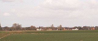
Warffum is a village in the Dutch province of Groningen. It is located in the municipality of Het Hogeland. It had a population of around 2,175 in January 2017.

Roodeschool is a community situated in the northeast of Groningen province in the Netherlands and forming part of the municipality of Het Hogeland. It had a population of around 860 in January 2017.

Rottum is a small village on an artificial dwelling hill between Kantens and Usquert in the municipality of Het Hogeland, falling under the province Groningen in the Netherlands. It had a population of around 85 in January 2017.
Ulrum is a village in the Dutch province of Groningen. It is located in the municipality of Het Hogeland.
Eenrum is a village in the Dutch province of Groningen. It is located in the municipality of Het Hogeland, 17 km northwest of the city of Groningen.

Kantens is a village in the Dutch province of Groningen. It is located in the municipality of Het Hogeland, about 16 km north of the city of Groningen. It had a population of around 965 including the surrounding area in January 2017.

Kloosterburen is a village in the Dutch province of Groningen. It is located in the municipality of Het Hogeland. The village developed around a monastery. Kloosterburen was a separate municipality until 1990, when it was merged with Leens, Ulrum and Eenrum. During the combining of the four municipalities they were called 'de LEUK gemeenten'. In 2019, it became part of Het Hogeland.

Stitswerd is a village in the municipality of Het Hogeland, Groningen, the Netherlands. It had a population of around 45 in January 2017. Stitswerd is located on a wierde near the estuary of the former river Fivel.

Oosteinde is a village in the municipality of Het Hogeland, Groningen, the Netherlands. It is located southeast of Roodeschool, near the river Groote Tjariet. It had a population of around 160 in January 2017.

Oosternieland is a village in the municipality of Het Hogeland, Groningen, the Netherlands. It is located just north of Zijldijk, along the N46 road between the city of Groningen and the Eemshaven seaport. It had a population of around 100 in January 2017.
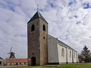
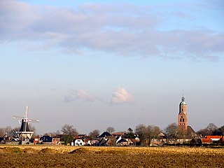
Mensingeweer is a small village in the Netherlands; it is located in the municipality of Het Hogeland, Groningen. It lies on the provincial road N361 from Winsum to Leens at the crossroads to Eenrum. The long-distance footpath called Pieterpad runs through the town and the Michaelkerk has an old Arp Schnitger organ that came from a church in Pieterburen and was installed in 1901. The town also has an old windmill called the Hollands Welvaart built in 1855.

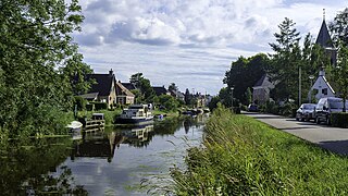
Onderdendam is a village in Het Hogeland municipality in the province of Groningen, the Netherlands. It had a population of around 575 in 2021.
Zuidwolde is a village in Het Hogeland municipality in the province of Groningen, the Netherlands. It had a population of around 1,010 in January 2017.

Oldenzijl is a small village in Het Hogeland municipality in the Dutch province of Groningen. It had a population of around 45 in January 2017.

Oudeschip is a small village in Het Hogeland municipality in the Dutch province of Groningen. It had a population of around 125 in January 2017.
Zandeweer is a village in Het Hogeland municipality in the Dutch province of Groningen. It had a population of around 475 in January 2017.

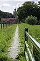
Den Andel is a village in the municipality Het Hogeland which is part of the province Groningen in the Netherlands. It is located about 20 kilometres (12 mi) north of the city of Groningen near the Wadden Sea coast.