Pieterburen

Last updated
Pieterburen
Pieterburen RA.JPG
Hoofdstraat, Pieterburen, at the left the café Het wapen van Hunsingo (nowadays Bij de buren van Pieter)
2010-NL-P01-Groningen-positiekaart-gemnamen.jpg
Red pog.svg
Pieterburen
Location of Pieterburen in the province of Groningen
Netherlands location map.svg
Red pog.svg
Pieterburen
Pieterburen (Netherlands)
Coordinates: 53°24′00″N6°27′10″E / 53.40000°N 6.45278°E / 53.40000; 6.45278
Country Netherlands
Province Groningen
Municipality Het Hogeland
Area
[1]
  Total0.69 km2 (0.27 sq mi)
Elevation
[2]
1 m (3 ft)
Population
 (2021) [1]
  Total290
  Density420/km2 (1,100/sq mi)
Time zone UTC+1 (CET)
  Summer (DST) UTC+2 (CEST)
Postal code
9968
Dialing code 0595

Pieterburen is a village in the northeastern Netherlands, located in the municipality of Het Hogeland, Groningen. [3]

Contents

History

Around 1300, a dike was built north of the present village. During the 14th century, a settlement appeared on a mudflat of the river Hunze. [4] The village was first mentioned in 1371 as Sancti Petri when the church was constructed. Pieterburen means the neighbourhood near Saint Peter. [5]

Overview

Pieterburen is situated on the ‘Hogeland’ (high land) of northeastern Groningen. It is an area with brick Gothic churches, stately farms, and endless views over the land, all the way to the Wadden Sea.

Pieterburen is known for its Seal Rehabilitation and Research Centre, the vicarage garden Domies toen, the old mill De Vier Winden (The Four Winds). [3] The castle, Dijksterhuis, was built in the 15th century, but torn down in 1903. [4]

Pieterburen is one of the starting points for wadlopen (mudflat hiking). At low tide, it is possible to walk to the island of Schiermonnikoog. [6] Mudflat hiking is potentially dangerous, and is only allowed under the supervision of a licensed guide. [7]

Pieterburen is the start of the Pieterpad, a long-distance hiking trail to Sint Pieter in the extreme south of the Netherlands. [3]

Notable people

Related Research Articles

<span class="mw-page-title-main">De Marne</span> Municipality in Groningen, Netherlands

De Marne is a former municipality in the northeast of the Netherlands. On 1 January 2019 it merged with the municipalities of Bedum, Eemsmond and Winsum to form the new municipality Het Hogeland.

<span class="mw-page-title-main">Winsum</span> Town and former municipality in Groningen, Netherlands

Winsum is a town and a former municipality in the northeastern Netherlands. On 1 January 2019 the municipality merged with the municipalities of Bedum, De Marne and Eemsmond to form the new municipality Het Hogeland.

<span class="mw-page-title-main">Zoutkamp</span> Village in Groningen, Netherlands

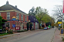
Zoutkamp is a village in the municipality Het Hogeland which is part of the province Groningen in the Netherlands. The village started as a sconce. During the Dutch Revolt, it was the site of the Battle of Zoutkamp. Later it became a fishing village. The harbour was moved to Lauwersoog in 1969 as a result of the closure of the Lauwersmeer, and is nowadays used for recreational purposes. The economy of the village mainly depends on fishing.

<span class="mw-page-title-main">Mudflat hiking</span>

Mudflat hiking is a recreation enjoyed in the Netherlands, northwest Germany, Denmark, England and France. Mudflat hikers are people who, with the aid of a tide table, use a period of low water to walk and wade on the watershed of the mudflats, especially from the Frisian mainland coast to the Frisian islands.

<span class="mw-page-title-main">Adorp</span> Village in Groningen, Netherlands

Adorp is a village in the municipality of Het Hogeland, Netherlands. It is located about 6 km north of Groningen. Until 1990, Adorp was a separate municipality, however the seat was in Sauwerd.

<span class="mw-page-title-main">Eenrum</span> Village in Groningen, Netherlands

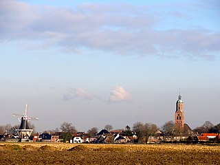
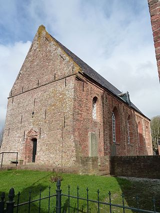
Eenrum is a village in the Dutch province of Groningen. It is located in the municipality of Het Hogeland, 17 km northwest of the city of Groningen.

<span class="mw-page-title-main">Kloosterburen</span> Village in Groningen, Netherlands

Kloosterburen is a village in the Dutch province of Groningen. It is located in the municipality of Het Hogeland. The village developed around a monastery. Kloosterburen was a separate municipality until 1990, when it was merged with Leens, Ulrum and Eenrum. During the combining of the four municipalities they were called 'de LEUK gemeenten'. In 2019, it became part of Het Hogeland.

<span class="mw-page-title-main">Holwert</span> Village in Friesland, Netherlands

Holwert is a village in Noardeast-Fryslân municipality in the northern Netherlands, in the province of Friesland. It had a population of around 1,607 in January 2017. Before 2019, the village was part of the Dongeradeel municipality.

<span class="mw-page-title-main">Stitswerd</span> Village in Groningen, Netherlands

Stitswerd is a village in the municipality of Het Hogeland, Groningen, the Netherlands. It had a population of around 45 in January 2017. Stitswerd is located on a wierde near the estuary of the former river Fivel.

<span class="mw-page-title-main">Oosteinde, Groningen</span> Village in Groningen, Netherlands

Oosteinde is a village in the municipality of Het Hogeland, Groningen, the Netherlands. It is located southeast of Roodeschool, near the river Groote Tjariet. It had a population of around 160 in January 2017.

<span class="mw-page-title-main">Oosternieland</span> Village in Groningen, Netherlands

Oosternieland is a village in the municipality of Het Hogeland, Groningen, the Netherlands. It is located just north of Zijldijk, along the N46 road between the city of Groningen and the Eemshaven seaport. It had a population of around 100 in January 2017.

<span class="mw-page-title-main">Mensingeweer</span> Village in Groningen, Netherlands

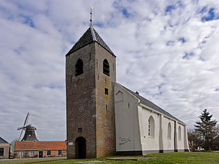
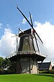
Mensingeweer is a small village in the Netherlands; it is located in the municipality of Het Hogeland, Groningen. It lies on the provincial road N361 from Winsum to Leens at the crossroads to Eenrum. The long-distance footpath called Pieterpad runs through the town and the Michaelkerk has an old Arp Schnitger organ that came from a church in Pieterburen and was installed in 1901. The town also has an old windmill called the Hollands Welvaart built in 1855.

<span class="mw-page-title-main">Noordwolde, Groningen</span> Village in Groningen, Netherlands

Noordwolde is a village in Het Hogeland municipality in the province of Groningen, the Netherlands. It had a population of around 275 in January 2017.

<span class="mw-page-title-main">Onderdendam</span> Village in Groningen, Netherlands

Onderdendam is a village in Het Hogeland municipality in the province of Groningen, the Netherlands. It had a population of around 575 in 2021.

<span class="mw-page-title-main">Zuidwolde, Groningen</span> Village in Groningen, Netherlands

Zuidwolde is a village in Het Hogeland municipality in the province of Groningen, the Netherlands. It had a population of around 1,010 in January 2017.

<span class="mw-page-title-main">Zandeweer</span> Village in Groningen, Netherlands

Zandeweer is a village in Het Hogeland municipality in the Dutch province of Groningen. It had a population of around 475 in January 2017.

<span class="mw-page-title-main">Het Hogeland</span> Municipality in Groningen, Netherlands

Het Hogeland is a municipality in the north of the province of Groningen in the northeast of the Netherlands.

<span class="mw-page-title-main">Kleine Huisjes</span> Village in Groningen, Netherlands

Kleine Huisjes is a village in the Dutch province of Groningen. It is a part of the municipality of Het Hogeland. It is located 1.5 kilometres (0.93 mi) north-east of Kloosterburen.

<span class="mw-page-title-main">Westernieland</span> Village in Groningen, Netherlands

Westernieland is a village in the Dutch province of Groningen. It is part of the municipality of Het Hogeland. The village is located near the Wadden Sea.

<span class="mw-page-title-main">Den Andel</span> Village in Groningen, Netherlands

Den Andel is a village in the municipality Het Hogeland which is part of the province Groningen in the Netherlands. It is located about 20 kilometres (12 mi) north of the city of Groningen near the Wadden Sea coast.

References

  1. 1 2 "Kerncijfers wijken en buurten 2021". Central Bureau of Statistics. Retrieved 8 March 2022.
  2. "Postcodetool for 9968AA". Actueel Hoogtebestand Nederland (in Dutch). Het Waterschapshuis. Retrieved 8 March 2022.
  3. 1 2 3 "Pieterburen". Plaatsengids (in Dutch). Retrieved 8 March 2022.
  4. 1 2 Redmer Alma (1998). Pieterburen (in Dutch). Zwolle: Waanders Uitgevers. p. 186. ISBN   90 400 9258 3 . Retrieved 8 March 2022.
  5. "Pieterburen - (geografische naam)". Etymologie Bank (in Dutch). Retrieved 8 March 2022.
  6. "Wadlopen in Pieterburen". Wadlopen in Pieterburen (in Dutch). Retrieved 8 March 2022.
  7. "Verordening van 13 december 1995, houdende regels met betrekking tot het wadlopen (Wadloopverordening 1996)" [1996 law for mudflat hiking](PDF). Waddenzee (in Dutch). 13 December 1995. Retrieved 8 March 2022.
  8. Braaksma, B. L. J. (1975). "In memoriam C. S. Meijer" (PDF). Nieuw Archief voor Wiskunde. Vierde Serie. 23 (2): 229. ISSN   0028-9825. MR   0373809.