Lauwersoog

Last updated
Lauwersoog
Village and harbour
Lauwersoog haven.JPG
Lauwersoog in 2008
2010-NL-P01-Groningen-positiekaart-gemnamen.jpg
Red pog.svg
Lauwersoog
Location of Lauwersoog in the province of Groningen
Netherlands location map.svg
Red pog.svg
Lauwersoog
Lauwersoog (Netherlands)
Coordinates: 53°24.23′N6°13.13′E / 53.40383°N 6.21883°E / 53.40383; 6.21883
Country Netherlands
Province Groningen
Municipality Het Hogeland
Established1969
Area
[1]
  Total0.37 km2 (0.14 sq mi)
Elevation
[2]
0 m (0 ft)
Population
 (2021) [1]
  Total130
  Density350/km2 (910/sq mi)
Time zone UTC+1 (CET)
  Summer (DST) UTC+2 (CEST)
Postal code
9976
Dialing code 0519

Lauwersoog is a seaside village and harbour in the province of Groningen, located in the northern part of the Netherlands. It is part of the municipality of Het Hogeland. It was established on 23 May 1969. [3] The ferry to Schiermonnikoog departs from Lauwersoog.The Population is mainly German And English Fishermen. It is north of Friesland

Contents

History

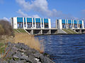
As part of the Zuiderzee Works, it was decided to transform the Lauwerszee (a bay) into the Lauwersmeer (lake). In 1969, a dike was completed on the border of the provinces of Friesland and Groningen which separates the Lauwersmeer from the Wadden Sea. [3] The village and harbour were named Lauwersoog in 1964 based on a suggestion by Sip Sytsma who worked for the Ministry of Transport and Water Management, to match the nearby islands of Rottumeroog and Schiermonnikoog. [4] The name received some criticism because -oog means island, and it is not an island. [4] [5]

On 23 May 1969, Lauwersoog was officially established. [3] There was an agreement to locate the village in Groningen, however the decision was later disputed by Friesland. Groningen intended to use the harbour for recreational purposes only, because they were constructing the Eemshaven, as a new main harbour. Friesland and the Groninger fishing village of Zoutkamp desired a commercial harbour. In January 1970, the conflict was brought to the States General of the Netherlands. [6] [7]

Lauwersoog remained in Groningen, but did become a commercial harbour. It started to specialise in fishing. From 1973 onwards, many English and German fishers started using Lauwersoog to deliver their catch, and by 1986, it was the second largest fishing harbour. [8] As a village, it was not very successful. It first appeared on maps in 1984 and has remained small. [3] [1]

Transport

The ferry to Schiermonnikoog departs from Lauwersoog. [9]

Qbuzz provides a bus service (route 163 Groningen - Lauwersoog - Holwerd) and Arriva (bus route 50 Leeuwarden - Lauwersoog). They connect with the departures of the ferry to Schiermonnikoog. [10]

Lauwersoog can be reached by car from Leeuwarden and the city of Groningen via the N361  [ nl ]. [11] [12]

Coastal trails

The E9 European long distance path passes through Lauwersoog. The Friese Kustpad  [ nl ] is a long-distance trail from Stavoren to Lauwersoog (131 kilometres (81 mi)). [13]

Related Research Articles

<span class="mw-page-title-main">Friesland</span> Province of the Netherlands

Friesland, historically and traditionally known as Frisia, named after the Frisians, is a province of the Netherlands located in the country's northern part. It is situated west of Groningen, northwest of Drenthe and Overijssel, north of Flevoland, northeast of North Holland, and south of the Wadden Sea. As of January 2023, the province had a population of about 660,000, and a total area of 5,753 km2 (2,221 sq mi).

<span class="mw-page-title-main">Leeuwarden</span> City and municipality in Friesland, Netherlands

Leeuwarden is a city and municipality in Friesland, Netherlands, with a population of 127,073 (2023). It is the provincial capital and seat of the Provincial Council of Friesland.

<span class="mw-page-title-main">Groningen (province)</span> Northeasternmost province of the Netherlands

Groningen is the northeasternmost province of the Netherlands. It borders on Friesland to the west, Drenthe to the south, the German state of Lower Saxony to the east, and the Wadden Sea to the north. As of January 2023, Groningen had a population of about 596,000, and a total area of 2,955 km2 (1,141 sq mi).

<span class="mw-page-title-main">Schiermonnikoog</span> Municipality in Friesland, Netherlands

Schiermonnikoog is an island, a municipality and national park in the Northern Netherlands. Schiermonnikoog is one of the West Frisian Islands, and is part of the province of Friesland. It is situated between the islands of Ameland and Rottumerplaat.

<span class="mw-page-title-main">Vlieland</span> Municipality in Friesland, Netherlands

Vlieland is a municipality and island in the northern Netherlands. The municipality of Vlieland is the second most sparsely populated municipality in the Netherlands, after Schiermonnikoog.

<span class="mw-page-title-main">Harlingen, Netherlands</span> Municipality in Friesland, Netherlands

Harlingen is a municipality and a city in the northern Netherlands, in the province of Friesland.

<span class="mw-page-title-main">Bad Nieuweschans</span> Village in Groningen, Netherlands

Bad Nieuweschans is a village in the north-eastern Netherlands on the border with Germany. It forms part of the municipality of Oldambt. Nieuweschans means "new fortification (sconce)". In 2009, the word Bad ("spa") was prefixed to the name of the village to promote it as a tourist destination.

<span class="mw-page-title-main">Zoutkamp</span> Village in Groningen, Netherlands

Zoutkamp is a village in the municipality Het Hogeland which is part of the province Groningen in the Netherlands. The village started as a sconce. During the Dutch Revolt, it was the site of the Battle of Zoutkamp. Later it became a fishing village. The harbour was moved to Lauwersoog in 1969 as a result of the closure of the Lauwersmeer, and is nowadays used for recreational purposes. The economy of the village mainly depends on fishing.

<span class="mw-page-title-main">Lauwersmeer</span> Artificial lake in Groningen, Friesland

Lauwersmeer is a man-made lake in the north of the Netherlands, on the border of the provinces of Groningen and Friesland. The lake was formed on 23 May 1969, when the dike between the bay called Lauwers Sea and the Wadden Sea was closed. It is noted for birdwatching.

<span class="mw-page-title-main">Chris Arlman</span> Dutch politician

Christiaan "Chris" Arlman was a Dutch politician of the Labour Party (PvdA). During 26 years he was the mayor of four different municipalities, and the chairman of two professional football clubs. He is noted for developing wellness tourism to Nieuweschans, being the first mayor of a united Pekela, for expanding the sea port of Harlingen, and for handling major budget crises at BV Veendam and Cambuur Leeuwarden.

<span class="mw-page-title-main">Eurosonic Noorderslag</span> Annual music festival in Groningen

ESNS is an annual four-day music showcase festival and conference held in January in Groningen, the Netherlands. The first three days of the festival (Eurosonic) feature artists from all over Europe, the last day of the festival (Noorderslag) features only Dutch artists. The conference is held during all four days of the event. Several awards are presented during Eurosonic Noorderslag: the Music Moves Europe Talent Awards, the European Festivals Awards, the Buma Cultuur Pop Award (Popprijs), the Pop Media Award, The Feather, the "Iron Venue and Festival Animals" and the Buma Music Meets Tech Award.

<i>Dagblad van het Noorden</i> Dutch newspaper

The Dagblad van het Noorden, abbreviated as DvhN, is a Dutch regional daily newspaper that is published and circulated in the provinces of Groningen and Drenthe in the northeastern Netherlands. The newspaper is owned by Mediahuis. Erik Wijnholds has been editor-in-chief since 2017. It had a circulation of 96,515 copies in 2015.

<i>Nieuwsblad van het Noorden</i> Dutch newspaper

The Nieuwsblad van het Noorden is a former regional daily newspaper from the city of Groningen in the Netherlands. It was published from 1888 to 2002, when it was merged with the Groninger Dagblad and the Drentse Courant into the Dagblad van het Noorden, which published its first edition on 2 April 2002.

<span class="mw-page-title-main">Fedde Schurer</span> Dutch schoolteacher, journalist, language activist and politician

Fedde Schurer was a Dutch schoolteacher, journalist, language activist and politician, and one of the most influential poets in the West Frisian language of the 20th century.

Mediahuis Noord, formerly known as NDC Mediagroep, is a Dutch publisher of newspapers, magazines, and websites focused on the three northern provinces of the Netherlands: Drenthe, Friesland and Groningen. It is owned by Mediahuis, a Belgian company. Headquarters are in Leeuwarden, other offices are in Groningen and Meppel. In addition to three main provinces, NDC publishes and distributes also in the Kop van Overijssel, Noordoostpolder, and northern Flevoland.

<span class="mw-page-title-main">Noardeast-Fryslân</span> Municipality in Friesland, Netherlands

Noardeast-Fryslân is a municipality of Friesland in the northern Netherlands. It was established 1 January 2019 and consists of the former municipalities of Dongeradeel, Ferwerderadiel and Kollumerland en Nieuwkruisland, all three of which dissolved on the same day.

Jan Geersing was a Dutch politician of the Reformed Political League and later Christian Union, who served as a member of the Friesland Parliament and as Mayor of Ferwerderadeel.

<span class="mw-page-title-main">Visvliet</span> Village in Groningen, Netherlands

Visvliet is a village in the Dutch province of Groningen. It is part of the municipality of Westerkwartier, and is located near the river Lauwers, the border between Friesland and Groningen.

<span class="mw-page-title-main">Westernieland</span> Village in Groningen, Netherlands

Westernieland is a village in the Dutch province of Groningen. It is part of the municipality of Het Hogeland. The village is located near the Wadden Sea.

References

  1. 1 2 3 "Kerncijfers wijken en buurten 2021". Central Bureau of Statistics. Retrieved 7 March 2022.
  2. "Postcodetool for 9976VA". Actueel Hoogtebestand Nederland (in Dutch). Het Waterschapshuis. Retrieved 8 March 2022.
  3. 1 2 3 4 "Lauwersoog". Plaatsengids (in Dutch). Retrieved 8 March 2022.
  4. 1 2 Erik Betten (8 July 2008). "Lauwersoog - mooie naam, maar hij klopt niet". Friesch Dagblad (in Dutch). Archived from the original on 24 September 2015. Retrieved 8 March 2022.
  5. "Lauwersoog of -haven". Nieuwsblad van het Noorden (in Dutch). 18 February 1964. Retrieved 8 March 2022.
  6. "Lauwersoog bij Groningen niet in veilige handen". Nieuwsblad van het Noorden (in Dutch). 30 December 1969. Retrieved 8 March 2022.
  7. "Hearing in gebouw Tweede Kamer". Nederlands dagblad (in Dutch). 5 January 1970. Retrieved 8 March 2022.
  8. "Nieuw record afslag Lauwersoog". Leeuwarder courant : hoofdblad van Friesland (in Dutch). 23 January 1986. Retrieved 8 March 2022.
  9. Wagenborg Passagiersdiensten Schiermonnikoog Retrieved on 8 March 2018.
  10. Wagenborg Passagiersdiensten public transportation Retrieved on 8 March 2018.
  11. "N361 Veilig". Province of Groningen (in Dutch). Retrieved 8 March 2022.
  12. "Van Leeuwarden naar de Wadden". Visit Leeuwarden (in Dutch). Retrieved 8 March 2022.
  13. "Friese Kustpad 131km". Voetstappen (in Dutch). Retrieved 8 March 2022.