Zandeweer | |
|---|---|
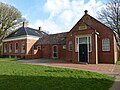
 Zandeweer Church | |
 Zandeweer Location of Oldenzijl in the province of Groningen  Zandeweer Zandeweer (Netherlands) | |
| Coordinates: 53°23′N6°41′E / 53.383°N 6.683°E | |
| Country | Netherlands |
| Province | Groningen |
| Municipality | Het Hogeland |
| Area | |
• Total | 0.43 km2 (0.17 sq mi) |
| Elevation | 0.7 m (2.3 ft) |
| Population (2021) [1] | |
• Total | 450 |
| • Density | 1,000/km2 (2,700/sq mi) |
| Postal code | 9997 [1] |
| Dialing code | 0595 |
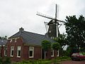
Zandeweer is a village in Het Hogeland municipality in the Dutch province of Groningen. It had a population of around 475 in January 2017. [3]