
Uithuizermeeden is a village in the Netherlands, with a population of about 3,200 people. It is part of the municipality of Het Hogeland, close to the Wadden Sea.

Usquert is a village in the Dutch province of Groningen. It is located in the municipality of Het Hogeland. It had a population of around 1,415 in January 2017.

Rottum is a small village on an artificial dwelling hill between Kantens and Usquert in the municipality of Het Hogeland, falling under the province Groningen in the Netherlands. It had a population of around 85 in January 2017.
Eenrum is a village in the Dutch province of Groningen. It is located in the municipality of Het Hogeland, 17 km northwest of the city of Groningen.

Offingawier is a neighbourhood of Sneek and former village in Súdwest-Fryslân municipality in the province of Friesland, the Netherlands. It had a population of around 205 in January 2017. In 1984, it was annexed by the city of Sneek and became a neighbourhood.

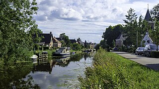
Raerd is a village in Súdwest-Fryslân municipality in the province Friesland, the Netherlands. It had a population of around 630 in January 2017.

Sibrandabuorren is a village in Súdwest-Fryslân municipality in the province of Friesland, the Netherlands. It had a population of around 365 in January 2017.

Poppenwier is a village in Súdwest-Fryslân municipality in the province of Friesland, the Netherlands. It had a population of around 170 in January 2017.

Oosteinde is a village in the municipality of Het Hogeland, Groningen, the Netherlands. It is located southeast of Roodeschool, near the river Groote Tjariet. It had a population of around 160 in January 2017.

Oosternieland is a village in the municipality of Het Hogeland, Groningen, the Netherlands. It is located just north of Zijldijk, along the N46 road between the city of Groningen and the Eemshaven seaport. It had a population of around 100 in January 2017.

Witmarsum is a village in the northern Netherlands. It is located in Súdwest-Fryslân, Friesland. Witmarsum had a population of around 1,735 in January 2017. Witmarsum was birthplace of Menno Simons (1496–1561), the leader of what would become the Mennonites.

Schraard is a village in Súdwest-Fryslân in the province of Friesland, the Netherlands. It had a population of around 165 in January 2017.

Dedgum is a small village in Súdwest-Fryslân municipality in the province of Friesland, the Netherlands. It had a population of around 95 in January 2017.

Goënga is a village in Súdwest-Fryslân municipality in the province of Friesland, the Netherlands. It had a population of around 240 in January 2017.
Folsgare is a village in Súdwest-Fryslân in the province of Friesland, the Netherlands. It had a population of around 325 in January 2017.

Westhem is a village in the Súdwest-Fryslân municipality, in the province of Friesland, the Netherlands. It had a population of around 70 in January 2017.
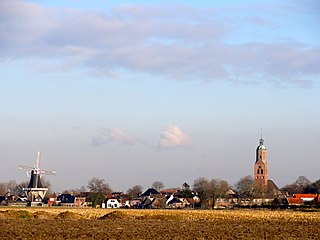
Mensingeweer is a small village in the Netherlands; it is located in the municipality of Het Hogeland, Groningen. It lies on the provincial road N361 from Winsum to Leens at the crossroads to Eenrum. The long-distance footpath called Pieterpad runs through the town and the Michaelkerk has an old Arp Schnitger organ that came from a church in Pieterburen and was installed in 1901. The town also has an old windmill called the Hollands Welvaart built in 1855.
Noordwolde is a village in Het Hogeland municipality in the province of Groningen, the Netherlands. It had a population of around 275 in January 2017.
Zuidwolde is a village in Het Hogeland municipality in the province of Groningen, the Netherlands. It had a population of around 1,010 in January 2017.

Oudeschip is a small village in Het Hogeland municipality in the Dutch province of Groningen. It had a population of around 125 in January 2017.


