Uithuizermeeden is a village in the Netherlands, with a population of about 3,200 people. It is part of the municipality of Het Hogeland, close to the Wadden Sea.

Sauwerd is a village in the municipality of Het Hogeland, Groningen, Netherlands. Until the local government reorganization of 1990 the village was the head of the former municipality of Adorp.

Usquert is a village in the Dutch province of Groningen. It is located in the municipality of Het Hogeland. It had a population of around 1,415 in January 2017.

Warffum is a village in the Dutch province of Groningen. It is located in the municipality of Het Hogeland. It had a population of around 2,175 in January 2017.

Roodeschool is a community situated in the northeast of Groningen province in the Netherlands and forming part of the municipality of Het Hogeland. It had a population of around 860 in January 2017.

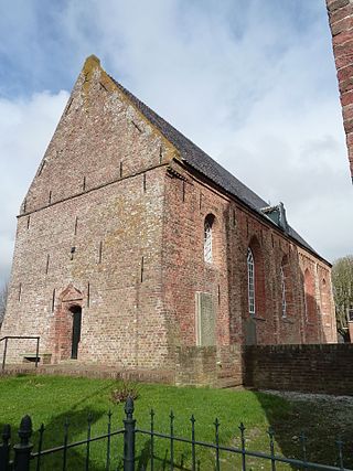
Rottum is a small village on an artificial dwelling hill between Kantens and Usquert in the municipality of Het Hogeland, falling under the province Groningen in the Netherlands. It had a population of around 85 in January 2017.
Eenrum is a village in the Dutch province of Groningen. It is located in the municipality of Het Hogeland, 17 km northwest of the city of Groningen.

Kantens is a village in the Dutch province of Groningen. It is located in the municipality of Het Hogeland, about 16 km north of the city of Groningen. It had a population of around 965 including the surrounding area in January 2017.

Kloosterburen is a village in the Dutch province of Groningen. It is located in the municipality of Het Hogeland. The village developed around a monastery. Kloosterburen was a separate municipality until 1990, when it was merged with Leens, Ulrum and Eenrum. During the combining of the four municipalities they were called 'de LEUK gemeenten'. In 2019, it became part of Het Hogeland.

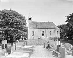
Stitswerd is a village in the municipality of Het Hogeland, Groningen, the Netherlands. It had a population of around 45 in January 2017. Stitswerd is located on a wierde near the estuary of the former river Fivel.

Oosteinde is a village in the municipality of Het Hogeland, Groningen, the Netherlands. It is located southeast of Roodeschool, near the river Groote Tjariet. It had a population of around 160 in January 2017.
Noordwolde is a village in Het Hogeland municipality in the province of Groningen, the Netherlands. It had a population of around 275 in January 2017.

Onderdendam is a village in Het Hogeland municipality in the province of Groningen, the Netherlands. It had a population of around 575 in 2021.
Zuidwolde is a village in Het Hogeland municipality in the province of Groningen, the Netherlands. It had a population of around 1,010 in January 2017.

Oldenzijl is a small village in Het Hogeland municipality in the Dutch province of Groningen. It had a population of around 45 in January 2017.

Oudeschip is a small village in Het Hogeland municipality in the Dutch province of Groningen. It had a population of around 125 in January 2017.
Zandeweer is a village in Het Hogeland municipality in the Dutch province of Groningen. It had a population of around 475 in January 2017.

Kleine Huisjes is a village in the Dutch province of Groningen. It is a part of the municipality of Het Hogeland. It is located 1.5 kilometres (0.93 mi) north-east of Kloosterburen.

Westernieland is a village in the Dutch province of Groningen. It is part of the municipality of Het Hogeland. The village is located near the Wadden Sea.

Wehe-Den Hoorn is a village in the Dutch province of Groningen. It is part of the municipality of Het Hogeland. It is a 1966 merger of the villages of Wehe and Den Hoorn.