Wetsinge

Last updated
Wetsinge
Klein Wetsinge - kerk.jpg
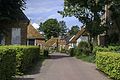
The church of Wetsinge
2010-NL-P01-Groningen-positiekaart-gemnamen.jpg
Red pog.svg
Wetsinge
Location of Wetsinge in the province of Groningen
Netherlands location map.svg
Red pog.svg
Wetsinge
Wetsinge (Netherlands)
Coordinates: 53°18′2″N6°31′50″E / 53.30056°N 6.53056°E / 53.30056; 6.53056 Coordinates: 53°18′2″N6°31′50″E / 53.30056°N 6.53056°E / 53.30056; 6.53056
Country Netherlands
Province Groningen
Municipality Het Hogeland
Area
[1]
  Total0.10 km2 (0.04 sq mi)
Elevation
[2]
0.7 m (2.3 ft)
Population
 (2021) [1]
  Total50
  Density500/km2 (1,300/sq mi)
Postal code
9773 [1]
Dialing code 050

Groot Wetsinge (English: Big Wetsinge) and Klein Wetsinge (English: Small Wetsinge) are two villages in the municipality of Het Hogeland in the Dutch province of Groningen. The villages are less than half a kilometre apart and are often referred to together as Wetsinge. The closest village, at a distance of less than a kilometre to Wetsinge is Sauwerd.

Contents

The name Groot Wetsinge is a rather confusing name, because there are fewer houses in Groot Wetsinge than in Klein Wetsinge. In this context, Groot means high. This is because of the wierde on which the village lies. Klein Wetsinge is not situated on a wierde.

The first occupation of the mound of Groot Wetsinge dates from the 3rd century BC. Several discoveries have been made in the wierde, including an earthen lamp from the first century BC. The wierde is part of a cluster of wierdes along the eastern bank of the Hunze.

Wetsinge was part of the area controlled by the family Onsta, which also built the Onstaborg to the northeast of Wetsinge.

Church of Wetsinge

The aisleless church of Wetsinge was built in the 11th or 12th century BC. The detached gothic clock tower, which appears on the map of Joannes Baptista Regemortes from 1643 or 1644, was probably built in the 13th or 14th century southeast of the church, when more detached church towers were built in Groningen. Shortly after 1645 the tower was demolished. Because the clay was strong enough the tower had no foundation, so that nothing of the tower is left. Between 1616 and 1630, a new tower was built on the west side of the church which replaced the old one. Early 19th century the church fell into disrepair and in 1840 it was, together with the church of Sauwerd, demolished. It was replaced the same year by a church built halfway between Wetsinge and Sauwerd. The site of the new church was then popularly called Klein Wetsinge. This church has a simple neoclassical facade. The pulpit probably came from the former church of Sauwerd. Also the bell, dating from 1609, probably came from Sauwerd.

Related Research Articles

Zoutkamp Village in Groningen, Netherlands

Zoutkamp is a village in the municipality Het Hogeland which is part of the province Groningen in the Netherlands. The village started as a sconce. During the Dutch Revolt, it was the site of the Battle of Zoutkamp. Later it became a fishing village. The harbour was moved to Lauwersoog in 1969 as a result of the closure of the Lauwersmeer, and is nowadays used for recreational purposes. The economy of the village mainly depends on fishing.

Sauwerd Village in Groningen, Netherlands

Sauwerd is a village in the municipality of Het Hogeland, Groningen, Netherlands. Until the local government reorganization of 1990 the village was the head of the former municipality of Adorp.

<i>Terp</i> Raised ground to provide a refuge from flooding

A terp, also known as a wierde, woerd, warf, warft, werf, werve, wurt or værft, is an artificial dwelling mound found on the North European Plain that has been created to provide safe ground during storm surges, high tides and sea or river flooding. The various terms used reflect the regional dialects of the North European region. In English sources, terp appears to be by far the most common term used.

Noordlaren Village in Groningen, Netherlands

Noordlaren is a village in the municipality of Groningen in the Dutch province of Groningen. It had a population of around 545 in 2021.

Farmsum Village in Groningen, Netherlands

Farmsum is a village in the Dutch province of Groningen. It is a part of the municipality of Eemsdelta.

Wagenborgen Village in Groningen, Netherlands

Wagenborgen is a village in the Dutch province of Groningen. It is a part of the municipality of Eemsdelta, and lies about 25 km east of Groningen.

Spijk, Groningen Village in Groningen, Netherlands

Spijk is a village in the Dutch province of Groningen. It is a part of the municipality of Eemsdelta, and lies about 26 kilometres (16 mi) northeast of Groningen. Spijk is a radial terp village from 600-700 BC where the original structure is still clearly visible.

Zeerijp Village in Groningen, Netherlands

Zeerijp is a village north of city of Groningen. Its most striking building is its brick church for the 14th century with detached bell tower. Formerly dedicated to John the Baptist, now it is a Dutch Reformed church. Also there is a famous organ inside the church, a Faber organ. Because there are so few inhabitants, Zeerijp has no shops, but there is a primary school 'De Wilgenstee' and a cafe. Also, there is a famous mill, 'de Leeuw'. There is also a gold and silver smith, Van Hulsen.

Noordbroek Village in Groningen, Netherlands

Noordbroek (Gronings:Noordbrouk) is a village in the Dutch province of Groningen. It is located in the municipality of Midden-Groningen, about 8 km northeast of Hoogezand.

Stedum Village in Groningen, Netherlands

Stedum is a village in the Dutch province of Groningen. It is located in the municipality of Eemsdelta, about 15 km northeast of the city of Groningen.

Westerlee, Groningen Village in Groningen, Netherlands

Westerlee is a village in the Dutch province of Groningen. It is located in the municipality of Oldambt, about 3 km west of the city of Winschoten.

Dorkwerd Village in Groningen, Netherlands

Dorkwerd is a small village in Groningen, the Netherlands. It is located in the municipality of Groningen, about 4 km northwest of the city center. Recent construction of new residential areas have brought the city to less than 500 meters from the village of Dorkwerd, and the postal authorities have placed it under Groningen.

Surhuizum Village in Friesland, Netherlands

Surhuizum is a village in Achtkarspelen in the province of Friesland, the Netherlands. It had a population of around 1300 in 2017. Surhuizum is known for its church tower.

Burdaard Village in Friesland, Netherlands

Burdaard is a village in Noardeast-Fryslân in the province of Friesland, the Netherlands. It had a population of around 1,173 in January 2017. Before 2019, the village was part of the Ferwerderadiel municipality.

Oostrum Village in Friesland, Netherlands

Oostrum is a village in Noardeast-Fryslân in the province of Friesland, the Netherlands. It had a population of around 188 in January 2017. Before 2019, the village was part of the Dongeradeel municipality.

Wetsens Village in Friesland, Netherlands

Wetsens is a village in Noardeast-Fryslân in the province of Friesland, the Netherlands. It had a population of around 55 in January 2017. and is considered to be one of the oldest villages in the north-east of Friesland. Before 2019, the village was part of the Dongeradeel municipality.

Jelsum Village in Friesland, Netherlands

Jelsum is a village in Leeuwarden municipality in the province of Friesland, the Netherlands. It had a population of around 195 in January 2017. The stins Dekemastate is located in Jelsum.

Oostum Hamlet in Groningen, Netherlands

Oostum is a wierde on the territory of Garnwerd in the municipality of Westerkwartier in the Dutch province of Groningen. The hamlet lies on the road of the city of Groningen to Garnwerd and is part of the Pieterpad.

Schildwolde Village in Groningen, Netherlands

Schildwolde is a village in the Dutch province of Groningen. It is part of the municipality of Midden-Groningen. It is known for its detached church tower from the 13th century.

Garrelsweer Village in Groningen, Netherlands

Garrelsweer is a village in the Dutch province of Groningen. It is a part of the municipality of Eemsdelta.

References

  1. 1 2 3 "Kerncijfers wijken en buurten 2021". Central Bureau of Statistics. Retrieved 8 April 2022.
  2. "Postcodetool for 9773AA". Actueel Hoogtebestand Nederland (in Dutch). Het Waterschapshuis. Retrieved 8 April 2022.