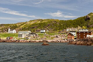
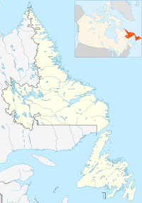
Piccadilly Slant-Abraham's Cove is a local service district and designated place in the Canadian province of Newfoundland and Labrador. It is located on the island of Newfoundland, along St. George's Bay, on the Port au Port Peninsula. The DPL consists of the fishing villages of Abraham's Cove and Piccadilly.

Open Hall-Red Cliffe is a local service district and designated place in the Canadian province of Newfoundland and Labrador.
Charlottetown is a town in Labrador with a population of 292 in the Canadian province of Newfoundland and Labrador. It was said to be founded by Benjamin Powell in 1950 and named for Charlottetown, Prince Edward Island: "I thought that maybe someday the place would be the capital of the bay, the same way Charlottetown is the capital of Prince Edward Island."

Rattling Brook is a local service district and designated place in the Canadian province of Newfoundland and Labrador. It is in the north-central portion of the island of Newfoundland near Baie Verte and Springdale. Formerly a fishing village, its main residents are retirees and seasonal tourists.
Deadman's Bayis a local service district and designated place in the Canadian province of Newfoundland and Labrador. It is on the Straight Shore of Bonavista Bay near the community of Lumsden. The community is located near fishing grounds, contributing to its diversified and successful fishery despite its exposed, sandy coastline and harsh fall storms.
Charlottetown, Bonavista Bay is a local service district and designated place in the Canadian province of Newfoundland and Labrador. It is on the island of Newfoundland within Terra Nova National Park.
O'Donnells is a local service district and designated place in the Canadian province of Newfoundland and Labrador. It is southeast of Placentia. The first postmistress was Mrs. Theresa M. Hanlon on July 16, 1951. By 1956 there was a population of 244.

Black Duck Brook and Winterhouse is a local service district and designated place in the Canadian province of Newfoundland and Labrador. It consists of the unincorporated fishing settlements of Black Duck Brook and Winterhouse on the Port au Port Peninsula. The communities had a combined population of 57 in the Canada 2006 Census.
Loon Bay is a local service district and designated place in the Canadian province of Newfoundland and Labrador.

La Poile is a local service district and designated place in the Canadian province of Newfoundland and Labrador. It is on La Poile Bay. The community is inaccessible by road and is served by a ferry via a port in Rose Blanche.
Great Brehat is a local service district and designated place in the Canadian province of Newfoundland and Labrador. It is on the Great Northern Peninsula of the island of Newfoundland, 10 km north of St. Anthony. As fishing has declined, the village has become a tourist attraction.
Freshwater is a local service district and designated place in the Canadian province of Newfoundland and Labrador.
Gander Bay North is a local service district and designated place in the Canadian province of Newfoundland and Labrador.
Caplin Cove-Southport is a local service district and designated place in Trinity Bay in the Canadian province of Newfoundland and Labrador. Caplin Cove-Southport is approximately 50km from Clarenville.
Burnt Point-Gull Island-Northern Bay is a local service district and designated place in the Canadian province of Newfoundland and Labrador.
Little Harbour (East) is a local service district and designated place in the Canadian province of Newfoundland and Labrador on the Placentia Bay of the island of Newfoundland.
North Harbour is a local service district and designated place in the Canadian province of Newfoundland and Labrador on St. Mary's Bay of the island of Newfoundland.
Pensons Arm is a local service district and designated place in the Canadian province of Newfoundland and Labrador. Pensons Arm, is a coastal village in Labrador, 20 km southeast of Charlottetown. It has a population of 43 in the 2021 census.
Summerville-Princeton-Southern Bay is a local service district and designated place in the Canadian province of Newfoundland and Labrador.
West Bay is a local service district and designated place in the Canadian province of Newfoundland and Labrador.


