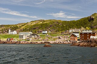
Open Hall-Red Cliffe is a local service district and designated place in the Canadian province of Newfoundland and Labrador.
Upper Amherst Cove, is a local service district and designated place in the Canadian province of Newfoundland and Labrador. Situated approximately 20 kilometers southeast of Bonavista, it lies just off Route 235.
Deadman's Bay is a local service district and designated place in the Canadian province of Newfoundland and Labrador. It is on the Straight Shore of Bonavista Bay near the community of Lumsden. The community is located near fishing grounds, contributing to its diversified and successful fishery despite its exposed, sandy coastline and harsh fall storms.
Spillars Cove is a local service district and designated place in the Canadian province of Newfoundland and Labrador. It is just outside Bonavista.
Norman's Bay is a local service district and designated place in the Canadian province of Newfoundland and Labrador. It is an isolated community at the head of Norman Bay, an extension of Martin Bay. The population of the community was 15 in the 2021 census.
Mattis Point is a local service district and designated place in the Canadian province of Newfoundland and Labrador. It is in the Bay St. George area.
Loon Bay is a local service district and designated place in the Canadian province of Newfoundland and Labrador.
Freshwater is a local service district and designated place in the Canadian province of Newfoundland and Labrador.
Eddies Cove West is a local service district and designated place in the Canadian province of Newfoundland and Labrador.
Canning's Cove is a local service district and designated place in the Canadian province of Newfoundland and Labrador. It is on Bonavista Bay.

Birchy Cove is a local service district and designated place in the Canadian province of Newfoundland and Labrador.
Gander Bay North is a local service district and designated place in the Canadian province of Newfoundland and Labrador.
Burnt Point-Gull Island-Northern Bay is a local service district and designated place in the Canadian province of Newfoundland and Labrador.
Hopeall is a local service district and designated place in the Canadian province of Newfoundland and Labrador.
Little Harbour (East) is a local service district and designated place in the Canadian province of Newfoundland and Labrador on the Placentia Bay of the island of Newfoundland.
North Harbour is a local service district and designated place in the Canadian province of Newfoundland and Labrador on St. Mary's Bay of the island of Newfoundland.
Pensons Arm is a local service district and designated place in the Canadian province of Newfoundland and Labrador. Pensons Arm, is a coastal village in Labrador, 20 km southeast of Charlottetown. It has a population of 43 in the 2021 census.
St. Joseph's Cove-St. Veronica's is a local service district and designated place in the Canadian province of Newfoundland and Labrador.
Summerville-Princeton-Southern Bay is a local service district and designated place in the Canadian province of Newfoundland and Labrador.
West Bay is a local service district and designated place in the Canadian province of Newfoundland and Labrador.


