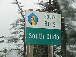
South Dildo

Last updated

South Dildo
South Dildo (27908129416).jpg
Canada Newfoundland and Labrador relief location map.jpg
Red pog.svg
South Dildo
Location of South Dildo
Canada relief map 2.svg
Red pog.svg
South Dildo
South Dildo (Canada)
Coordinates: 47°31′23″N53°33′07″W / 47.523°N 53.552°W / 47.523; -53.552 Coordinates: 47°31′23″N53°33′07″W / 47.523°N 53.552°W / 47.523; -53.552
CountryCanada
Province Newfoundland and Labrador
Region Newfoundland
Census division 1
Census subdivision Y
Government
  Type Unincorporated
Area
[1]
  Land3.94 km2 (1.52 sq mi)
Population
 (2021) [1]
  Total195
  Density49.5/km2 (128/sq mi)
Time zone UTC−03:30 (NST)
  Summer (DST) UTC−02:30 (NDT)
Area code 709
Highways NL Route 80.svg Route 80

South Dildo is a local service district and designated place in the Canadian province of Newfoundland and Labrador.

Contents

Geography

South Dildo is in Newfoundland within Subdivision Y of Division No. 1. [2]

Demographics

As a designated place in the 2016 Census of Population conducted by Statistics Canada, South Dildo recorded a population of 249 living in 106 of its 135 total private dwellings, a change of

Government

South Dildo is a local service district (LSD) [4] that is governed by a committee responsible for the provision of certain services to the community. [5] The chair of the LSD committee is Robert Legge. [4]

See also

Related Research Articles

Old Shop is a local service district and designated place in the Canadian province of Newfoundland and Labrador. It is on the western side of the Dildo Arm, at the southern end of Trinity Bay. It is northwest of South Dildo, across the Dildo Arm from Dildo proper.

Gander Bay South is a local service district and designated place in the Canadian province of Newfoundland and Labrador. Gander Bay was a small place in the Fogo and Twillingate area in 1864. It was north of Gander. The way office opened in 1885 and the first waymaster was John Bursey. It became a post office on May 30, 1891, and the first postmaster was James Rowsell. It had no population after 1940. They moved to Gander Bay South.

Blaketown is a local service district and designated place in the Canadian province of Newfoundland and Labrador.

Bellevue is a local service district and designated place in the Canadian province of Newfoundland and Labrador.

Bellevue Beach is a local service district and designated place in the Canadian province of Newfoundland and Labrador.

Burnt Cove, St. Michael's, Bauline South is a local service district and designated place in the Canadian province of Newfoundland and Labrador.

Castor River South is a local service district and designated place in the Canadian province of Newfoundland and Labrador.

Diamond Cove is a local service district and designated place in the Canadian province of Newfoundland and Labrador.

Fairhaven is a local service district and designated place in the Canadian province of Newfoundland and Labrador.

Forresters Point is a local service district and designated place in the Canadian province of Newfoundland and Labrador.

Goobies is a local service district and designated place in the Canadian province of Newfoundland and Labrador.

Hopeall is a local service district and designated place in the Canadian province of Newfoundland and Labrador.

Little Harbour (East) is a local service district and designated place in the Canadian province of Newfoundland and Labrador on the Placentia Bay of the island of Newfoundland.

Marysvale is a local service district and designated place in the Canadian province of Newfoundland and Labrador.

Nameless Cove is a local service district and designated place in the Canadian province of Newfoundland and Labrador.

Piccadilly Head is a local service district and designated place in the Canadian province of Newfoundland and Labrador.

Pleasantview is a local service district and designated place in the Canadian province of Newfoundland and Labrador.

Sheppardville is a local service district and designated place in the Canadian province of Newfoundland and Labrador.

Thornlea is a local service district and designated place in the Canadian province of Newfoundland and Labrador.

West Bay is a local service district and designated place in the Canadian province of Newfoundland and Labrador.

References

  1. 1 2 Statistics Canada. 2022. (table). Census Profile. 2021 Census. Statistics Canada Catalogue no. 98-316-X2021001. Ottawa. Released February 9, 2022. https://www12.statcan.gc.ca/census-recensement/2021/dp-pd/prof/index.cfm?Lang=E (accessed April 16, 2022).
  2. "Population and dwelling counts, for Canada, provinces and territories, census divisions, census subdivisions (municipalities) and designated places, 2016 and 2011 censuses – 100% data (Newfoundland and Labrador)". Statistics Canada. February 7, 2018. Retrieved December 23, 2021.
  3. "Population and dwelling counts, for Canada, provinces and territories, and designated places, 2016 and 2011 censuses – 100% data (Newfoundland and Labrador)". Statistics Canada. February 7, 2018. Retrieved December 22, 2021.
  4. 1 2 "Directory of Local Service Districts" (PDF). Government of Newfoundland and Labrador. October 2021. Retrieved January 1, 2022.
  5. "Local Service Districts – Frequently Asked Questions". Government of Newfoundland and Labrador. Retrieved January 1, 2022.