North Lampung Regency

Last updated
North Lampung Regency
(Kabupaten Lampung Utara)
Bendungan Way Rarem.jpg
Way Rarem dam
Lambang Kabupaten Lampung Utara.png
Motto(s): 
Ragem Tunas Lampung
(Advancement by diversity)
Lokasi Lampung Kabupaten Lampung Utara.svg
Location within Lampung
Location map Southern Sumatra.png
Red pog.svg
North Lampung Regency
Location in Southern Sumatra, Sumatra and Indonesia
Indonesia Sumatra location map.svg
Red pog.svg
North Lampung Regency
North Lampung Regency (Sumatra)
Indonesia location map.svg
Red pog.svg
North Lampung Regency
North Lampung Regency (Indonesia)
Coordinates: 4°49′00″S104°48′00″E / 4.8167°S 104.8000°E / -4.8167; 104.8000
Country Indonesia
Province Lampung
Regency seat Kotabumi
Government
  RegentAgung Ilmu Mangkunegara
  Vice RegentSri Widodo
Area
  Total2,667.21 km2 (1,029.82 sq mi)
Population
 (mid 2023 estimate) [1]
  Total666,618
  Density250/km2 (650/sq mi)
Time zone UTC+7 (IWST)
Area code (+62) 724
Website lampungutarakab.go.id

North Lampung Regency (Kabupaten Lampung Utara) is an inland regency (kabupaten) of Lampung Province, Sumatra, in Indonesia. As originally created, it covered a much larger share (over 53%) of the land area of Lampung Province, but on 16 August 1991 its western districts were split off to create a new West Lampung Regency (at that time inclusive of the subsequently-separated West Pesisir Regency); on 3 January 1997 its north-eastern districts were split off to create a new Tulang Bawang Regency (at that time inclusive of the subsequently-separated Mesuji Regency and West Tulang Bawang Regency); and on 20 April 1999 its north-western districts were split off to create a new Way Kanan Regency.

Contents

The residual North Lampung Regency has an area of 2,725.63 km2 and had a population of 583,925 at the 2010 census [2] and 633,099 at the 2020 census; [3] the official estimate as at mid 2023 was 666,618 (comprising 339,226 males and 327,392 females). [1] The regency seat is the town of Kotabumi.

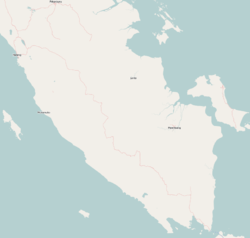
Administrative divisions

Administratively the regency is divided into twenty-three districts ( kecamatan ), tabulated below with their areas and their populations at the 2010 census [2] and the 2020 census, [3] together with the official estimates as at mid 2023. [1] The table also includes the locations of the district administrative centres, the numbers of administrative villages in each district, and its post codes.

Kode
Wilayah
Name of
District
(kecamatan)
Area
in
km2
Pop'n
2010
census
Pop'n
2020
census
Pop'n
mid 2023
estimate
Admin
centre
No.
of
villages
Post
code(s)
18.03.01Bukit Kemuning163.2538,70841,83944,070Bukit Kemuning834564
18.03.12Abung Tinggi
(Higher Abung)
56.2116,02617,91619,020Ulak Rengas834556
18.03.04Tanjung Raja228.2029,88031,95333,890Tanjung Raja1934557
18.03.06Abung Barat
(West Abung)
89.7418,57420,47221,560Ogan Lima1434558
18.03.11Abung Tengah
(Central Abung)
78.5915,43817,16418,020Gunung Besar1134584
18.03.22Abung Kunang51.679,3459,94710,340Aji Kagungan734565
18.03.19Abung Pekurun162.2311,16212,38613,200Pekurun Tengah934582
18.03.02Kotabumi81.2551,86354,84157,430Kotabumi Ilir1334511
- 34518
18.03.09Kotabumi Utara
(North Kotabumi)
143.3830,13934,30136,010Madukoro834511
18.03.10Kotabumi Selatan
(South Kotabumi)
100.4064,02768,98772,610Mulang Maya1434511
- 34519
18.03.07Abung Selatan
(South Abung)
110.3146,72752,46354,460Kalibalangan1634581
18.03.13Abung Semuli100.8923,54226,03627,970Semuli Jaya734580
18.03.23Blambangan Pagar100.7217,29519,33620,450Blambangan734586
18.03.05Abung Timur
(East Abung)
192.5033,74136,70839,140Bumi Agung Marga1234583
18.03.14Abung Surakarta72.8427,07328,38530,170Tata Karya934585
18.03.03Sungkai Selatan
(South Sungkai)
91.3821,16422,72124,120Ketapang1134554
18.03.15Muara Sungkai123.5214,21214,68415,350Negeri Ujung Karang1134559
18.03.16Bunga Mayang209.1931,99133,83934,370Negara Tulang Bawang1134555
18.03.21Sungkai Barat
(West Sungkai)
74.4111,89411,80912,750Sinar Harapan1034552
18.03.20Sungkai Jaya
(Great Sungkai)
58.789,8049,53910,220Cempaka934553
18.03.08Sungkai Utara
(North Sungkai)
207.7032,41335,73237,510Negara Ratu1534563
18.03.17Hulu Sungkai
(Upper Sungkai)
89.9113,75614,97915,460Gedung Makripat1034561
18.03.18Sungkai Tengah
(Central Sungkai)
80.1315,50317,06218,510Batu Nangkop834562
Totals2,667.21584,277633,099666,618Kotabumi247

The districts are sub-divided into 247 villages, comprising 232 rural desa and 15 urban kelurahan - the latter comprising 9 in Kotabumi District (Cempedak, Kota Gapura, Kotabumi Ilir, Kotabumi Pasar, Kotabumi Tengah, Kotabumi Udik, Rejosari, Sindang Sari and Sribasuki), 5 in Kotabumi Selatan District (Kelapa Tujuh, Kota Alam, Tanjung Aman, Tanjung Harapan and Tanjung Senang), and 1 in Bukit Kemuning District (Bukit Kemuning town). [4]

History

North Lampung Regency, which used to be the largest district in Lampung, Based on Law no, 1 of 1945, during the independence of the Republic of Indonesia, North Lampung Regency was the administrative area of the Kewedanan Marga, On December 3, 1952 the system of Marga, 75 Marga and 11 Buay Indeling Residentie Lampung 1:750.000 Derukkrij 1930 was abolished, with the issuance of Resident Presiden No. 153 of 1952. However, after the issuance of Law No. RI. 14 of 1964 concerning the formation of Lampung Province, then North Lampung became part of the Lampung Province (previously North Lampung was part of South Sumatra Province). [5] Due to the expansion of several districts. So that the Low of the Republik of Indonesia Number 18 of 1965 was issued. [5]

Since the formation of North Lampung Regency, three areas have been split off from it to form new regencies during the 1990s. The first was the formation of West Lampung Regency on 16 August 1991, with its administrative capital at Liwa, Indonesia. [5] This formation was based on Law No. 6 of 1991. [5] The second separation of the territory was the establishment of Tulang Bawang Regency on 3 January 1997, which was established based on Law no. 2 of 1997. [5] The third separation was the formation of Way Kanan Regency on 20 April 1999; this creation was based on the Law of the Republik of Indonesia Number 12 of 1999. [5]

Tourist attractions

Related Research Articles

<span class="mw-page-title-main">Lampung</span> Province of Indonesia

Lampung, officially the Province of Lampung, is a province of Indonesia. It is located on the southern tip of the island of Sumatra. It has a short border with the province of Bengkulu to the northwest, and a longer border with the province of South Sumatra to the north, as well a maritime border with the province of Banten and Jakarta to the east. It is the original home of the Lampung people, who speak their own language, and possess their own written script. Its capital is Lampung New City.

<span class="mw-page-title-main">Bulungan Regency</span> Regency in North Kalimantan, Indonesia

Bulungan Regency is a regency of North Kalimantan Province in Indonesia. It covers an area of 13,181.92 km2 and had a population of 112,663 at the 2010 Census and 151,844 at the 2020 Census; the official estimate as at mid 2023 was 165,775. The administrative centre is at Tanjung Selor.

<span class="mw-page-title-main">Nunukan Regency</span> Regency in North Kalimantan, Indonesia

Nunukan Regency is a regency of North Kalimantan Province in Indonesia. It was created on 4 October 1999 from the northern districts of Bulungan Regency. Nunukan Regency shares international borders with the Malaysian states of Sabah to the north and Sarawak to the west, and inter-regency borders with Tana Tidung Regency and Malinau Regency to the south, as well as the coastal city of Tarakan in the east. The regency covers an area of 14,247.50 km2 and it had a population of 140,841 at the 2010 census and 199,090 at the 2020 census; the official estimate as at mid 2023 was 217,923.

<span class="mw-page-title-main">Bintan Regency</span> Regency in Riau Islands, Indonesia

Bintan Regency is an administrative area in the Riau Islands Province of Indonesia. Bintan Regency includes all of Bintan Island and also includes many outlying islands including the Tambelan Archipelago and Badas Islands situated between Bintan and West Kalimantan; altogether there are 273 islands comprising the regency.

<span class="mw-page-title-main">North Labuhanbatu Regency</span> Regency in North Sumatra, Indonesia

North Labuhanbatu Regency is a regency of North Sumatra, Indonesia, created on 21 July 2008 by being carved out of the north-western districts of the existing Labuhanbatu Regency, which until 2008 covered an area of 9,703 square kilometres and had a population of 840,382 according to the 2000 census. 60.99% of the regency is forested. The new North Labuhanbatu Regency covers 3,545.8 square kilometres and had a population of 331,660 at the 2010 Census, rising to 381,994 at the 2020 Census; the official estimate as at mid 2023 was 401,863 . The Kualuh River is located in this regency. The administrative centre of the regency is at the town of Aek Kanopan.

<span class="mw-page-title-main">North Kalimantan</span> Province

North Kalimantan is a province of Indonesia. It is located on the northernmost of Kalimantan, the Indonesian part of the island of Borneo. North Kalimantan borders the Malaysian states of Sabah to the north and Sarawak to the west, and by the Indonesian province of East Kalimantan to the south. Tanjung Selor serves as the capital of the province, while Tarakan is the largest city and the financial centre.

<span class="mw-page-title-main">Ogan Komering Ilir Regency</span> Regency in South Sumatra

Ogan Komering Ilir Regency is a regency of South Sumatra Province, Indonesia. It takes its name from the Ogan River and the Komering River, which are the two main rivers that drain the area. The name Ilir means downstream. The administrative centre is the town of Kayu Agung. The regency borders Banyuasin Regency to the northwest, Bangka Strait, and the Java Sea to the east, Lampung Province to the south, and Palembang city, Ogan Ilir Regency, and East Ogan Komering Ulu Regency to the west.

<span class="mw-page-title-main">East Lampung Regency</span> Regency in Lampung, Indonesia

East Lampung Regency is a regency (kabupaten) of Lampung Province, Sumatra, Indonesia. It has an area of 5,325.03 km2 and a population of 951,639 people at the 2010 census and 1,110,340 at the 2020 census. The official estimate as at mid 2023 was 1,114,016 - comprising 566,648 males and 547,368 females. The regency seat is at the town of Sukadana.

<span class="mw-page-title-main">Mesuji Regency</span> Regency in Lampung, Sumatra, Indonesia

Mesuji Regency is a regency (kabupaten) of Lampung Province, on Sumatra island, Indonesia. It was created on 29 October 2008 from what were previously the most northern districts of Tulang Bawang Regency. It has an area of 2,200.51 km2 and a population of 187,286 people at the 2010 census and 227,518 at the 2020 census; the official estimate as at mid 2023 was 237,935. The regency seat is the town of Mesuji.

<span class="mw-page-title-main">Tanggamus Regency</span> Regency in Lampung, Indonesia

Tanggamus Regency is a regency (kabupaten) of Lampung Province, Sumatra, Indonesia. It has an area of 4,654.96 km2 which consists of a land area of 2,855.46 km2 and a sea area of 1,799.5 km2. It had a population of 534,595 at the 2010 Census and 640,275 at the 2020 Census; the official estimate as at mid 2023 was 662,542. The regency seat is the town of Kota Agung Pusat. The regency was created on 21 March 1997 from what were previously the western districts of South Lampung Regency, but districts in its eastern part split away on 29 October 2008 to form the new Pringsewu Regency. It lies in the southwest of the province, and surrounds Semangka Bay on its west, north and east coasts.

<span class="mw-page-title-main">Tulang Bawang Regency</span> Regency in Lampung, Indonesia

Tulang Bawang Regency is a regency (kabupaten) of Lampung Province, Sumatra, Indonesia. The regency was created on 3 January 1997 from the eastern half of North Lampung Regency; when created, it originally covered a much wider area, but on 29 October 2008 the seven northern districts were separated off to form a new Mesuji Regency, and the eight western districts were also separated off to form a new West Tulang Bawang Regency. It now has an area of 3,466.32 square kilometres (1,338.35 sq mi) and had a population of 397,906 at the 2010 Census and 430,021 at the 2020 Census; the official estimate as at mid 2023 was 433,570. The regency seat is the town of Menggala, located about 120 kilometres (75 mi) from the provincial capital of Bandar Lampung. The regency takes its name from the Tulang Bawang River which flows through the province.

<span class="mw-page-title-main">West Tulang Bawang Regency</span> Regency in Lampung, Indonesia

West Tulang Bawang Regency is a regency (kabupaten) of Lampung Province, Sumatra, Indonesia. It was created on 29 October 2008 from what were formerly the western districts of Tulang Bawang Regency. It has an area of 1,201.15 km2 and had a population of 250,707 people at the 2010 Census and 286,162 at the 2020 Census; the official estimate as at mid 2023 was 295,481. The regency seat is the town of Panaragan Jaya.

<span class="mw-page-title-main">Way Kanan Regency</span> Regency in Lampung, Indonesia

Way Kanan Regency is a landlocked regency (kabupaten) of Lampung Province, Sumatra, Indonesia. It was created on 20 April 1999 from what were formerly the northern and northwestern districts of North Lampung Regency. It has an area of 3,921.63 km2 and had a population of 406,123 at the 2010 census and 473,575 at the 2020 census; the official estimate as at mid 2023 was 489,773. The administrative centre lies at the town of Blambangan Umpu.

<span class="mw-page-title-main">Minahasa Regency</span> Regency in North Sulawesi, Indonesia

Minahasa Regency is a regency in North Sulawesi, Indonesia. Its capital is Tondano. It covers an area of 1,141.64 km2 and had a population of 310,384 at the 2010 Census; this rose to 347,290 at the 2020 Census, and the official estimate as at mid 2023 was 351,920.

Curup is a town and district of Rejang Lebong Regency, part of Bengkulu Province of Indonesia. It is also the administrative capital of the regency. Curup is the second-largest town in the province of Bengkulu. Curup District has an area of 6.21 km², consisting of nine Administrative villages, with 26,971 residents at the 2020 Census, rising to 27,017 in the official estimates as at mid 2021. However, the urban area of which Curup District is the centre - including also South Curup, North Curup, Central Curup, and East Curup Districts - covered 174.05 km² and had a mid 2021 population of 130,888.

Banjar Agung is a district (kecamatan) located in the Tulang Bawang Regency of Lampung Province in Sumatra, Indonesia.

Banjar Baru is a district (kecamatan) located in the Tulang Bawang Regency of Lampung Province in Sumatra, Indonesia.

East Rawajitu is a district located in the Tulang Bawang Regency of Lampung Province in Sumatra, Indonesia.

References

  1. 1 2 3 Badan Pusat Statistik, Jakarta, 28 February 2024, Kabupaten Lampung Utara Dalam Angka 2024 (Katalog-BPS 1102001.1803)
  2. 1 2 Biro Pusat Statistik, Jakarta, 2011.
  3. 1 2 Badan Pusat Statistik, Jakarta, 2021.
  4. "Profile of Regency of North Lampung". Indonesia Investment Coordinating Board. Retrieved 22 February 2011.
  5. 1 2 3 4 5 6 https://bandarlampungkota.go.id/new/sejarah.html [ bare URL ]

4°49′00″S104°48′00″E / 4.8167°S 104.8000°E / -4.8167; 104.8000