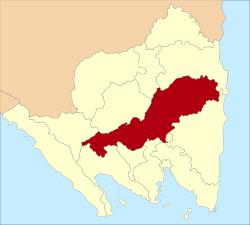
Central Lampung Regency is a regency of the province of Lampung, on Sumatra, Indonesia. On 20 April 1999, two areas were separated from the original regency - the southeastern portion was split off to form a separate East Lampung Regency (including all of the regency's former sea coast), while the town of Metro was created as an independent city. The reduced regency has an area of 4,559.57km2 and had a population of 1,170,048 people at the 2010 census[2] and 1,460,045 at the 2020 census;[3] the official estimate as at mid 2024 was 1,525,088 (comprising 777,250 males and 747,838 females).[1] The regency seat is the town of Gunung Sugih.
Central Lampung Regency consists of twenty-eight districts (kecamatan), tabulated below with their areas and their populations at the 2010 census[2] and 2020 census,[3] together with the official estimates as at mid 2024.[1] Foe ease of location, they are grouped below into three geographical sectors (which have no administrative function). The table also includes the locations of the district administrative centres, the number of villages in each district (totaling 301 rural desa or kampung, and 10 urban kelurahan), and its post code.
Kode Wilayah
Name of District (kecamatan)
Area in km2
Pop'n 2010 census
Pop'n 2020 census
Pop'n mid 2024 estimate
Admin centre
No. of villages
Post code
18.02.03
Padang Ratu
164.13
47,457
62,716
66,965
Haduyang Ratu
15
34175
18.02.20
Selagai Lingga
272.62
31,253
39,956
42,120
Negri Katon
14
34177
18.02.19
Pubian
187.77
40,514
53,854
57,633
Negri Kepayungan
20
34176
18.02.21
Anak Tuha
162.81
35,314
48,028
51,855
Negara Aji Tua
12
34161
18.02.27
Anak Ratu Aji
70.28
15,370
19,927
21,120
Gedung Sari
6
35513
18.02.01
Kalirejo
110.35
62,808
76,884
79,695
Kalirejo
17
34174
18.02.22
Sendang Agung
99.46
36,006
45,996
48,472
Sendang Agung
9
34178
18.02.02
Bangun Rejo
104.97
55,232
70,242
73,895
Bangun Rejo
17
34173
18.02.15
Bekri
94.21
25,077
31,370
32,791
Kusumadadi
8
34162
Sub-totals for
Western Sector
1,266.60
349,031
449,973
474,546
118
18.02.04
Gunung Sugih
164.14
62,043
78,030
81,735
Gunung Sugih
15 (a)
34165
18.02.14
Bumi Ratu Nuban
63.75
28,419
35,533
37,136
Bulusari
10
34160
18.02.05
Trimurjo
64.88
48,829
58,570
60,236
Simbar Waringin
14 (b)
34171 & 34172
18.02.06
Punggur
60.74
35,920
42,068
42,866
Tanggul Angin
9
34152
18.02.23
Kota Gajah
46.93
31,600
37,064
37,789
Kota Gajah
7
34153
18.02.08
Seputih Raman
130.10
45,800
54,030
55,210
Rukti Harjo
14
34155
18.02.07
Terbanggi Besar
217.32
107,389
129,482
133,434
Terbanggi Besar
10 (c)
34163
18.02.16
Seputih Agung
107.05
45,925
57,479
60,095
Dono Arum
10
34166
18.02.17
Way Pengubuan
214.65
36,851
48,099
51,112
Tanjung Ratu Ilir
8
35213
18.02.13
Terusan Nunyai
300.08
44,362
58,850
62,930
Gunung Batin Ilir
7
34167
18.02.11
Seputih Mataram
116.05
45,638
55,956
58,038
Kurnia Mataram
12
34164
Sub-totals for
Central Sector
1,485.69
532,776
655,261
680,551
116
18.02.18
Bandar Mataram
1,018.62
72,190
84,621
86,256
Jati Datar
9
34169
18.02.10
Seputih Banyak
136.72
41,627
53,453
56,443
Tanjung Harapan
13
34156
18.02.25
Way Seputih
62.39
16,877
20,744
21,537
Suko Binangun
6
34179
18.02.09
Rumbia
118.47
33,501
41,305
42,935
Reno Basuki
9
34154
18.02.24
Bumi Nabung
97.82
30,734
38,112
39,704
Bumi Nabung Ilir
7
34160
18.02.28
Putra Rumbia
93.45
17,243
22,562
23,998
Binakarya Utama
10
34157
18.02.12
Seputih Surabaya
141.64
44,267
53,600
55,326
Gaya Baru Satu
13
34158
18.02.26
Bandar Surabaya
138.17
32,471
41,514
43,762
Surabaya Ilir
10
34159
Sub-totals for
Eastern Sector
1,807.28
288,910
355,911
369,961
77
Totals for
Regency
4,559.57
1,170,048
1,460,045
1,525,088
Gunung Sugih
311
Note: (a) includes the 4 urban villages (kelurahan) of Gunung Sugih (with 7,125 inhabitants as at mid 2024), Gunung Sugih Raya (4,453), Komering Agung (6,588) and Seputih Jaya (6,005).[4] (b) includes the 3 urban villages (kelurahan) of Adipuro (with 6,442 inhabitants as at mid 2024), Simbar Waringin (5,571) and Trimurjo (3,854).[5] (c) includes the 3 urban villages (kelurahan) of Bandar Jaya Barat (with 20,204 inhabitants as at mid 2024), Bandar Jaya Timur (16,055) and Yukum Jaya (7,903), all located to the north of Gunung Sugih; the towns of Terbanggi Besar itself (26,805) and Adi Jaya (14,589) have desa status.[6]
History
In August 2009, a former senior regency official - Herman Hazbullah, former head of the Revenue and Financial Management Agency - was arrested for graft.[7]
References
123Badan Pusat Statistik, Jakarta, 28 February 2025, Kabupaten Lampung Tengah Dalam Angka 2025 (Katalog-BPS 1102001.1805)
This page is based on this Wikipedia article Text is available under the CC BY-SA 4.0 license; additional terms may apply. Images, videos and audio are available under their respective licenses.