Northwood, New South Wales

Last updated

Northwood
Sydney,  New South Wales
Northwood Wharf.JPG
Northwood Wharf
Northwood, New South Wales
Population916 (SAL 2021) [1]
Postcode(s) 2066
Location8 km (5 mi) north-west of Sydney central business district
LGA(s) Municipality of Lane Cove
State electorate(s) Lane Cove
Federal division(s) North Sydney
Suburbs around Northwood:
Lane Cove Osborne Park Gore Hill
Longueville Northwood Greenwich
Longueville Woolwich Greenwich

Northwood is a suburb on the Lower North Shore of Sydney, in the state of New South Wales, Australia, eight kilometres north-west of the Sydney central business district, in the local government area of the Municipality of Lane Cove. Northwood is on the northern side of the Lane Cove River between Woodford Bay and Gore Creek.

Contents

History

Northwood is named after Northwood House, designed by Edmund Blacket (1817–1883) and built by Mrs Jane Davy in 1878. The name was chosen because it is descriptive of its location, a woodland area in the north. Mrs Davy also built a ferry at her own expense, so that her family could travel to the city by ferry. [2] For the early history of Northwood see John and Pam Ball, Exploring the early history of Northwood, Riverview, 2016.

Heritage listings

Northwood has a number of heritage-listed sites, including:

Transport

Busways bus route 261 from Lane Cove to King Street Wharf operates via Northwood. [4] Northwood ferry wharf is served by peak-hour Captain Cook Cruises services to Circular Quay. [5] The nearest railway station is St Leonards.

Population

Demographics

In the 2016 Australian Bureau of Statistics Census of Population and Housing, the population of Northwood stood at 982 people, 49.2% females and 50.8% males, with a median age of 45 years. 31.3% of the population was born overseas with England (5.5%), Malaysia (2.1%) and New Zealand (1.5%) the most common. The five strongest religious affiliations in the area were in descending order: Catholic (29.5%), no religion (28.2%), Anglican (19.4%), and Uniting Church (3.4%). [6]

Northwood's population is typically wealthy, with a median weekly household income of A$4,152, compared with A$1,438 in Australia. The most common types of occupation for employed persons were Professionals (48.6%), Managers (17.4%), and Clerical and Administrative Workers (12.1%). 91.0% of the suburbs occupied private dwellings were family households, and 9.0% were single (lone) person households. [6]

Notable residents

Northwood was the home of landscape artist Lloyd Rees for many years before his death in 1988. [7] Many of his later paintings are of the area.

Northwood was also home to portrait artist William Pidgeon, aka Bill Pidgeon and WEP, (1909 – 1981) who was an Australian painter. He won the Archibald Prize three times, 1958, 1961 and 1968.

Related Research Articles

<span class="mw-page-title-main">Ryde, New South Wales</span> Suburb of Sydney, New South Wales, Australia

Ryde is a suburb of Sydney, New South Wales, Australia. Ryde is located 13 km north-west of the Sydney central business district and 8 km east of Parramatta. Ryde is the administrative centre of the local government area of the City of Ryde and part of the Northern Sydney region. It lies on the north bank of the Parramatta River. People from Ryde are colloquially known as Ryders, Rydiens or Rydemen.

<span class="mw-page-title-main">Greenwich, New South Wales</span> Suburb of Sydney, New South Wales

Greenwich is a suburb on the Lower North Shore of Sydney, in the state of New South Wales, Australia. Greenwich is located 7 kilometres (4.3 mi) north-west of the Sydney central business district, in the local government area of the Municipality of Lane Cove.

<span class="mw-page-title-main">Lane Cove</span> Suburb of Sydney, New South Wales, Australia

Lane Cove is a suburb on the Lower North Shore of Sydney, New South Wales, Australia. Lane Cove is nine kilometres north-west of the Sydney central business district and is the administrative centre for the local government area of the Lane Cove Council. Lane Cove West and Lane Cove North are separate suburbs.

<span class="mw-page-title-main">Clontarf, New South Wales</span> Suburb of Sydney, New South Wales, Australia

Clontarf is a suburb of northern Sydney, in the state of New South Wales, Australia. Clontarf is located 13 kilometres north-east of the Sydney central business district in the local government area of Northern Beaches Council, in the Northern Beaches region.

<span class="mw-page-title-main">North Epping, New South Wales</span> Suburb of Sydney, New South Wales, Australia

North Epping is a suburb of Sydney, in the state of New South Wales, Australia 19 kilometres north-west of the Sydney central business district in the local government area of Hornsby Shire. North Epping is in the Northern Sydney region, and is often referred to as part of the "North-West" or North Shore. Epping is a separate suburb to the south and under the Parramatta City Council, which shares the postcode of 2121.

<span class="mw-page-title-main">Longueville, New South Wales</span> Suburb of Sydney, New South Wales, Australia

Longueville is a suburb on the Lower North Shore of Sydney, New South Wales, 8 kilometres north-west of the Sydney central business district, in the local government area of the Municipality of Lane Cove.

<span class="mw-page-title-main">Macquarie Park, New South Wales</span> Suburb of Sydney, New South Wales, Australia

Macquarie Park is a suburb in the Northern Sydney region of Sydney, New South Wales, Australia. Macquarie Park is located 13 kilometres north-west of the Sydney central business district in the local government area of the City of Ryde.

<span class="mw-page-title-main">Cremorne Point</span> Suburb of Sydney, New South Wales, Australia

Cremorne Point is a harbourside suburb on the Lower North Shore of Sydney, New South Wales, Australia located six kilometres north of the Sydney central business district, in the local government area of North Sydney Council.

<span class="mw-page-title-main">Woolwich, New South Wales</span> Suburb of Sydney, New South Wales, Australia

Woolwich is a suburb on the Lower North Shore of Sydney, in the state of New South Wales, Australia. Woolwich is located 11 kilometres north-west of the Sydney central business district, in the local government area of the Municipality of Hunter's Hill. Woolwich sits on the peninsula between the Lane Cove River and the Parramatta River, jutting out from Hunters Hill.

<span class="mw-page-title-main">Lane Cove Council</span> Local government area in New South Wales, Australia

The Lane Cove Council is a local government area located on the Lower North Shore of Sydney, New South Wales, Australia. The administrative seat of Lane Cove is located 10 kilometres (6.2 mi) north-west of the Sydney central business district.

<span class="mw-page-title-main">South Turramurra</span> Suburb of Sydney, New South Wales, Australia

South Turramurra is a suburb on the Upper North Shore of Sydney in the state of New South Wales, Australia 18 kilometres (11 mi) north-west of the Sydney central business district, in the local government area of Ku-ring-gai Council. Turramurra and North Turramurra are separate suburbs.

<span class="mw-page-title-main">Meadowbank, New South Wales</span> Suburb of Sydney, New South Wales, Australia

Meadowbank is a suburb of Sydney, New South Wales, Australia, 15 kilometres north west of the Sydney central business district, in the local government area of the City of Ryde and part of the Northern Sydney region. Meadowbank sits in a valley on the northern bank of the Parramatta River.

<span class="mw-page-title-main">Linley Point, New South Wales</span> Suburb of Sydney, New South Wales, Australia

Linley Point is a small peninsular suburb located on the Lower North Shore of Sydney, in the local government area of the Municipality of Lane Cove, in the state of New South Wales, Australia. It is approximately 10 kilometres north-west of the Sydney central business district by car.

<span class="mw-page-title-main">Cabarita, New South Wales</span> Suburb of Sydney, New South Wales, Australia

Cabarita is a bayside suburb in the Inner West of Sydney, in the state of New South Wales, Australia. Cabarita is located 16 kilometres west of the Sydney central business district, in the local government area of the City of Canada Bay.

<span class="mw-page-title-main">Chiswick, New South Wales</span> Suburb of Sydney, New South Wales, Australia

Chiswick is a suburb in the Inner West of Sydney, in the state of New South Wales, Australia. It is located 9 kilometres west of the Sydney central business district in the local government area of the City of Canada Bay. Chiswick sits on the peninsula between Abbotsford Bay and Five Dock Bay, on the Parramatta River. It is surrounded by the suburbs of Abbotsford, Russell Lea and Drummoyne.

<span class="mw-page-title-main">Church Point, New South Wales</span> Suburb of Sydney, New South Wales, Australia

Church Point is a suburb in the Northern Beaches region of Sydney, in the state of New South Wales, Australia. Church Point is 32 kilometres north of the Sydney central business district, in the local government area of Northern Beaches Council.

<span class="mw-page-title-main">Lane Cove North</span> Suburb of Sydney, New South Wales, Australia

Lane Cove North is a suburb on the Lower North Shore of Sydney, in the state of New South Wales, Australia. Lane Cove North is located 11 kilometres north-west of the Sydney central business district, in the local government areas of the Municipality of Lane Cove and the City of Willoughby. Lane Cove and Lane Cove West are separate suburbs.

<span class="mw-page-title-main">Kurraba Point, New South Wales</span> Suburb of Sydney, New South Wales, Australia

Kurraba Point is a harbourside suburb on the lower North Shore of Sydney, New South Wales, Australia. Kurraba Point is located 4 kilometres north of the Sydney central business district, in the local government area of North Sydney Council.

<span class="mw-page-title-main">Huntleys Cove, New South Wales</span> Suburb of Sydney, New South Wales, Australia

Huntleys Cove is a suburb on the Lower North Shore of Sydney, in the state of New South Wales, Australia. Huntleys Cove is located 9 kilometres north-west of the Sydney central business district, in the local government area of the Municipality of Hunter's Hill. Huntleys Cove sits on the peninsula between Tarban Creek and the Parramatta River.

<span class="mw-page-title-main">Riverview, New South Wales</span> Suburb of Sydney, New South Wales, Australia

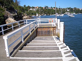
Riverview is a suburb on the Lower North Shore of Sydney, New South Wales, Australia. Riverview is located 9 kilometres north-west of the Sydney central business district, in the local government area of the Municipality of Lane Cove. It is situated on the northern side of the Lane Cove River, at the head of Tambourine Bay; the foreshore is occupied by Tambourine Bay Park. Riverview is primarily a residential area.

References

  1. Australian Bureau of Statistics (28 June 2022). "Northwood (NSW) (suburb and locality)". Australian Census 2021 QuickStats. Retrieved 28 June 2022.  OOjs UI icon edit-ltr-progressive.svg
  2. The Book of Sydney Suburbs, Compiled by Frances Pollen, Angus & Robertson 1990 ISBN   0-207-14495-8
  3. "Northwood House & Cottage". New South Wales State Heritage Register . Department of Planning & Environment. H00440. Retrieved 18 May 2018. CC BY icon.svg Text is licensed by State of New South Wales (Department of Planning and Environment) under CC-BY 4.0 licence .
  4. Route 261 timetable Transport for NSW
  5. Lane Cove River Ferry Captain Cook Cruises
  6. 1 2 Australian Bureau of Statistics (27 June 2017). "Northwood (State Suburb)". 2016 Census QuickStats. Retrieved 16 January 2018. OOjs UI icon edit-ltr-progressive.svg
  7. Commonwealth of Australia, It's an Honour: AC, 1987. Retrieved 24 March 2010.

33°49′41″S151°10′34″E / 33.82813°S 151.17619°E / -33.82813; 151.17619

"The Gardener's Gamble" by Helen Laidlaw